
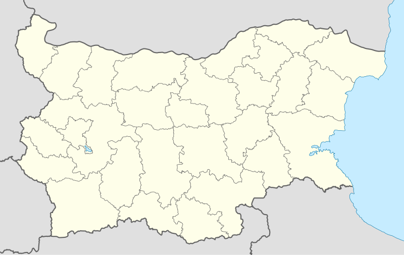
Attēls:Bulgaria location map.svg

Size of this PNG preview of this SVG file: 800 × 505 pikseļi. Citi izmēri: 320 × 202 pikseļi | 640 × 404 pikseļi | 1 024 × 646 pikseļi | 1 280 × 808 pikseļi | 2 560 × 1 615 pikseļi | 1 642 × 1 036 pikseļi.
Sākotnējais fails (SVG fails, definētais izmērs 1 642 × 1 036 pikseļi, faila izmērs: 275 KB)
| Šis fails ir no Vikikrātuves. Tā apraksts no attēla lapas Vikikrātuvē ir parādīts zemāk. Vikikrātuve ir brīvi licencēta failu krātuve. Tu vari tai palīdzēt. |
Kopsavilkums
| Apraksts |
Deutsch: Positionskarte von Bulgarien
Quadratische Plattkarte, N-S-Streckung 130 %. Geographische Begrenzung der Karte:
English: Location map of Bulgaria
Equirectangular projection, N/S stretching 130 %. Geographic limits of the map:
|
| Datums | 05-08-2008 |
| Avots |
own work, using
|
| Autors | NordNordWest |
| Citas versijas |
Derivative works of this file:
|
.svg)

|
Šī karte bija uzlabota vācu Kartenwerkstatt. Jūs arī varat piedāvāt citas kartes uzlabošanai.
|
Licence
Es, šī darba autortiesību īpašnieks, publicēju to saskaņā ar šīm licencēm:

|
Ir dota atļauja kopēt, izplatīt un/vai pārveidot šo dokumentu saskaņā ar GNU brīvās dokumentācijas licences, versijas 1.2 vai jebkuras vēlākas versijas, ko publiskojis Brīvās programmatūras fonds nosacījumiem; bez nemainīgajām sadaļā, priekšējā un aizmugurēja'vāka tekstiem. Licences kopija ir iekļauta sadaļā ar nosaukumu GNU brīvās dokumentācijas licence. |
Šis fails tiek izplatīts saskaņā ar licences Creative Commons Atsauce-Līdzīgi Noteikumi 3.0 Vispārējiem noteikumiem.
- Jūs varat brīvi:
- koplietot – kopēt, izplatīt un pārraidīt darbu
- remiksēt – pielāgot darbu
- Saskaņā ar šādiem nosacījumiem:
- atsaucoties – Tev ir jānorāda autors, saite uz licenci un to, vai veiktas kādas izmaiņas. To var darīt jebkādā saprātīgā veidā, bet ne tādā, kas norādītu, ka licencētājs atbalsta tevi vai veidu, kā tu izmanto šo darbu.
- nemainot licenci – Ja tu miksē, pārveido vai izmanto materiālu, tev savs devums jāpublicē ar to pašu vai saderīgu licenci kā oriģināls.
Jūs varat izvēlēties licenci pēc jūsu vēlmes.
Faila hronoloģija
Uzklikšķini uz datums/laiks kolonnā esošās saites, lai apskatītos, kā šis fails izskatījās tad.
| Datums/Laiks | Attēls | Izmēri | Dalībnieks | Komentārs | |
|---|---|---|---|---|---|
| tagadējais | 2010. gada 6. oktobris, plkst. 21.28 | | 1 642 × 1 036 (275 KB) | NordNordWest | upd |
| 2009. gada 12. augusts, plkst. 21.23 |  | 1 536 × 970 (204 KB) | Пакко | fixed Iskar Lake | |
| 2009. gada 3. augusts, plkst. 21.12 |  | 1 534 × 967 (207 KB) | Пакко | fixed some borders according to current administrative division | |
| 2008. gada 25. augusts, plkst. 21.52 |  | 1 645 × 1 038 (297 KB) | NordNordWest | size correction | |
| 2008. gada 12. augusts, plkst. 15.25 |  | 548 × 346 (291 KB) | NordNordWest | corrected | |
| 2008. gada 5. augusts, plkst. 23.30 |  | 548 × 346 (289 KB) | NordNordWest | {{Information |Description= {{de|Positionskarte von Bulgarien}} Quadratische Plattkarte, N-S-Streckung 130 %. Geographische Begrenzung der Karte: * N: 44.4° N * S: 41.1° N * W: 22.1° O * O: 28.9° O {{en|Location map of [[:en:Bulgaria |
Faila lietojums
Šo failu izmanto šajās 39 lapās:
- Amerikāņu universitāte Bulgārijā
- Asena cietoksnis
- Bačkovo klosteris
- Blagojevgrada
- Bojanas baznīca
- Botevgrada
- Bulgārija
- Bulgārijas administratīvais iedalījums
- Bulgārijas pilsētu uzskaitījums
- Burgasa
- Burgasas lidosta
- Debeltosa
- Dobriča
- Donavas tilts
- Efbet arēna
- Gabrova
- Haskova
- Ivanovas klinšu baznīcas
- Kardžali
- Kjustendila
- Nesebara
- Plevena
- Pliskas kauja
- Plovdiva
- Rilas klosteris
- Roženas klosteris
- Ruse
- Slančevbrjaga
- Slivena
- Sofija
- Stara Zagora
- Trojanas klosteris
- Trāķiešu kapenes Kazanlakā
- Trāķiešu kapenes Sveštaros
- Varna
- Veliko Tarnova
- Vidina
- Šumena
- Veidne:VietasKarte Bulgārija
Globālais faila lietojums
Šīs Vikipēdijas izmanto šo failu:
- Izmantojums af.wikipedia.org
- Izmantojums als.wikipedia.org
- Izmantojums am.wikipedia.org
- Izmantojums an.wikipedia.org
- Izmantojums ar.wikipedia.org
- Izmantojums arz.wikipedia.org
- Izmantojums ast.wikipedia.org
- Burgas
- Sofía
- Varna
- Plovdiv
- Veliko Tarnovo
- Stara Zagora
- Pleven
- Vidin
- Asenovgrad
- Montes Rila
- Sredna Gora
- Ruse
- Catedral d'Alexandre Nevski de Sofía
- Módulu:Mapa de llocalización/datos/Bulgaria
- Aeropuertu de Burgas
- Aeropuertu de Plovdiv
- Aeropuertu de Sofía
- Aeropuertu de Varna
- Puertu de Burgas
- Puertu de Varna
- Módulu:Mapa de llocalización/datos/Bulgaria/usu
- Izmantojums azb.wikipedia.org
Skatīt šī faila pilno globālo izmantojumu.