
Attēls:Kyalami.svg

Size of this PNG preview of this SVG file: 800 × 528 pikseļi. Citi izmēri: 320 × 211 pikseļi | 640 × 422 pikseļi | 1 024 × 676 pikseļi | 1 280 × 845 pikseļi | 2 560 × 1 689 pikseļi | 1 329 × 877 pikseļi.
Sākotnējais fails (SVG fails, definētais izmērs 1 329 × 877 pikseļi, faila izmērs: 36 KB)
| Šis fails ir no Vikikrātuves. Tā apraksts no attēla lapas Vikikrātuvē ir parādīts zemāk. Vikikrātuve ir brīvi licencēta failu krātuve. Tu vari tai palīdzēt. |
Kopsavilkums
| Apraksts |
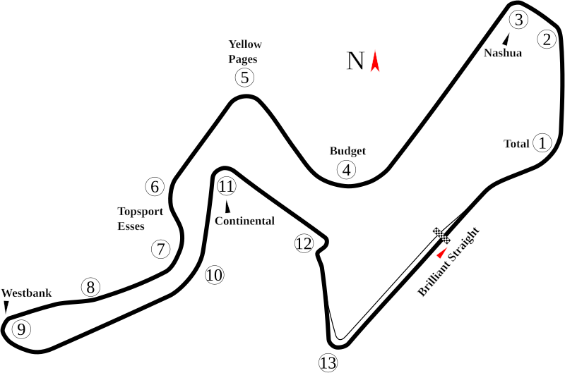
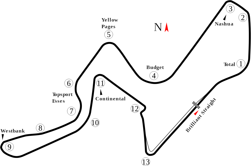
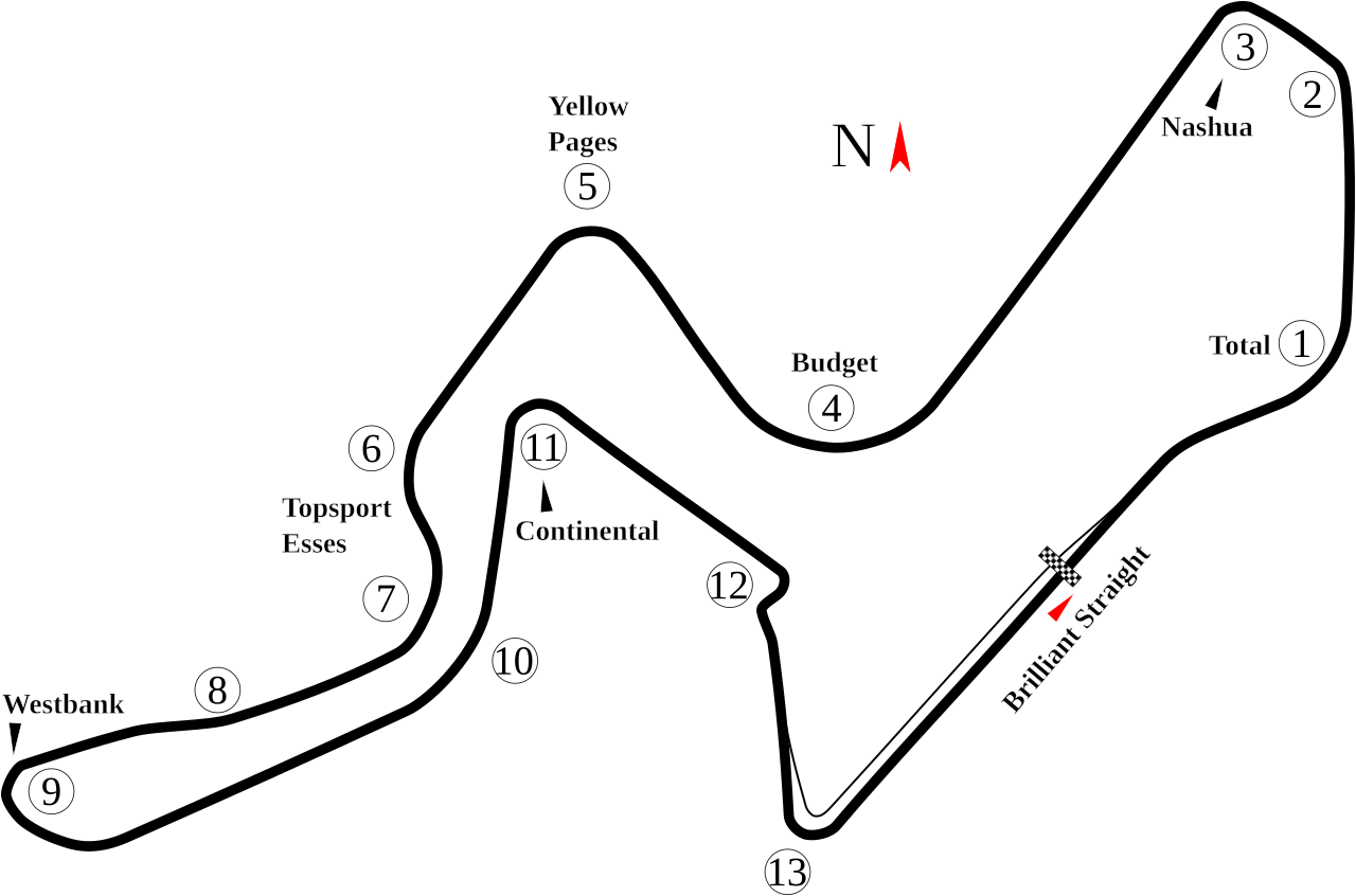
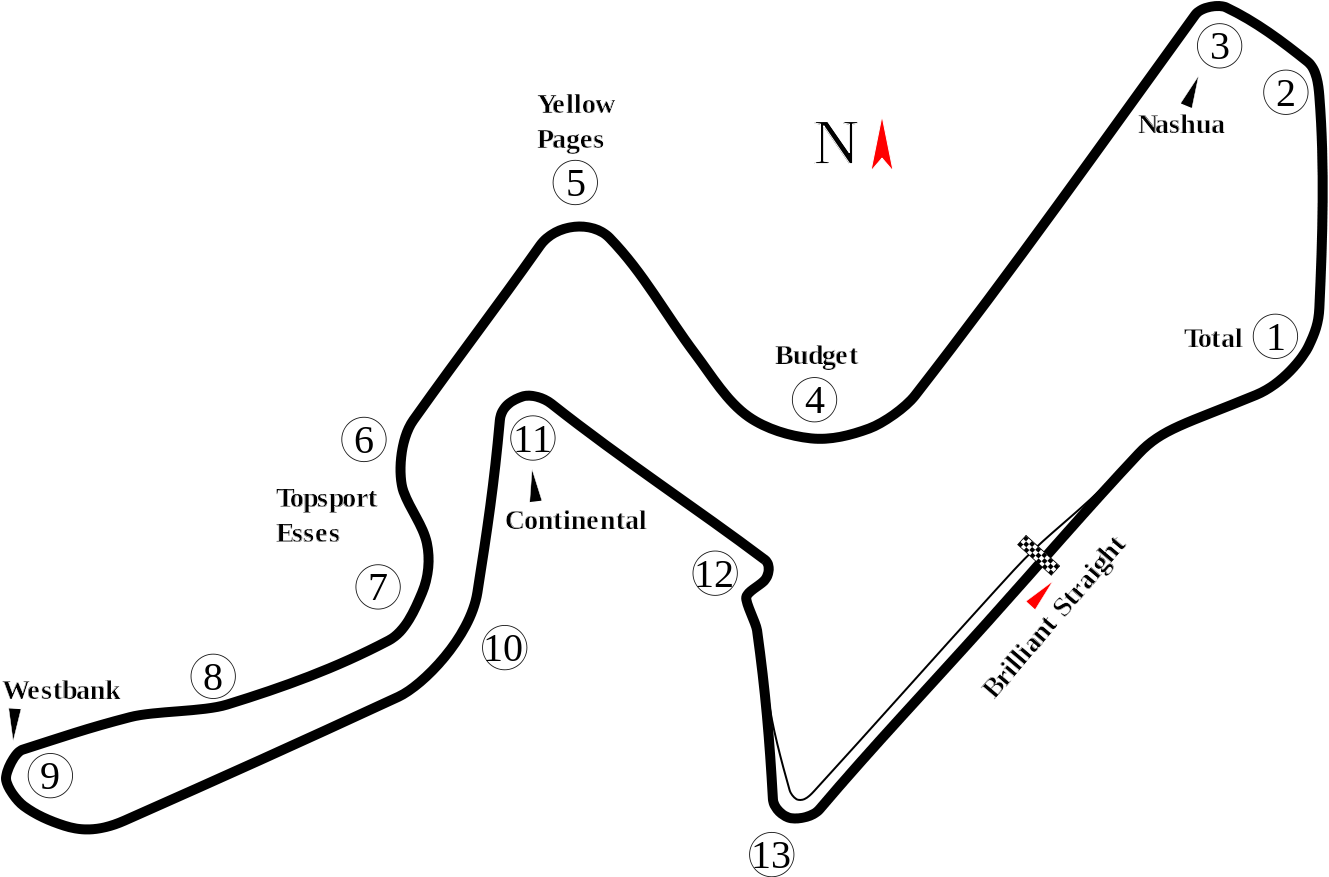
English: Track map for Kyalami. |
| Datums | |
| Avots | Paša darbs |
| Autors | Will Pittenger |
| Citas versijas |
|


| Camera location | | View this and other nearby images on: OpenStreetMap |
|---|
Licence
| I, the copyright holder of this work, release this work into the public domain. This applies worldwide. In some countries this may not be legally possible; if so: I grant anyone the right to use this work for any purpose, without any conditions, unless such conditions are required by law. |
Faila hronoloģija
Uzklikšķini uz datums/laiks kolonnā esošās saites, lai apskatītos, kā šis fails izskatījās tad.
| Datums/Laiks | Attēls | Izmēri | Dalībnieks | Komentārs | |
|---|---|---|---|---|---|
| tagadējais | 2008. gada 19. jūlijs, plkst. 06.09 | | 1 329 × 877 (36 KB) | Will Pittenger | {{Information |Description={{en|1=Track map for w:Kyalami.}} |Source=Own work by uploader |Author=Will Pittenger |Date=7-18-2008 |Permission= |other_versions=<gallery>Image:Circuit Jerez.png|Old version — obsolete\Image: |
Faila lietojums
Šo failu izmanto šajās 2 lapās:
Globālais faila lietojums
Šīs Vikipēdijas izmanto šo failu:
- Izmantojums af.wikipedia.org
- Izmantojums ar.wikipedia.org
- Izmantojums ast.wikipedia.org
- Izmantojums bg.wikipedia.org
- Izmantojums bn.wikipedia.org
- Izmantojums ca.wikipedia.org
- Izmantojums da.wikipedia.org
- Izmantojums de.wikipedia.org
- Izmantojums en.wikipedia.org
- Kyalami
- 1999 Kyalami Superbike World Championship round
- List of A1 Grand Prix circuits
- User talk:Chubbennaitor/archive2
- User talk:Barkjon/Archive 2
- Wikipedia:WikiProject Formula One/Newsletter/200808
- User talk:Hellboy2hell/archive2
- User talk:NapHit/Archive 1
- User talk:4u1e/archive5
- User talk:Typ932/Archive 3
- User talk:Midgrid/Archive 6
- User talk:Thelb4/Archive 5
- User talk:Chubbennaitor/Archive7
- User talk:Readro/Archive 3
- 2008–09 A1 Grand Prix of Nations, South Africa
- User talk:Donnie Park/Archive 1
- User talk:The359/Archive 4
- User talk:Cs-wolves/Archive 3
- User talk:Bam123456789/Archive 1
- User talk:Sage Callahan/Archive 1
- User talk:Cdhaptomos/Archive 1
- 1995 Birkin Cars/TVR Invitational Race
- User talk:Spenalzo/Archive/2008
- User talk:Clyde1998/Archive/2008
- Izmantojums es.wikipedia.org
- Izmantojums eu.wikipedia.org
- Izmantojums fa.wikipedia.org
- Izmantojums fi.wikipedia.org
- Izmantojums fr.wikipedia.org
- Izmantojums gl.wikipedia.org
Skatīt šī faila pilno globālo izmantojumu.