
Attēls:LA County Incorporated Areas.svg

Size of this PNG preview of this SVG file: 730 × 599 pikseļi. Citi izmēri: 292 × 240 pikseļi | 585 × 480 pikseļi | 935 × 768 pikseļi | 1 247 × 1 024 pikseļi | 2 494 × 2 048 pikseļi | 950 × 780 pikseļi.
Sākotnējais fails (SVG fails, definētais izmērs 950 × 780 pikseļi, faila izmērs: 261 KB)
| Šis fails ir no Vikikrātuves. Tā apraksts no attēla lapas Vikikrātuvē ir parādīts zemāk. Vikikrātuve ir brīvi licencēta failu krātuve. Tu vari tai palīdzēt. |
Kopsavilkums
| Apraksts |
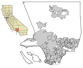
This map shows all the incorporated areas (cities) within Los Angeles County, in Southern California. I created it in Inkscape using data from the Los Angeles County Website (Los Angeles County Incorporated Area and District Map (PDF). |
| Datums | |
| Avots | My own work, based on public domain information. Though I strove to be as accurate in the detail as possible, the information shown is not guaranteed to be completely accurate. |
| Autors | Ixnayonthetimmay |
| Atļauja: (Šī faila izmantošana citur) |
Public Domain |
| Citas versijas | See Category:Maps of Los Angeles County, California for other versions of this image. |
Licence
| I, the copyright holder of this work, release this work into the public domain. This applies worldwide. In some countries this may not be legally possible; if so: I grant anyone the right to use this work for any purpose, without any conditions, unless such conditions are required by law. |
Faila hronoloģija
Uzklikšķini uz datums/laiks kolonnā esošās saites, lai apskatītos, kā šis fails izskatījās tad.
| Datums/Laiks | Attēls | Izmēri | Dalībnieks | Komentārs | |
|---|---|---|---|---|---|
| tagadējais | 2007. gada 18. jūnijs, plkst. 01.36 | | 950 × 780 (261 KB) | Ixnayonthetimmay | == Summary == {{Information |Description=This map shows the incorporated areas in Los Angeles County, California. I created it in Inkscape using data from the L |
Faila lietojums
Šo failu izmanto šajā 1 lapā:
Globālais faila lietojums
Šīs Vikipēdijas izmanto šo failu:
- Izmantojums az.wikipedia.org
- Izmantojums en.wikipedia.org
- Izmantojums eo.wikipedia.org
- Izmantojums es.wikipedia.org
- Izmantojums et.wikipedia.org
- Izmantojums fa.wikipedia.org
- Izmantojums fr.wikipedia.org
- Izmantojums he.wikipedia.org
- Izmantojums hsb.wikipedia.org
- Izmantojums id.wikipedia.org
- Izmantojums nl.wikipedia.org
- Izmantojums pam.wikipedia.org
- Izmantojums pt.wikipedia.org
- Izmantojums ru.wikipedia.org
- Izmantojums tr.wikipedia.org
- Izmantojums vi.wikipedia.org