
Attēls:NavassaEastCoastAerialUSGS.jpg

Šī priekšskata izmērs: 800 × 527 pikseļi. Citi izmēri: 320 × 211 pikseļi | 640 × 421 pikseļi | 1 024 × 674 pikseļi | 1 280 × 843 pikseļi | 1 800 × 1 185 pikseļi.
Sākotnējais fails (1 800 × 1 185 pikseļi, faila izmērs: 392 KB, MIME tips: image/jpeg)
| Šis fails ir no Vikikrātuves. Tā apraksts no attēla lapas Vikikrātuvē ir parādīts zemāk. Vikikrātuve ir brīvi licencēta failu krātuve. Tu vari tai palīdzēt. |
Kopsavilkums
| Apraksts |
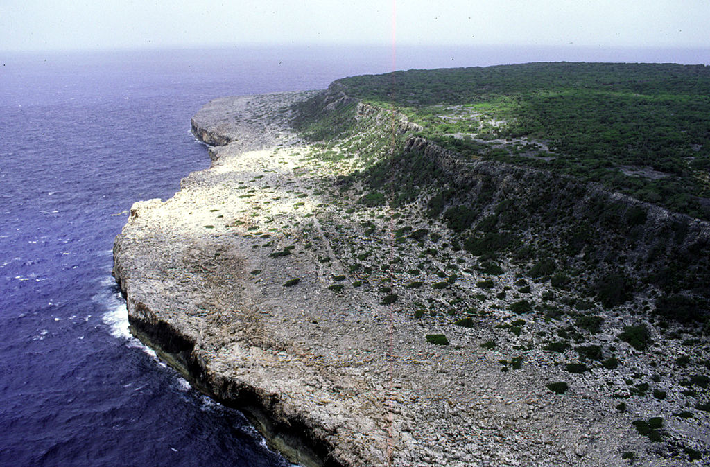
Deutsch: Luftaufnahme der Ostküste von Navassa, Blickrichtung Süden
English: Aerial photo of the east coast of Navassa Island, looking south |
| Datums | not specified |
| Avots | http://coastal.er.usgs.gov/navassa/geology/terraces4.html |
| Autors | USGS |
Licence
This image is in the public domain in the United States because it only contains materials that originally came from the United States Geological Survey, an agency of the United States Department of the Interior. For more information, see the official USGS copyright policy.
|
Original upload log
Original Uploader was Jonathunder (talk) at 22 February 2006.
00:41, 22 February 2006 . . Jonathunder (Talk | contribs) . . 1800×1185 (401,763 bytes) (United States Geological Survey aerial photo of the east coast of Navassa Island, looking south. Source: http://coastal.er.usgs.gov/navassa/geology/terraces4.html)
Faila hronoloģija
Uzklikšķini uz datums/laiks kolonnā esošās saites, lai apskatītos, kā šis fails izskatījās tad.
| Datums/Laiks | Attēls | Izmēri | Dalībnieks | Komentārs | |
|---|---|---|---|---|---|
| tagadējais | 2007. gada 15. maijs, plkst. 14.41 | | 1 800 × 1 185 (392 KB) | Telim tor | {{Information |Description=Aerial photo of the east coast of Navassa Island, looking south. |Source=http://coastal.er.usgs.gov/navassa/geology/terraces4.html |Date=unknown |Author=unknown |Permission=PD, see licensing |other_versions= }} == Licensing == |
Faila lietojums
Šo failu izmanto šajās 2 lapās:
Globālais faila lietojums
Šīs Vikipēdijas izmanto šo failu:
- Izmantojums be.wikipedia.org
- Izmantojums de.wikipedia.org
- Izmantojums el.wikipedia.org
- Izmantojums en.wikipedia.org
- Izmantojums fa.wikipedia.org
- Izmantojums fr.wikipedia.org
- Izmantojums hu.wikipedia.org
- Izmantojums io.wikipedia.org
- Izmantojums ka.wikipedia.org
- Izmantojums nds.wikipedia.org
- Izmantojums no.wikipedia.org
- Izmantojums pa.wikipedia.org
- Izmantojums pl.wikipedia.org
- Izmantojums pnb.wikipedia.org
- Izmantojums pt.wikibooks.org
- Izmantojums ru.wikipedia.org
- Izmantojums su.wikipedia.org
- Izmantojums th.wikipedia.org
- Izmantojums uz.wikipedia.org
- Izmantojums vi.wikipedia.org
- Izmantojums yo.wikipedia.org