
Attēls:Relief Map of Poland.svg

Size of this PNG preview of this SVG file: 617 × 600 pikseļi. Citi izmēri: 247 × 240 pikseļi | 494 × 480 pikseļi | 790 × 768 pikseļi | 1 053 × 1 024 pikseļi | 2 107 × 2 048 pikseļi | 861 × 837 pikseļi.
Sākotnējais fails (SVG fails, definētais izmērs 861 × 837 pikseļi, faila izmērs: 4 MB)
| Šis fails ir no Vikikrātuves. Tā apraksts no attēla lapas Vikikrātuvē ir parādīts zemāk. Vikikrātuve ir brīvi licencēta failu krātuve. Tu vari tai palīdzēt. |
Kopsavilkums
| Apraksts |
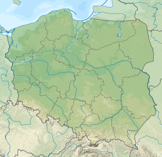
Deutsch: Positionskarte von Polen
Quadratische Plattkarte, N-S-Streckung 160 %. Geographische Begrenzung der Karte:
English: Location map of Poland
Equirectangular projection, N/S stretching 160 %. Geographic limits of the map:
|
| Datums | |
| Avots |
Paša darbs This vector image includes elements that have been taken or adapted from this file: This vector image includes elements that have been taken or adapted from this file: |
| Autors |
TUBS |
| Citas versijas |
|
| SVG veidošana | This map was created with Adobe Illustrator by TUBS. |


Licence
Es, šī darba autortiesību īpašnieks, publicēju to saskaņā ar šo licenci:
Šis fails tiek izplatīts saskaņā ar licences Creative Commons Atsauce-Līdzīgi Noteikumi 3.0 Vispārējiem noteikumiem.
- Jūs varat brīvi:
- koplietot – kopēt, izplatīt un pārraidīt darbu
- remiksēt – pielāgot darbu
- Saskaņā ar šādiem nosacījumiem:
- atsaucoties – Tev ir jānorāda autors, saite uz licenci un to, vai veiktas kādas izmaiņas. To var darīt jebkādā saprātīgā veidā, bet ne tādā, kas norādītu, ka licencētājs atbalsta tevi vai veidu, kā tu izmanto šo darbu.
- nemainot licenci – Ja tu miksē, pārveido vai izmanto materiālu, tev savs devums jāpublicē ar to pašu vai saderīgu licenci kā oriģināls.

|
I'd greatly appreciate, that you attribute this media file to Wikimedia Commons, if used outside Wikipedia or Commons. For use in publications such as books, newspapers, blogs, websites, please insert here the following line:
|
Faila hronoloģija
Uzklikšķini uz datums/laiks kolonnā esošās saites, lai apskatītos, kā šis fails izskatījās tad.
| Datums/Laiks | Attēls | Izmēri | Dalībnieks | Komentārs | |
|---|---|---|---|---|---|
| tagadējais | 2021. gada 1. decembris, plkst. 02.20 | | 861 × 837 (4 MB) | Puck04 | fixed SVG code (was "W3C-invalid") + cleanup using text editor; contains raster graphics however |
| 2021. gada 3. februāris, plkst. 23.54 |  | 861 × 837 (4,18 MB) | SANtosito | Vectorized topo | |
| 2011. gada 1. decembris, plkst. 00.52 |  | 861 × 837 (4,87 MB) | TUBS | == {{int:filedesc}} == {{Information |Description={{en|Relief map of Poland}} Equirectangular projection, N/S stretching 160 %. Geographic limits of the map: * N: 55.2° N * S: 48.7° N * W: 13.8° E * E: 24.5° E |Source={{own}}{{Adobe Il |
Faila lietojums
Šo failu izmanto šajā 41 lapā:
- Augstie Tatri
- Bebžas nacionālais parks
- Belovežas gārša
- Bjalovežas nacionālais parks
- Drvenca
- Duklas pāreja
- Elblongas kanāls
- Gdaņskas līcis
- Grunvaldes kauja
- Helas strēle
- Karkonošes nacionālais parks
- Krkonoše
- Krālīku Snežnīks
- Lebsko ezers
- Līkais mežs
- Mamrijs
- Medves ezers
- Nareva
- Narevas nacionālais parks
- Neise
- Ojcovas nacionālais parks
- Pomerānijas līcis
- Poprada (upe)
- Puckas līcis
- Rietumu Tatri
- Risijs
- Sudeti
- Sņardvijs
- Sņežka
- UNESCO Pasaules mantojuma vietas Polijā
- Vesterplate
- Vigru ezers
- Vislas līcis
- Vislas strēle
- Volina
- Čarna Haņča
- Ščecinas līcis
- Ūzedoma
- Veidne:VietasKarte Polija
- Modulis:VietasKarte/dati/Polija
- Modulis:VietasKarte/dati/Polija/doc
Globālais faila lietojums
Šīs Vikipēdijas izmanto šo failu:
- Izmantojums ab.wikipedia.org
- Izmantojums als.wikipedia.org
- Izmantojums ar.wikipedia.org
- Izmantojums av.wikipedia.org
- Izmantojums azb.wikipedia.org
- Izmantojums az.wikipedia.org
- Şablon:Yer xəritəsi Polşa
- Əyri meşə
- Slovinski Milli Parkı
- Dzivna boğazı
- Yamno gölü
- Baltik dili
- Şablon:Dil (coğrafiya)
- Şablon:Dil (coğrafiya)/doc
- Xel dili
- Blendovka səhrası
- Morskie Oko gölü
- Belka-Snejna mağarası
- Karsibur adası
- Ambarlar adası
- Qrabovski adası
- Haliç dağı
- Jives gölü
- Rozeve burnu
- Lısa-Gora dağı
- Avqustovskaya puşa
- Tuxolskie borı
- Rastoçe
- Rominten meşəsi
- Solina gölü
- Qartal Yuvası təbiət parkı
- Izmantojums ban.wikipedia.org
- Taman Nasional Tatra, Polandia
- Taman Nasional Bieszczady
- Lis taman nasional ring Polandia
- Taman Nasional Wielkopolska
- Taman Nasional Pieniny (Polandia)
- Taman Nasional Gorce
- Taman Nasional Babia Góra
- Taman Nasional Białowieża
- Taman Nasional Biebrza
- Taman Nasional Kampinos
- Taman Nasional Narew
- Taman Nasional Wigry
- Taman Nasional Magura
- Taman Nasional Roztocze
- Taman Nasional Polesie
- Taman Nasional Świętokrzyski
- Taman Nasional Ojców
Skatīt šī faila pilno globālo izmantojumu.