
Attēls:Scandinavia-12th century.png
Šī priekšskata izmērs: 507 × 599 pikseļi. Citi izmēri: 203 × 240 pikseļi | 406 × 480 pikseļi | 650 × 768 pikseļi | 866 × 1 024 pikseļi | 1 650 × 1 950 pikseļi.
Sākotnējais fails (1 650 × 1 950 pikseļi, faila izmērs: 340 KB, MIME tips: image/png)
| Šis fails ir no Vikikrātuves. Tā apraksts no attēla lapas Vikikrātuvē ir parādīts zemāk. Vikikrātuve ir brīvi licencēta failu krātuve. Tu vari tai palīdzēt. |
Kopsavilkums
| Apraksts | |
| Avots | Paša darbs |
| Autors | Ningyou at somu Vikipēdija |

|
File:Scandinavia-12th century.svg is a vector version of this file. It should be used in place of this PNG file when not inferior.
File:Scandinavia-12th century.png → File:Scandinavia-12th century.svg
For more information, see Help:SVG. |
 |
Licence
| I, the copyright holder of this work, release this work into the public domain. This applies worldwide. In some countries this may not be legally possible; if so: I grant anyone the right to use this work for any purpose, without any conditions, unless such conditions are required by law. |
Faila hronoloģija
Uzklikšķini uz datums/laiks kolonnā esošās saites, lai apskatītos, kā šis fails izskatījās tad.
| Datums/Laiks | Attēls | Izmēri | Dalībnieks | Komentārs | |
|---|---|---|---|---|---|
| tagadējais | 2007. gada 21. februāris, plkst. 22.19 | | 1 650 × 1 950 (340 KB) | Tene~commonswiki | Optimised (0) [Only tried 5 and 0] |
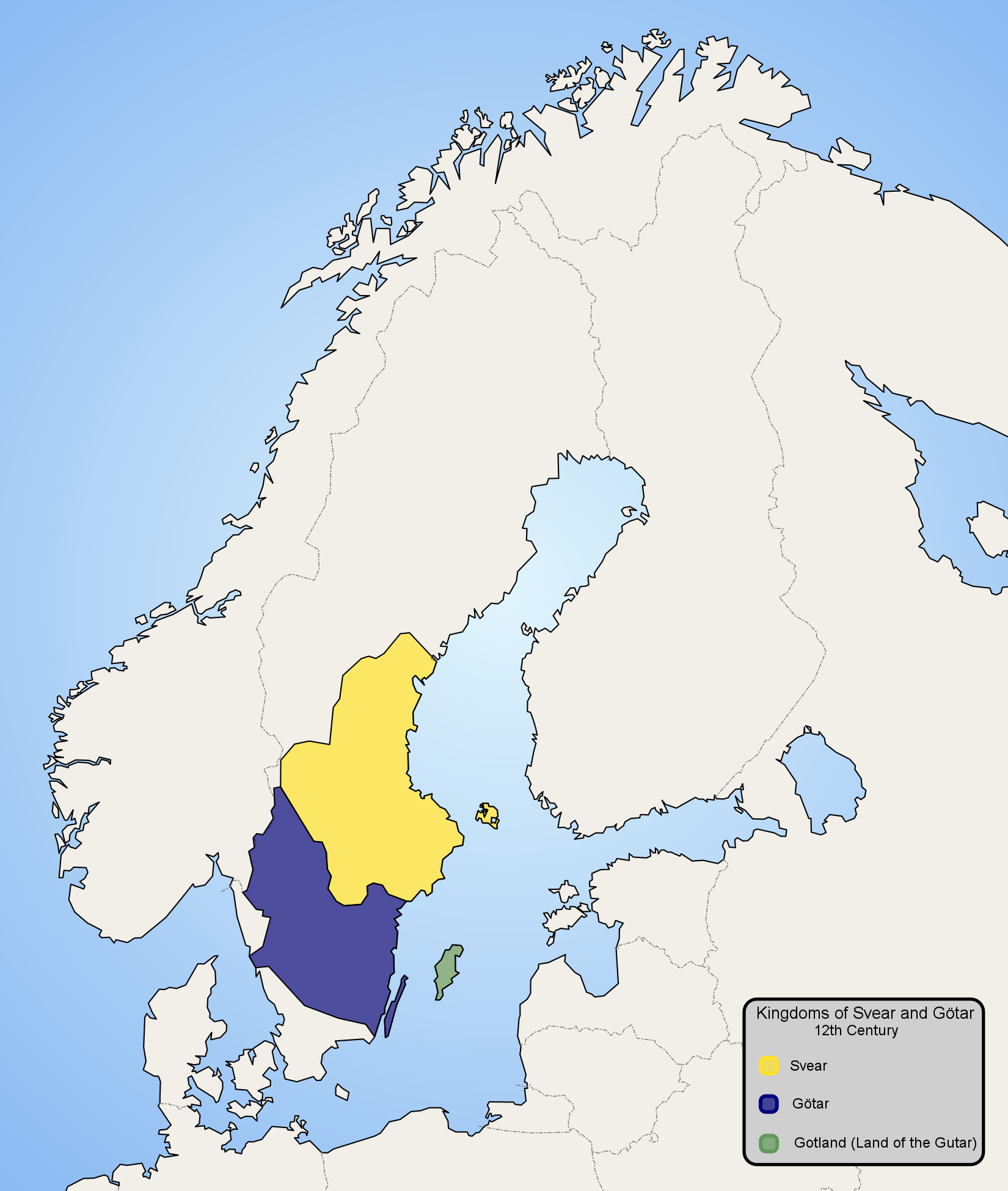
| 2006. gada 14. janvāris, plkst. 00.57 |  | 1 650 × 1 950 (479 KB) | Ningyou | Map of Scandinavia in 12th century, showing modern borders in grey. Made by fi:Käyttäjä:Ningyou. Category:Maps of Sweden Category:Maps of Scandinavia |
Faila lietojums
Šo failu izmanto šajās 4 lapās:
Globālais faila lietojums
Šīs Vikipēdijas izmanto šo failu:
- Izmantojums af.wikipedia.org
- Izmantojums am.wikipedia.org
- Izmantojums ar.wikipedia.org
- Izmantojums arz.wikipedia.org
- Izmantojums ast.wikipedia.org
- Izmantojums azb.wikipedia.org
- Izmantojums az.wikipedia.org
- Izmantojums be-tarask.wikipedia.org
- Izmantojums be.wikipedia.org
- Izmantojums bg.wikipedia.org
- Izmantojums ca.wikipedia.org
- Izmantojums ckb.wikipedia.org
- Izmantojums cs.wikipedia.org
- Izmantojums cv.wikipedia.org
- Izmantojums da.wikipedia.org
- Izmantojums de.wikipedia.org
- Izmantojums en.wikipedia.org
- Izmantojums en.wiktionary.org
- Izmantojums eo.wikipedia.org
- Izmantojums es.wikipedia.org
- Izmantojums et.wikipedia.org
- Izmantojums eu.wikipedia.org
- Izmantojums fi.wikipedia.org
- Izmantojums fr.wikipedia.org
- Izmantojums fy.wikipedia.org
.png)
Skatīt šī faila pilno globālo izmantojumu.