
Attēls:Cape Town Foreshore original coastline.svg

Size of this PNG preview of this SVG file: 800 × 523 pikseļi. Citi izmēri: 320 × 209 pikseļi | 640 × 418 pikseļi | 1 024 × 669 pikseļi | 1 280 × 837 pikseļi | 2 560 × 1 674 pikseļi | 1 190 × 778 pikseļi.
Sākotnējais fails (SVG fails, definētais izmērs 1 190 × 778 pikseļi, faila izmērs: 1,65 MB)
| Šis fails ir no Vikikrātuves. Tā apraksts no attēla lapas Vikikrātuvē ir parādīts zemāk. Vikikrātuve ir brīvi licencēta failu krātuve. Tu vari tai palīdzēt. |
| Apraksts |
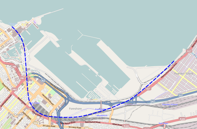
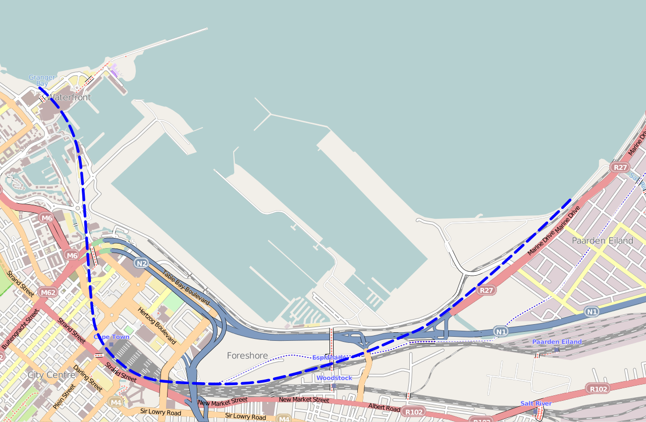
English: Map of the Foreshore area of central Cape Town, showing the approximate line of the original Table Bay coastline before land reclamation took place. |
|||
| Datums | ||||
| Avots | Base map from OpenStreetMap; coastline principally from 1891 "Map of Cape Town" drawn by the City Engineer | |||
| Autors | Htonl | |||
| Atļauja: (Šī faila izmantošana citur) |
Šis fails tiek izplatīts saskaņā ar licences Creative Commons Atsauce-Līdzīgi Noteikumi 2.0 Vispārējiem noteikumiem.
|
Faila hronoloģija
Uzklikšķini uz datums/laiks kolonnā esošās saites, lai apskatītos, kā šis fails izskatījās tad.
| Datums/Laiks | Attēls | Izmēri | Dalībnieks | Komentārs | |
|---|---|---|---|---|---|
| tagadējais | 2013. gada 6. marts, plkst. 12.51 | | 1 190 × 778 (1,65 MB) | Htonl | {{Information |Description ={{en|1=Map of the Foreshore area of central Cape Town, showing the approximate line of the original Table Bay coastline before land reclamation took place.}} |Source =Base map from OpenStreetMap; coastline princip... |
Faila lietojums
Šo failu izmanto šajā 1 lapā:
Globālais faila lietojums
Šīs Vikipēdijas izmanto šo failu:
- Izmantojums af.wikipedia.org
- Izmantojums en.wikipedia.org
- Izmantojums fr.wikipedia.org