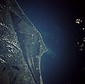
Attēls:Cape canaveral.jpg

Šī priekšskata izmērs: 606 × 600 pikseļi. Citi izmēri: 242 × 240 pikseļi | 485 × 480 pikseļi | 776 × 768 pikseļi | 1 035 × 1 024 pikseļi | 2 069 × 2 048 pikseļi | 5 320 × 5 266 pikseļi.
Sākotnējais fails (5 320 × 5 266 pikseļi, faila izmērs: 7,79 MB, MIME tips: image/jpeg)
Faila hronoloģija
Uzklikšķini uz datums/laiks kolonnā esošās saites, lai apskatītos, kā šis fails izskatījās tad.
| Datums/Laiks | Attēls | Izmēri | Dalībnieks | Komentārs | |
|---|---|---|---|---|---|
| tagadējais | 2009. gada 21. marts, plkst. 22.35 |  | 5 320 × 5 266 (7,79 MB) | Jhf | Same image with greater resolution |
| 2005. gada 18. jūnijs, plkst. 05.39 |  | 504 × 633 (98 KB) | Charlitos~commonswiki | Cape Canaveral, Florida, USA - August 1991 from: http://en.wikipedia.org/wiki/Image:Cape_canaveral.jpg image description [http://eol.jsc.nasa.gov/sseop/EFS/photoinfo.pl?PHOTO=STS043-84-31 here] {{PD-USGov-NASA}} |
Faila lietojums
Šo failu izmanto šajā 1 lapā:
Globālais faila lietojums
Šīs Vikipēdijas izmanto šo failu:
- Izmantojums af.wikipedia.org
- Izmantojums ang.wikipedia.org
- Izmantojums ar.wikipedia.org
- Izmantojums ast.wikipedia.org
- Izmantojums az.wikipedia.org
- Izmantojums be.wikipedia.org
- Izmantojums bg.wikipedia.org
- Izmantojums bn.wikipedia.org
- Izmantojums bs.wikipedia.org
- Izmantojums ca.wikipedia.org
- Izmantojums ceb.wikipedia.org
- Izmantojums ckb.wikipedia.org
- Izmantojums cs.wikipedia.org
- Izmantojums da.wikipedia.org
- Izmantojums de.wikipedia.org
- Izmantojums de.wikinews.org
- Izmantojums de.wikivoyage.org
- Izmantojums el.wikipedia.org
- Izmantojums en.wikipedia.org
- Izmantojums en.wikiversity.org
- Izmantojums eo.wikipedia.org
- Izmantojums es.wikipedia.org
- Izmantojums et.wikipedia.org
- Izmantojums eu.wikipedia.org
- Izmantojums fa.wikipedia.org
- Izmantojums fi.wikipedia.org
- Izmantojums fr.wikipedia.org
- Izmantojums gl.wikipedia.org
- Izmantojums he.wikipedia.org
- Izmantojums he.wikivoyage.org
- Izmantojums hr.wikipedia.org
- Izmantojums hu.wikipedia.org
Skatīt šī faila pilno globālo izmantojumu.
