
Attēls:ExpArchTreeFelling.jpg
Šī priekšskata izmērs: 800 × 600 pikseļi. Citi izmēri: 320 × 240 pikseļi | 640 × 480 pikseļi | 1 024 × 768 pikseļi | 1 280 × 960 pikseļi | 2 560 × 1 920 pikseļi | 3 648 × 2 736 pikseļi.
Sākotnējais fails (3 648 × 2 736 pikseļi, faila izmērs: 2,17 MB, MIME tips: image/jpeg)
| Šis fails ir no Vikikrātuves. Tā apraksts no attēla lapas Vikikrātuvē ir parādīts zemāk. Vikikrātuve ir brīvi licencēta failu krātuve. Tu vari tai palīdzēt. |
Kopsavilkums
| Apraksts |
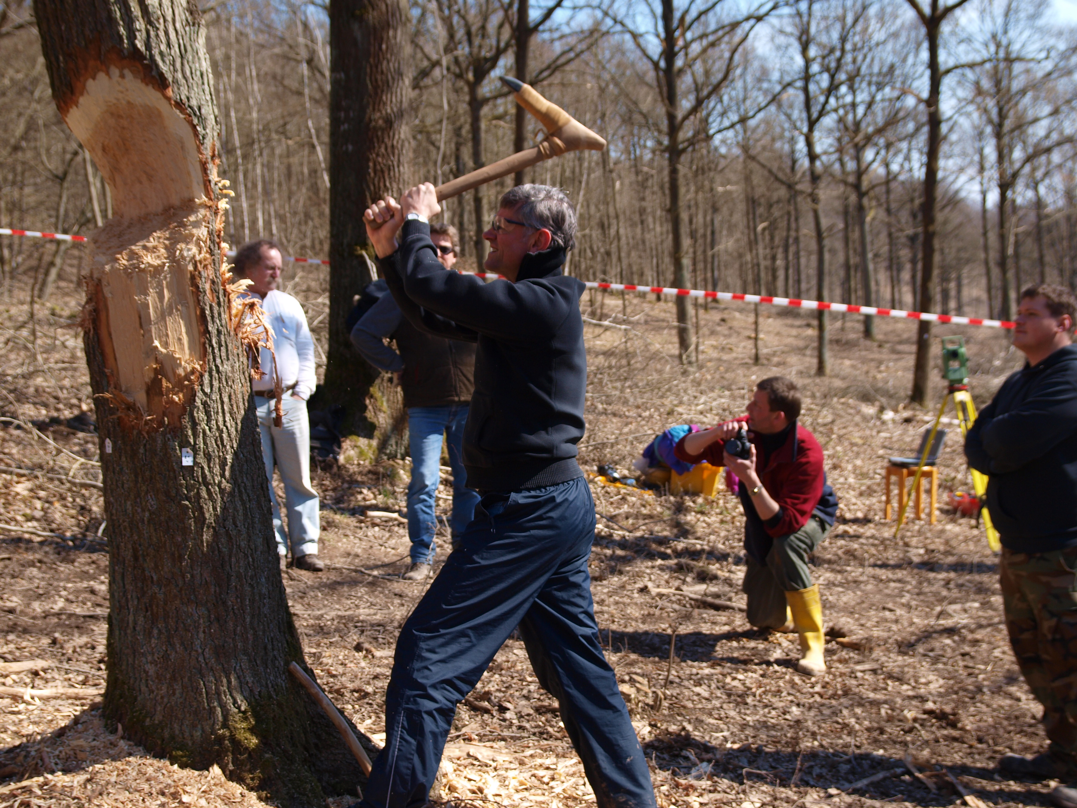
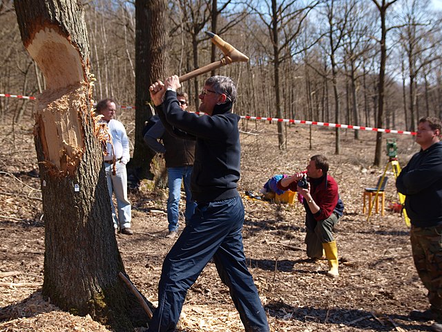
Deutsch: Experimentelle Archäologie im Feldversuch auf dem Ergersheimer Experiment 2011. Baumfällversuch mit rekonstruierten, als Dechsel (Querbeil) geschäfteten Schuhleistenkeilen aus Aktinolith-Hornblendeschiefer nach linearbandkeramischen Funden der Zeit um 5600 bis 5000 vor Chr. Für den Versuchsaufbau wurde der Stamm des Baumes mit Messpunkten versehen und die Fällkerbe regelmäßig mittels Laser-Tachymeter dreidimensional vermessen. Die Fällversuche wurden mit Videokameras, hochauflösenden Digitalkameras, Stereofotographie und schriftlichen Protokollen für die spätere Auswertung dokumentiert. Ziel des Experiments war die Analyse von Abnutzungsspuren an den Beilklingen, sowie der Bearbeitungsspuren an den Fällkerben des Baumes und den Holzwerkstücken im Vergleich zu entsprechenden archäologischen Funden.
English: Experimental archaeology at Ergersheim Experiments 2011. Experimental tree felling with reconstructed Adzes of archaeological finds of the Linear Pottery culture of approx. 5600 to 5000 BC. The tree has been equipped with reference marks and regularly been 3-D scanned with a Laser Total station. The experiment has been documented by video, high resolution photography and stereo photography as well as written protocols for the following scientific analysis. The target is the analysis of stress marks on the adze blades and ghost lines on the tree stump and the timber in comparison with marks on archaeological finds. |
| Datums | |
| Avots | Photographed near Ergersheim, Germany |
| Autors | Photographed by User:Bullenwächter |
| Object location | | View this and other nearby images on: OpenStreetMap |
|---|
Licence
Šis fails tiek izplatīts saskaņā ar licenci Creative Commons Atsauce-Līdzīgi Noteikumi 3.0 Vācijā.
- Jūs varat brīvi:
- koplietot – kopēt, izplatīt un pārraidīt darbu
- remiksēt – pielāgot darbu
- Saskaņā ar šādiem nosacījumiem:
- atsaucoties – Tev ir jānorāda autors, saite uz licenci un to, vai veiktas kādas izmaiņas. To var darīt jebkādā saprātīgā veidā, bet ne tādā, kas norādītu, ka licencētājs atbalsta tevi vai veidu, kā tu izmanto šo darbu.
- nemainot licenci – Ja tu miksē, pārveido vai izmanto materiālu, tev savs devums jāpublicē ar to pašu vai saderīgu licenci kā oriģināls.

|
This file was made by Andreas Franzkowiak alias User Bullenwächter. If you use one of my files, an email (account needed) or a message or direct to: my email account would be greatly appreciated. |
Faila hronoloģija
Uzklikšķini uz datums/laiks kolonnā esošās saites, lai apskatītos, kā šis fails izskatījās tad.
| Datums/Laiks | Attēls | Izmēri | Dalībnieks | Komentārs | |
|---|---|---|---|---|---|
| tagadējais | 2011. gada 24. marts, plkst. 09.59 | | 3 648 × 2 736 (2,17 MB) | Bullenwächter | More dynamic version uploaded |
| 2011. gada 24. marts, plkst. 09.53 |  | 3 648 × 2 736 (2,15 MB) | Bullenwächter | {{Information |Description= {{de|Experimentelle Archäologie im Feldversuch. Baumfällversuch mit rekonstruierten, als Dechsel (Querbeil) geschäfteten, [[:de:Schuhleistenkeil|Schuhleisten |
Faila lietojums
Šo failu izmanto šajā 1 lapā:
Globālais faila lietojums
Šīs Vikipēdijas izmanto šo failu:
- Izmantojums azb.wikipedia.org
- Izmantojums cs.wikipedia.org
- Izmantojums da.wikipedia.org
- Izmantojums de.wikipedia.org
- Izmantojums en.wikipedia.org
- Izmantojums eo.wikipedia.org
- Izmantojums et.wikipedia.org
- Izmantojums fi.wikipedia.org
- Izmantojums fr.wikipedia.org
- Izmantojums he.wikipedia.org
- Izmantojums hy.wikipedia.org
- Izmantojums it.wikipedia.org
- Izmantojums ja.wikipedia.org
- Izmantojums lt.wikipedia.org
- Izmantojums nds.wikipedia.org
- Izmantojums nl.wikipedia.org
- Izmantojums no.wikipedia.org
- Izmantojums ro.wikipedia.org
- Izmantojums ru.wikipedia.org
- Izmantojums sr.wikipedia.org
- Izmantojums uk.wikipedia.org
- Izmantojums war.wikipedia.org