
Attēls:Hadrian's Wall west of Housesteads 3.jpg

Šī priekšskata izmērs: 800 × 532 pikseļi. Citi izmēri: 320 × 213 pikseļi | 640 × 426 pikseļi | 1 024 × 681 pikseļi | 1 280 × 851 pikseļi | 3 008 × 2 000 pikseļi.
Sākotnējais fails (3 008 × 2 000 pikseļi, faila izmērs: 2,4 MB, MIME tips: image/jpeg)
| Šis fails ir no Vikikrātuves. Tā apraksts no attēla lapas Vikikrātuvē ir parādīts zemāk. Vikikrātuve ir brīvi licencēta failu krātuve. Tu vari tai palīdzēt. |
Kopsavilkums
| Apraksts |
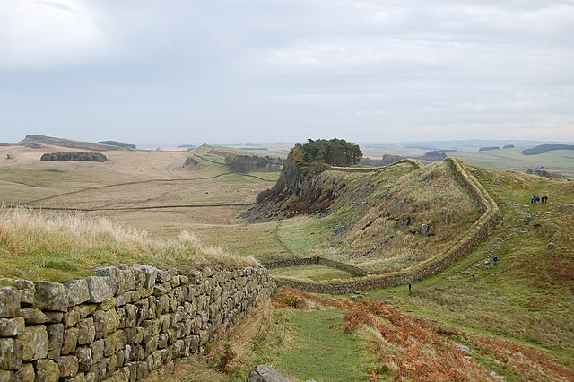
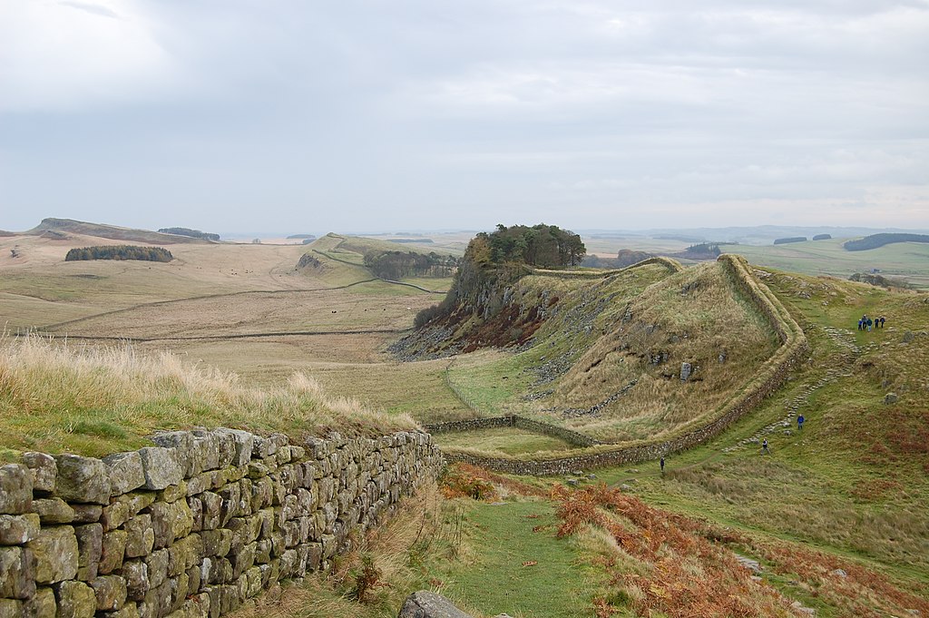
English: A stretch of Hadrian's Wall about 1 mile west of the Roman Fort near Housesteads.
Français : Une portion du mur d'Hadrien à 1,6 km environ du fort romain de Housesteads.
Deutsch: Der Hadrianswall westlich des Meilenkastells 37, das sich zwischen der kleinen, nicht sichtbaren Senke in der rechten Bildhälfte befindet. 1,6 km östlich liegt Kastell Housesteads, ebenfalls direkt an den Grenzanlagen errichtet. |
| Datums | |
| Avots | Paša darbs |
| Autors | Steven Fruitsmaak |
| Citas versijas |
| Camera location | | View this and other nearby images on: OpenStreetMap |
|---|
Licence
| I, the copyright holder of this work, release this work into the public domain. This applies worldwide. In some countries this may not be legally possible; if so: I grant anyone the right to use this work for any purpose, without any conditions, unless such conditions are required by law. |
This image has been assessed using the Quality image guidelines and is considered a Quality image.
|
Faila hronoloģija
Uzklikšķini uz datums/laiks kolonnā esošās saites, lai apskatītos, kā šis fails izskatījās tad.
| Datums/Laiks | Attēls | Izmēri | Dalībnieks | Komentārs | |
|---|---|---|---|---|---|
| tagadējais | 2007. gada 29. oktobris, plkst. 00.13 | | 3 008 × 2 000 (2,4 MB) | Stevenfruitsmaak | == Summary == {{Information |Description=A stretch of Hadrian's Wall about 1 mile west of the Roman Fort near Housesteads. |Source=self-made |Date=October 27, 2007 |Author= Steven Fruitsmaak }} == Licensing == {{PD-self}} [[Cat |
Faila lietojums
Šo failu izmanto šajās 2 lapās:
Globālais faila lietojums
Šīs Vikipēdijas izmanto šo failu:
- Izmantojums af.wikipedia.org
- Izmantojums ar.wikipedia.org
- Izmantojums ast.wikipedia.org
- Izmantojums br.wikipedia.org
- Izmantojums ca.wikipedia.org
- Izmantojums crh.wikipedia.org
- Izmantojums cs.wikipedia.org
- Izmantojums cy.wikipedia.org
- Izmantojums de.wikipedia.org
- Izmantojums de.wikivoyage.org
- Izmantojums de.wiktionary.org
- Izmantojums en.wikipedia.org
- Izmantojums en.wikivoyage.org
- Izmantojums eo.wikipedia.org
- Izmantojums es.wikipedia.org
- Izmantojums fa.wikipedia.org
- Izmantojums fi.wikipedia.org
- Izmantojums fr.wikipedia.org
- Izmantojums ga.wikipedia.org
- Izmantojums gl.wikipedia.org
- Izmantojums hu.wikipedia.org
- Izmantojums ia.wikipedia.org
- Izmantojums it.wikipedia.org
- Izmantojums it.wikivoyage.org
- Izmantojums ja.wikipedia.org
- Izmantojums ku.wikipedia.org
- Izmantojums lld.wikipedia.org
- Izmantojums oc.wikipedia.org
- Izmantojums os.wikipedia.org
- Izmantojums pl.wikipedia.org
- Izmantojums ro.wikipedia.org
- Izmantojums ru.wikipedia.org
- Izmantojums sq.wikipedia.org
Skatīt šī faila pilno globālo izmantojumu.