
Attēls:Indian states affected by July 2012 power cuts.svg

Size of this PNG preview of this SVG file: 530 × 599 pikseļi. Citi izmēri: 212 × 240 pikseļi | 425 × 480 pikseļi | 680 × 768 pikseļi | 906 × 1 024 pikseļi | 1 812 × 2 048 pikseļi | 1 639 × 1 852 pikseļi.
Sākotnējais fails (SVG fails, definētais izmērs 1 639 × 1 852 pikseļi, faila izmērs: 302 KB)
| Šis fails ir no Vikikrātuves. Tā apraksts no attēla lapas Vikikrātuvē ir parādīts zemāk. Vikikrātuve ir brīvi licencēta failu krātuve. Tu vari tai palīdzēt. |
Kopsavilkums
| Apraksts |
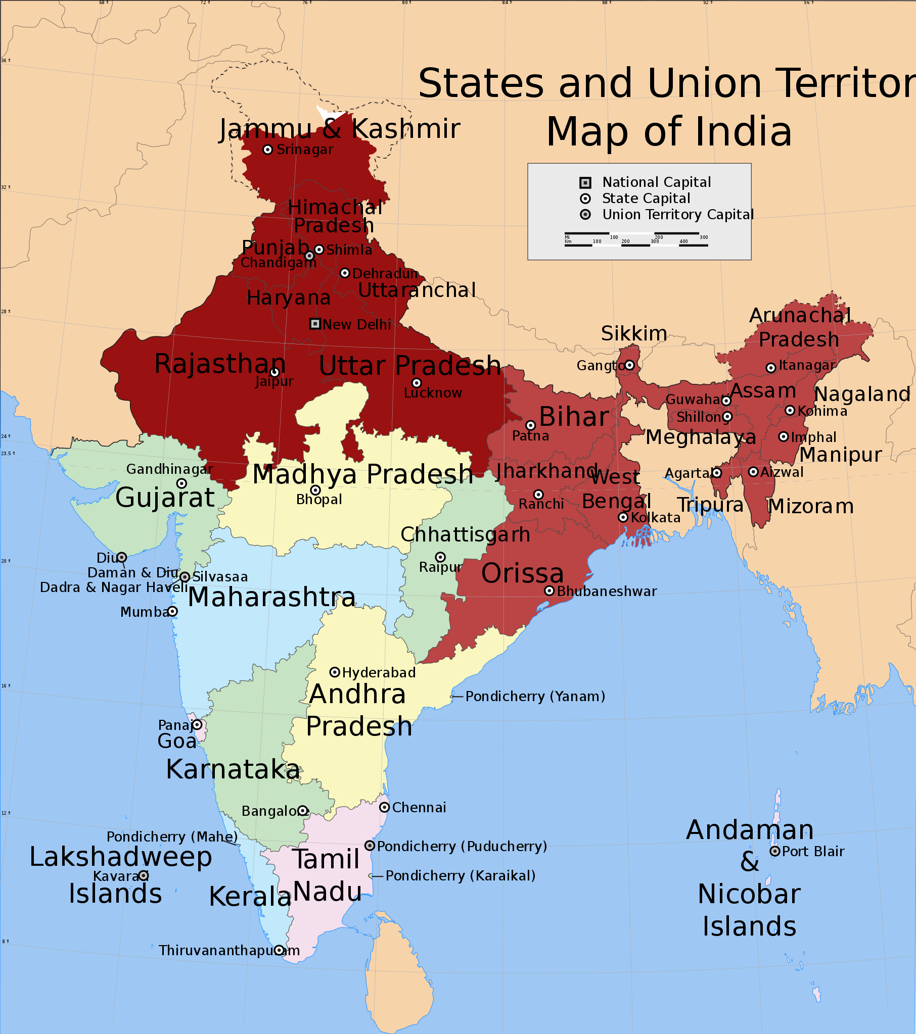
English: Shows in dark red the states listed at the time of creation: Jammu and Kashmir, Himachal Pradesh, Punjab, Haryana, Delhi, Rajasthan, Uttar Pradesh, Bihar, West Bengal, Orissa, Jharkhand, Sikkim, Assam, Meghalaya, Tripura, Nagaland, Manipur, Mizoram and Arunachal Pradesh.
Derived from India_states_and_union_territories_map.svg by changing the fill colour for those states. |
| Datums | Not known. Modified 2012. gada 31. jūlijs |
| Avots | File:India_states_and_union_territories_map.svg |
| Autors | Whoever uploaded File:India_states_and_union_territories_map.svg to English Wikipedia |
| Atļauja: (Šī faila izmantošana citur) |
http://en.wikipedia.org |
Licence
Šis fails tiek izplatīts saskaņā ar licences Creative Commons Atsauce-Līdzīgi Noteikumi 1.0 Vispārējiem noteikumiem.
- Jūs varat brīvi:
- koplietot – kopēt, izplatīt un pārraidīt darbu
- remiksēt – pielāgot darbu
- Saskaņā ar šādiem nosacījumiem:
- atsaucoties – Tev ir jānorāda autors, saite uz licenci un to, vai veiktas kādas izmaiņas. To var darīt jebkādā saprātīgā veidā, bet ne tādā, kas norādītu, ka licencētājs atbalsta tevi vai veidu, kā tu izmanto šo darbu.
- nemainot licenci – If you alter, transform, or build upon this work, you must distribute the resulting work under the same license as the original.
Original upload log
Transferred from en.wikipedia to Commons.
The original description page was here. All following user names refer to en.wikipedia.
- 2012-07-31 20:55 Maproom 1639×1852× (309753 bytes) Added Uttaranchal to affected area, removed Assam and states south and east of it.
- 2012-07-31 17:29 Maproom 1639×1852× (309753 bytes) Uploading a file from a free published source using [[Wikipedia:File_Upload_Wizard|File Upload Wizard]]
The original description page was here. All following user names refer to en.wikipedia.
- 2012-08-01 15:07 Maproom 1639×1852× (309753 bytes) altered the status of (Bihar, West Bengal, Jharkhand, Orissa, Chhattisgarh) to 2nd-day only.
- 2012-08-01 08:12 Maproom 1639×1852× (309753 bytes) re-added the north-eastern states, in a lighter colour
- 2012-08-01 08:09 Maproom 1639×1852× (309753 bytes) re-added the north-eastern states, in a lighter colour
- 2012-07-31 20:55 Maproom 1639×1852× (309753 bytes) Added Uttaranchal to affected area, removed Assam and states south and east of it.
- 2012-07-31 17:29 Maproom 1639×1852× (309753 bytes) Uploading a file from a free published source using [[Wikipedia:File_Upload_Wizard|File Upload Wizard]]
Faila hronoloģija
Uzklikšķini uz datums/laiks kolonnā esošās saites, lai apskatītos, kā šis fails izskatījās tad.
| Datums/Laiks | Attēls | Izmēri | Dalībnieks | Komentārs | |
|---|---|---|---|---|---|
| tagadējais | 2012. gada 9. augusts, plkst. 18.17 | | 1 639 × 1 852 (302 KB) | Maproom | un-marked Chhattisgarh, in accordance with request at http://en.wikipedia.org/wiki/Wikipedia:WikiProject_Maps/Requested_and_orphan_maps |
| 2012. gada 1. augusts, plkst. 20.34 |  | 1 639 × 1 852 (302 KB) | OgreBot | (BOT): Uploading old version of file from en.wikipedia; originally uploaded on 2012-08-01 15:07:18 by Maproom | |
| 2012. gada 1. augusts, plkst. 20.33 |  | 1 639 × 1 852 (302 KB) | OgreBot | (BOT): Uploading old version of file from en.wikipedia; originally uploaded on 2012-08-01 08:09:17 by Maproom | |
| 2012. gada 1. augusts, plkst. 20.33 |  | 1 639 × 1 852 (302 KB) | OgreBot | (BOT): Uploading old version of file from en.wikipedia; originally uploaded on 2012-07-31 17:29:42 by Maproom | |
| 2012. gada 1. augusts, plkst. 07.36 |  | 1 639 × 1 852 (302 KB) | Makecat | {{Information |Description={{en|Shows in dark red the states listed at the time of creation: Jammu and Kashmir, Himachal Pradesh, Punjab, Haryana, Delhi, Rajasthan, Uttar Pradesh, Bihar, West Bengal, Orissa, Jharkhand, Sikkim, Assam, Meghalaya, Tripura... |
Faila lietojums
Šo failu izmanto šajās 2 lapās:
Globālais faila lietojums
Šīs Vikipēdijas izmanto šo failu:
- Izmantojums af.wikipedia.org
- Izmantojums ar.wikipedia.org
- Izmantojums en.wikipedia.org
- Izmantojums es.wikipedia.org
- Izmantojums fr.wikipedia.org
- Izmantojums he.wikipedia.org
- Izmantojums ko.wikipedia.org
- Izmantojums pt.wikipedia.org
- Izmantojums ru.wikipedia.org
- Izmantojums ta.wikipedia.org
- Izmantojums th.wikipedia.org
- Izmantojums vi.wikipedia.org
- Izmantojums zh.wikipedia.org