
Attēls:Kuk New Guinea 2002.jpg

Šī priekšskata izmērs: 758 × 600 pikseļi. Citi izmēri: 303 × 240 pikseļi | 607 × 480 pikseļi | 971 × 768 pikseļi | 1 280 × 1 013 pikseļi | 2 560 × 2 026 pikseļi | 2 664 × 2 108 pikseļi.
Sākotnējais fails (2 664 × 2 108 pikseļi, faila izmērs: 1,27 MB, MIME tips: image/jpeg)
| Šis fails ir no Vikikrātuves. Tā apraksts no attēla lapas Vikikrātuvē ir parādīts zemāk. Vikikrātuve ir brīvi licencēta failu krātuve. Tu vari tai palīdzēt. |
Kopsavilkums
| Apraksts |
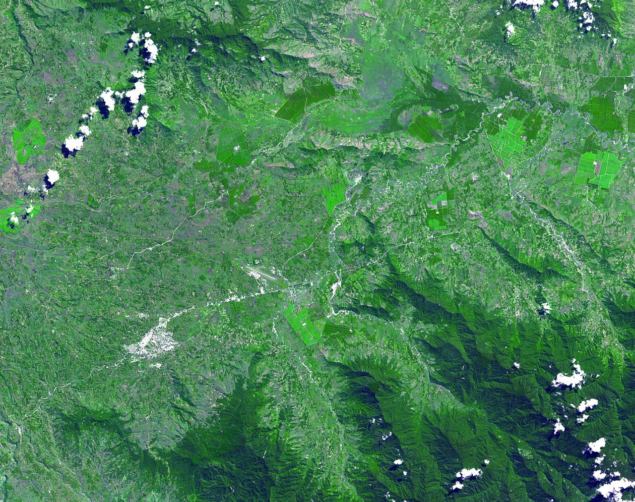
English: The Kuk Early Agricultural Site consists of 116 ha of swamps in the western highlands of New Guinea 1,500 meters above sea-level. Archaeological excavation has revealed the landscape to be one of wetland reclamation worked almost continuously for 7,000, and possibly for 10,000 years. The area was declared a UNESCO World Heritage Site in 2008. The image was acquired May 7, 2002, covers an area of 31.6 x 40 km, and is located at 5.8° S, 144.3° E. |
| Datums | |
| Avots | http://photojournal.jpl.nasa.gov/catalog/PIA13090 |
| Autors | NASA: JPL |
Licence
| This file is in the public domain in the United States because it was solely created by NASA. NASA copyright policy states that "NASA material is not protected by copyright unless noted". (See Template:PD-USGov, NASA copyright policy page or JPL Image Use Policy.) | ||
 |
Warnings:
|
Faila hronoloģija
Uzklikšķini uz datums/laiks kolonnā esošās saites, lai apskatītos, kā šis fails izskatījās tad.
| Datums/Laiks | Attēls | Izmēri | Dalībnieks | Komentārs | |
|---|---|---|---|---|---|
| tagadējais | 2010. gada 20. maijs, plkst. 05.54 | | 2 664 × 2 108 (1,27 MB) | Elekhh | {{Information |Description={{en|1=The Kuk Early Agricultural Site consists of 116 ha of swamps in the western highlands of New Guinea 1,500 meters above sea-level. Archaeological excavation has revealed the landsca |
Faila lietojums
Šo failu izmanto šajās 3 lapās:
Globālais faila lietojums
Šīs Vikipēdijas izmanto šo failu:
- Izmantojums af.wikipedia.org
- Izmantojums ar.wikipedia.org
- Izmantojums ast.wikipedia.org
- Izmantojums be.wikipedia.org
- Izmantojums ca.wikipedia.org
- Izmantojums cs.wikipedia.org
- Izmantojums de.wikipedia.org
- Izmantojums de.wikivoyage.org
- Izmantojums en.wikipedia.org
- Izmantojums es.wikipedia.org
- Izmantojums fa.wikipedia.org
- Izmantojums fr.wikipedia.org
- Izmantojums fr.wikivoyage.org
- Izmantojums gl.wikipedia.org
- Izmantojums he.wikipedia.org
- Izmantojums he.wikivoyage.org
- Izmantojums hr.wikipedia.org
- Izmantojums hy.wikipedia.org
- Izmantojums id.wikipedia.org
- Izmantojums it.wikipedia.org
- Izmantojums it.wikivoyage.org
- Izmantojums ja.wikipedia.org
- Izmantojums ka.wikipedia.org
- Izmantojums kk.wikipedia.org
- Izmantojums la.wikipedia.org
- Izmantojums lt.wikipedia.org
- Izmantojums mt.wikipedia.org
- Izmantojums ne.wikipedia.org
- Izmantojums nl.wikipedia.org
Skatīt šī faila pilno globālo izmantojumu.