
Attēls:MughalEmpire1700.svg

Size of this PNG preview of this SVG file: 800 × 467 pikseļi. Citi izmēri: 320 × 187 pikseļi | 640 × 374 pikseļi | 1 024 × 598 pikseļi | 1 280 × 748 pikseļi | 2 560 × 1 495 pikseļi | 2 568 × 1 500 pikseļi.
Sākotnējais fails (SVG fails, definētais izmērs 2 568 × 1 500 pikseļi, faila izmērs: 147 KB)
| Šis fails ir no Vikikrātuves. Tā apraksts no attēla lapas Vikikrātuvē ir parādīts zemāk. Vikikrātuve ir brīvi licencēta failu krātuve. Tu vari tai palīdzēt. |
| Apraksts |
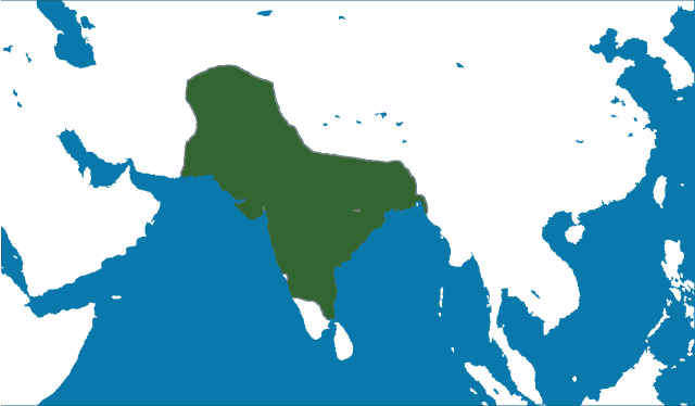
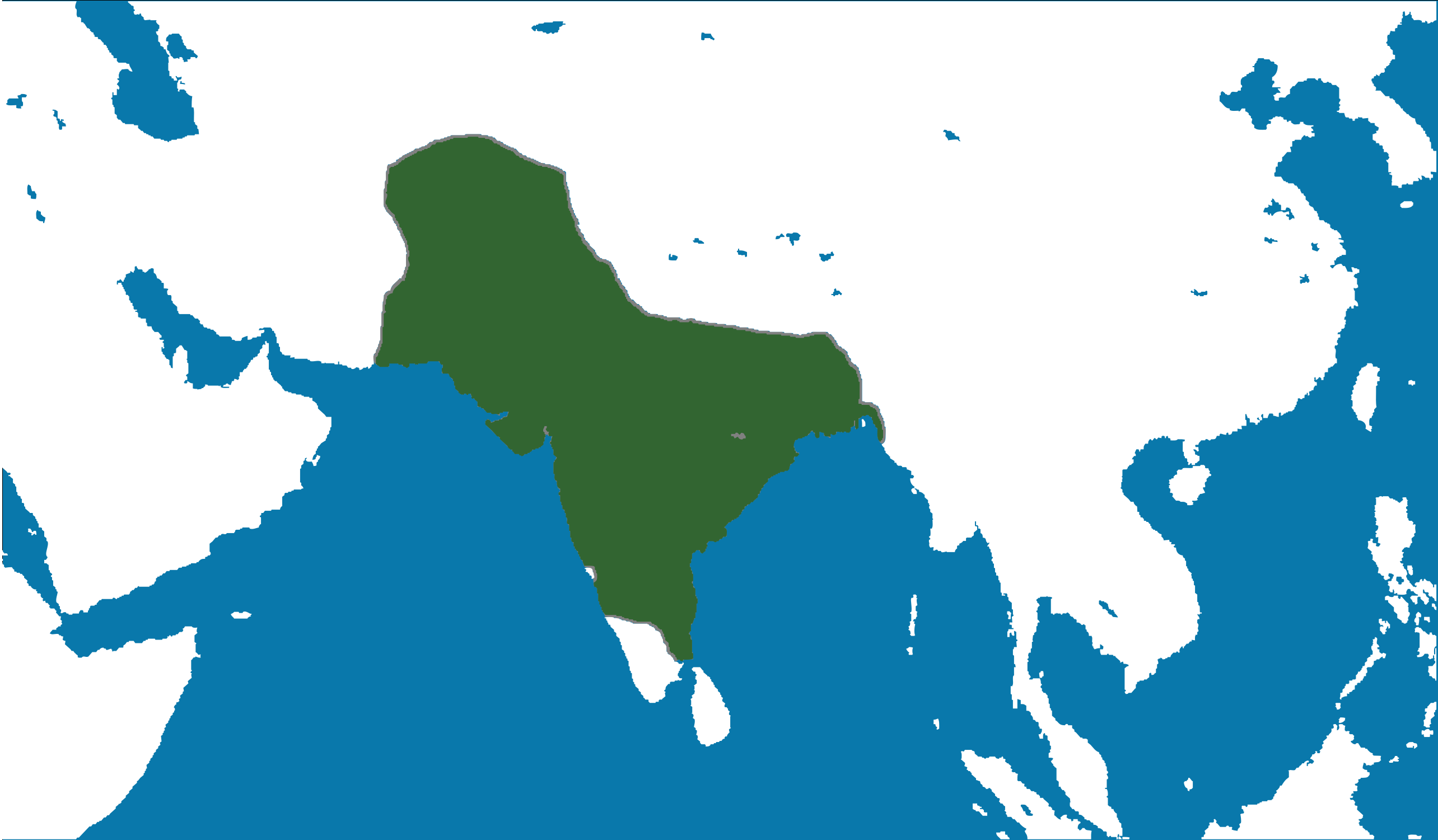
English: Locator map of the Mughal Empire, c. 1700.
(Partially based on Atlas of World History (2007) - The World 1600-1700, map) |
|||
| Datums | ||||
| Avots | Paša darbs | |||
| Autors | nafSadh | |||
| Atļauja: (Šī faila izmantošana citur) |
Es, šī darba autortiesību īpašnieks, publicēju to saskaņā ar šo licenci:
|
Faila hronoloģija
Uzklikšķini uz datums/laiks kolonnā esošās saites, lai apskatītos, kā šis fails izskatījās tad.
| Datums/Laiks | Attēls | Izmēri | Dalībnieks | Komentārs | |
|---|---|---|---|---|---|
| tagadējais | 2011. gada 8. jūnijs, plkst. 18.27 | | 2 568 × 1 500 (147 KB) | Nafsadh | Mughal Empire in 1700 CE. |
Faila lietojums
Šo failu izmanto šajā 1 lapā:
Globālais faila lietojums
Šīs Vikipēdijas izmanto šo failu:
- Izmantojums ast.wikipedia.org
- Izmantojums bg.wikipedia.org
- Izmantojums bn.wikipedia.org
- Izmantojums ca.wikipedia.org
- Izmantojums cs.wikipedia.org
- Izmantojums cy.wikipedia.org
- Izmantojums en.wikipedia.org
- Izmantojums es.wikipedia.org
- Izmantojums eu.wikipedia.org
- Izmantojums ga.wikipedia.org
- Izmantojums gl.wikipedia.org
- Izmantojums ha.wikipedia.org
- Izmantojums hi.wikipedia.org
- Izmantojums hr.wikipedia.org
- Izmantojums io.wikipedia.org
- Izmantojums ja.wikipedia.org
- Izmantojums kab.wikipedia.org
- Izmantojums ms.wikipedia.org
- Izmantojums pnb.wikipedia.org
- Izmantojums sh.wikipedia.org
- Izmantojums ta.wikipedia.org
- Izmantojums tk.wikipedia.org
- Izmantojums uk.wikipedia.org
- Izmantojums vi.wikipedia.org
- Izmantojums www.wikidata.org