
Attēls:Prefecture map of Crete (Greece).svg

Size of this PNG preview of this SVG file: 693 × 599 pikseļi. Citi izmēri: 278 × 240 pikseļi | 555 × 480 pikseļi | 888 × 768 pikseļi | 1 184 × 1 024 pikseļi | 2 369 × 2 048 pikseļi | 8 460 × 7 315 pikseļi.
Sākotnējais fails (SVG fails, definētais izmērs 8 460 × 7 315 pikseļi, faila izmērs: 1,82 MB)
| Šis fails ir no Vikikrātuves. Tā apraksts no attēla lapas Vikikrātuvē ir parādīts zemāk. Vikikrātuve ir brīvi licencēta failu krātuve. Tu vari tai palīdzēt. |
.svg?uselang=lv)
Kopsavilkums
| Apraksts |
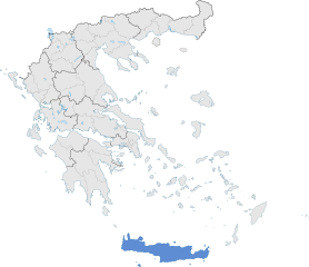
English: The prefecture of Crete within Greece. |
| Datums | |
| Avots | Paša darbs |
| Autors | SilentResident,Philly boy92 |
Licence
Es, šī darba autortiesību īpašnieks, publicēju to saskaņā ar šo licenci:
Šis fails tiek izplatīts saskaņā ar licences Creative Commons Atsauce-Līdzīgi Noteikumi 3.0 Vispārējiem noteikumiem.
- Jūs varat brīvi:
- koplietot – kopēt, izplatīt un pārraidīt darbu
- remiksēt – pielāgot darbu
- Saskaņā ar šādiem nosacījumiem:
- atsaucoties – Tev ir jānorāda autors, saite uz licenci un to, vai veiktas kādas izmaiņas. To var darīt jebkādā saprātīgā veidā, bet ne tādā, kas norādītu, ka licencētājs atbalsta tevi vai veidu, kā tu izmanto šo darbu.
- nemainot licenci – Ja tu miksē, pārveido vai izmanto materiālu, tev savs devums jāpublicē ar to pašu vai saderīgu licenci kā oriģināls.
Faila hronoloģija
Uzklikšķini uz datums/laiks kolonnā esošās saites, lai apskatītos, kā šis fails izskatījās tad.
| Datums/Laiks | Attēls | Izmēri | Dalībnieks | Komentārs | |
|---|---|---|---|---|---|
| tagadējais | 2015. gada 17. janvāris, plkst. 21.00 | | 8 460 × 7 315 (1,82 MB) | SilentResident | The Map has been updated to include some missing territories of Greece; fixed outline and color differences for some Greek islands in the Ionian and Aegean Seas that could confuse the readers. |
| 2015. gada 17. janvāris, plkst. 01.34 |  | 7 304 × 7 315 (1,74 MB) | SilentResident | {{Information |Description ={{en|1=The prefecture of Crete within Greece.}} |Source ={{own}} |Author =SilentResident,Philly boy92 |Date =2014-01-16 |Permission = |other_vers... |
Faila lietojums
Šo failu neizmanto nevienā lapā.
Globālais faila lietojums
Šīs Vikipēdijas izmanto šo failu:
- Izmantojums ar.wikipedia.org
- Izmantojums ast.wikipedia.org
- Izmantojums ca.wikipedia.org
- Izmantojums diq.wikipedia.org
- Izmantojums el.wikipedia.org
- Izmantojums en.wikipedia.org
- Izmantojums en.wikivoyage.org
- Izmantojums eu.wikipedia.org
- Izmantojums fi.wiktionary.org
- Izmantojums ga.wikipedia.org
- Izmantojums gl.wikipedia.org
- Izmantojums ha.wikipedia.org
- Izmantojums hy.wikipedia.org
- Izmantojums hyw.wikipedia.org
- Izmantojums ia.wikipedia.org
- Izmantojums la.wikipedia.org
- Izmantojums lb.wikipedia.org
- Izmantojums mzn.wikipedia.org
- Izmantojums tr.wikipedia.org
- Izmantojums tt.wikipedia.org
- Izmantojums www.wikidata.org
.svg)