
Attēls:Roman mill at Chemtou.jpg
Šī priekšskata izmērs: 450 × 600 pikseļi. Citi izmēri: 180 × 240 pikseļi | 360 × 480 pikseļi | 576 × 768 pikseļi | 768 × 1 024 pikseļi | 1 920 × 2 560 pikseļi.
Sākotnējais fails (1 920 × 2 560 pikseļi, faila izmērs: 935 KB, MIME tips: image/jpeg)
| Šis fails ir no Vikikrātuves. Tā apraksts no attēla lapas Vikikrātuvē ir parādīts zemāk. Vikikrātuve ir brīvi licencēta failu krātuve. Tu vari tai palīdzēt. |
Kopsavilkums
| Apraksts |
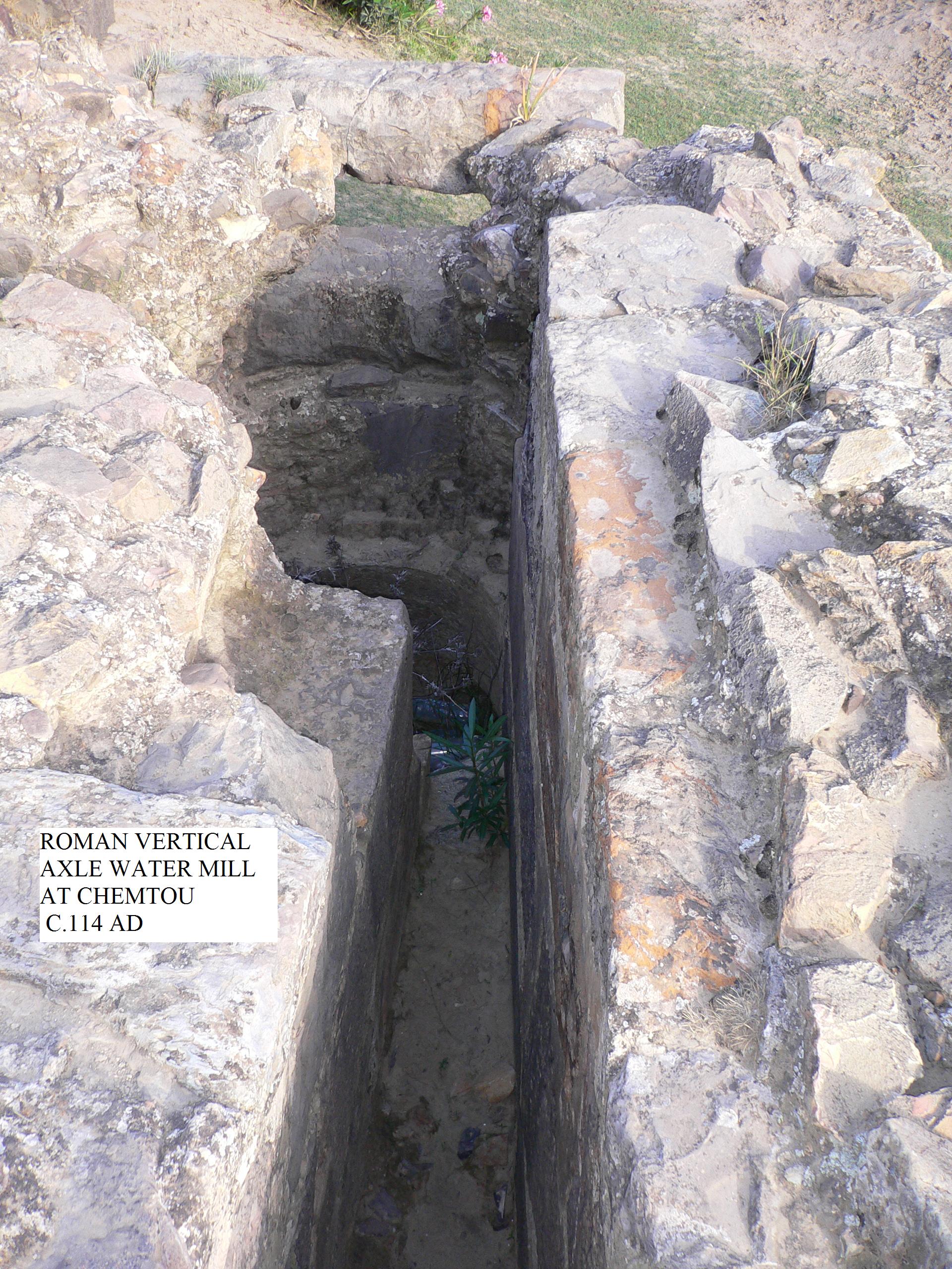
English: Vertical axle watermill at Chemtou, Tunisia c.114 AD. The date is taken from the inscription CIL VIII, 10117. While the inscription was not attached to this structure, it is reasonably sure that the two are related. |
| Datums | |
| Avots | Paša darbs |
| Autors | Sheredot |
| Camera location | | View this and other nearby images on: OpenStreetMap |
|---|
Licence
| I, the copyright holder of this work, release this work into the public domain. This applies worldwide. In some countries this may not be legally possible; if so: I grant anyone the right to use this work for any purpose, without any conditions, unless such conditions are required by law. |
| Annotations | This image is annotated: View the annotations at Commons |
Faila hronoloģija
Uzklikšķini uz datums/laiks kolonnā esošās saites, lai apskatītos, kā šis fails izskatījās tad.
| Datums/Laiks | Attēls | Izmēri | Dalībnieks | Komentārs | |
|---|---|---|---|---|---|
| tagadējais | 2008. gada 19. jūlijs, plkst. 23.28 | | 1 920 × 2 560 (935 KB) | Sheredot~commonswiki | {{Information |Description={{en|1=Vertical axle watermill at Chemtou, Tunisia c.114 AD}} |Source=Own work by uploader |Author=Sheredot |Date=19 July 2008 |Permission=Yes |other_versions= }} {{ImageUpload|full}} |
Faila lietojums
Šo failu izmanto šajā 1 lapā:
Globālais faila lietojums
Šīs Vikipēdijas izmanto šo failu:
- Izmantojums da.wikipedia.org
- Izmantojums de.wikipedia.org
- Izmantojums en.wikipedia.org
- Izmantojums es.wikipedia.org
- Izmantojums hu.wikipedia.org
- Izmantojums it.wikipedia.org
- Izmantojums ja.wikipedia.org
- Izmantojums no.wikipedia.org
- Izmantojums ru.wikipedia.org
- Izmantojums tr.wikipedia.org
- Izmantojums uk.wikipedia.org