
Attēls:Saint Peter in Dominica.svg

Size of this PNG preview of this SVG file: 525 × 599 pikseļi. Citi izmēri: 210 × 240 pikseļi | 421 × 480 pikseļi | 673 × 768 pikseļi | 897 × 1 024 pikseļi | 1 794 × 2 048 pikseļi | 1 104 × 1 260 pikseļi.
Sākotnējais fails (SVG fails, definētais izmērs 1 104 × 1 260 pikseļi, faila izmērs: 273 KB)
| Šis fails ir no Vikikrātuves. Tā apraksts no attēla lapas Vikikrātuvē ir parādīts zemāk. Vikikrātuve ir brīvi licencēta failu krātuve. Tu vari tai palīdzēt. |
Kopsavilkums
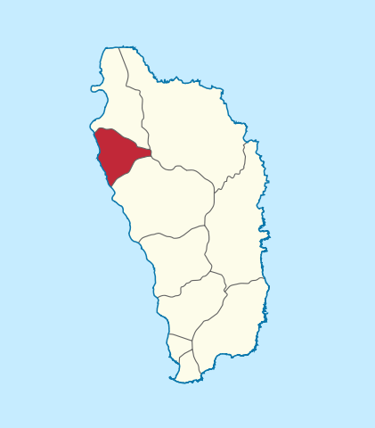
| Apraksts |
Deutsch: Lage der Gemeinde XY (siehe Dateiname) in Dominica.
English: Location of parish xy (see filename) in Dominica. |
||||||||||||||
| Datums | |||||||||||||||
| Avots |
Paša darbs This W3C-unspecified vector image was created with Adobe Illustrator. This SVG file was uploaded with Commonist. This vector image includes elements that have been taken or adapted from this file: |
||||||||||||||
| Autors |
TUBS |
||||||||||||||
| Atļauja: (Šī faila izmantošana citur) |
|
||||||||||||||
| Citas versijas |
|
||||||||||||||

.svg)
.svg)
.svg)
.svg)
.svg)
.svg)
.svg)

-en.svg)

.svg)
.svg)
.svg)

_(US48).svg)
_(small_islands_magnified)_(-mini_map_-rivers).svg)
.svg)
_(extra_close)_(US48).svg)
.svg)
_(zoom).svg)

.svg)


_(UNMIK).svg)
.svg)
_(disputed_hatched).svg)
_(claimed_and_disputed_hatched).svg)
.svg)
.svg)
_(%2Ball_claims_hatched).svg)

.svg)
_(shade).svg)
_(shade)_(special_marker).svg)
_(-mini_map).svg)
_(-mini_map).svg)
_(-mini_map).svg)


.svg)

.svg)
Faila hronoloģija
Uzklikšķini uz datums/laiks kolonnā esošās saites, lai apskatītos, kā šis fails izskatījās tad.
| Datums/Laiks | Attēls | Izmēri | Dalībnieks | Komentārs | |
|---|---|---|---|---|---|
| tagadējais | 2011. gada 4. novembris, plkst. 14.24 | | 1 104 × 1 260 (273 KB) | TUBS |
Faila lietojums
Šo failu izmanto šajās 2 lapās:
Globālais faila lietojums
Šīs Vikipēdijas izmanto šo failu:
- Izmantojums de.wikipedia.org
- Izmantojums es.wikipedia.org
- Izmantojums frr.wikipedia.org
- Izmantojums fr.wikipedia.org
- Izmantojums it.wikipedia.org
- Izmantojums ja.wikipedia.org
- Izmantojums lt.wikipedia.org
- Izmantojums no.wikipedia.org
- Izmantojums th.wikipedia.org
- Izmantojums zh.wikipedia.org