
Attēls:Stara planina2.JPG

Šī priekšskata izmērs: 800 × 372 pikseļi. Citi izmēri: 320 × 149 pikseļi | 640 × 298 pikseļi | 1 024 × 477 pikseļi | 1 280 × 596 pikseļi | 2 554 × 1 189 pikseļi.
Sākotnējais fails (2 554 × 1 189 pikseļi, faila izmērs: 461 KB, MIME tips: image/jpeg)
| Šis fails ir no Vikikrātuves. Tā apraksts no attēla lapas Vikikrātuvē ir parādīts zemāk. Vikikrātuve ir brīvi licencēta failu krātuve. Tu vari tai palīdzēt. |
Kopsavilkums
| Apraksts |
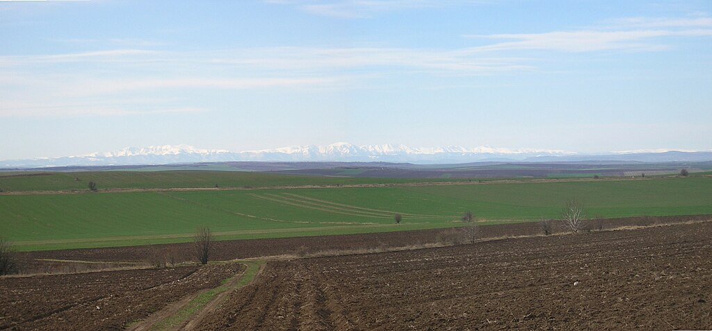
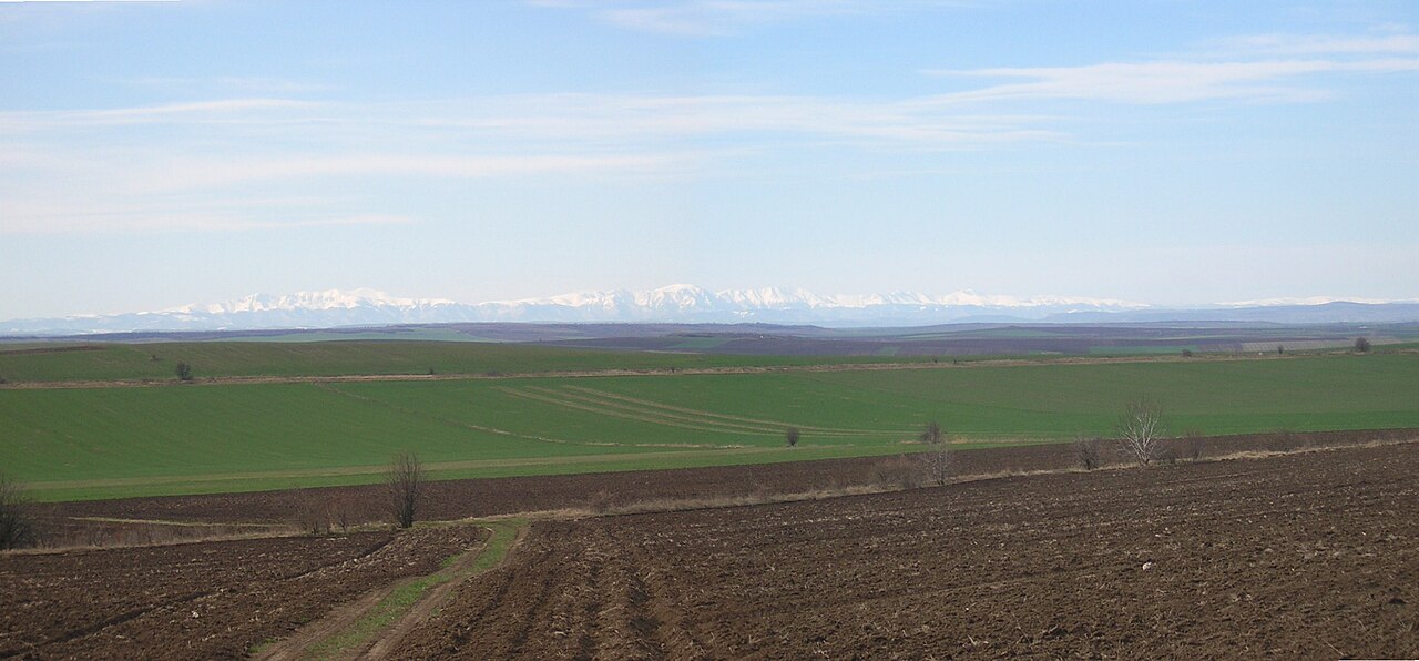
English: View from near Maslarovo village across the Danubian Plain towards the central Balkan Mountains (90 km distance) |
| Datums | |
| Avots | Paša darbs |
| Autors | myself |
| Atļauja: (Šī faila izmantošana citur) |
own work |
| Camera location | | View this and other nearby images on: OpenStreetMap |
|---|
Licence
| I, the copyright holder of this work, release this work into the public domain. This applies worldwide. In some countries this may not be legally possible; if so: I grant anyone the right to use this work for any purpose, without any conditions, unless such conditions are required by law. |
Faila hronoloģija
Uzklikšķini uz datums/laiks kolonnā esošās saites, lai apskatītos, kā šis fails izskatījās tad.
| Datums/Laiks | Attēls | Izmēri | Dalībnieks | Komentārs | |
|---|---|---|---|---|---|
| tagadējais | 2009. gada 25. marts, plkst. 17.09 | | 2 554 × 1 189 (461 KB) | Preslav~commonswiki | {{Information |Description={{en|1=View from near Maslarovo village across the Danubian Plain towards the central Balkan Mountains (90 km distance)}} |Source=own work |Author=myself |Date=2009-03-24 |Permission=own work |other_versions= }} {{location dec|4 |
Faila lietojums
Šo failu izmanto šajā 1 lapā:
Globālais faila lietojums
Šīs Vikipēdijas izmanto šo failu:
- Izmantojums bg.wikipedia.org
- Izmantojums da.wikipedia.org
- Izmantojums en.wikipedia.org
- Izmantojums es.wikipedia.org
- Izmantojums hy.wikipedia.org
- Izmantojums id.wikipedia.org
- Izmantojums it.wikipedia.org
- Izmantojums ka.wikipedia.org
- Izmantojums lt.wikipedia.org
- Izmantojums mk.wikipedia.org
- Izmantojums nn.wikipedia.org
- Izmantojums no.wikipedia.org
- Izmantojums ru.wikipedia.org
- Izmantojums sh.wikipedia.org
- Izmantojums sk.wikipedia.org
- Izmantojums sr.wikipedia.org
- Izmantojums uk.wikipedia.org
- Izmantojums www.wikidata.org