
Attēls:Strokkur geyser eruption, close-up view.jpg
Šī priekšskata izmērs: 800 × 533 pikseļi. Citi izmēri: 320 × 213 pikseļi | 640 × 426 pikseļi | 1 024 × 682 pikseļi | 1 280 × 853 pikseļi | 2 977 × 1 983 pikseļi.
Sākotnējais fails (2 977 × 1 983 pikseļi, faila izmērs: 695 KB, MIME tips: image/jpeg)
| Šis fails ir no Vikikrātuves. Tā apraksts no attēla lapas Vikikrātuvē ir parādīts zemāk. Vikikrātuve ir brīvi licencēta failu krātuve. Tu vari tai palīdzēt. |
| Apraksts |
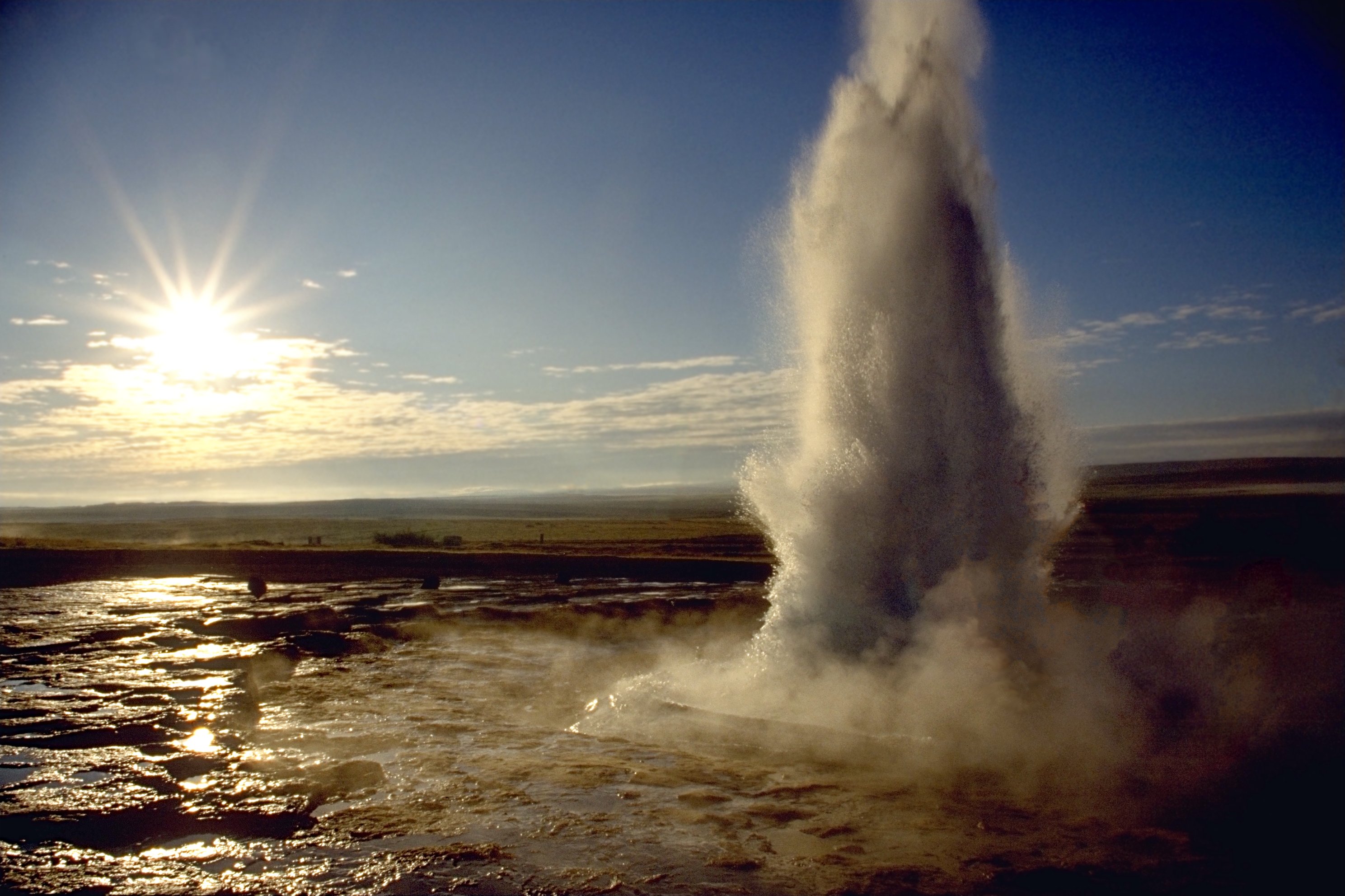
العربية: انفجار الفوَّارة الحارَّة «ستروكر».
Deutsch: Ein Ausbruch des Strokkur auf Island.
English: Eruption of Strokkur close by.
Français : Une éruption du Strokkur, en Islande. |
||
| Datums | |||
| Avots |
Paša darbs - see http://fam-tille.de/sparetime.html |
||
| Autors | Andreas Tille | ||
| Atļauja: (Šī faila izmantošana citur) |
Quote of http://fam-tille.de/island/iceland/geysir/1998_088.html - Permission is granted to copy, distribute and/or modify this images under the terms of the GNU Free Documentation License, Version 1.1 or any later version published by the Free Software Foundation. Es, šī darba autortiesību īpašnieks, publicēju to saskaņā ar šīm licencēm:
This file is licensed under the Creative Commons Attribution-Share Alike 3.0 Unported, 2.5 Generic, 2.0 Generic and 1.0 Generic license.
Jūs varat izvēlēties licenci pēc jūsu vēlmes. |

| Camera location | | View this and other nearby images on: OpenStreetMap |
|---|
| Camera Model | Minolta 600si |
|---|---|
| Lens | 28-80 |
| Filter(s) | none |
| Support | simple tripod |
| Film | Kodak slide |
|
This image was selected as picture of the day on Wikimedia Commons for 7 March 2005. It was captioned as follows: Other languages:
|
Faila hronoloģija
Uzklikšķini uz datums/laiks kolonnā esošās saites, lai apskatītos, kā šis fails izskatījās tad.
| Datums/Laiks | Attēls | Izmēri | Dalībnieks | Komentārs | |
|---|---|---|---|---|---|
| tagadējais | 2005. gada 10. decembris, plkst. 00.37 | | 2 977 × 1 983 (695 KB) | Tillea | |
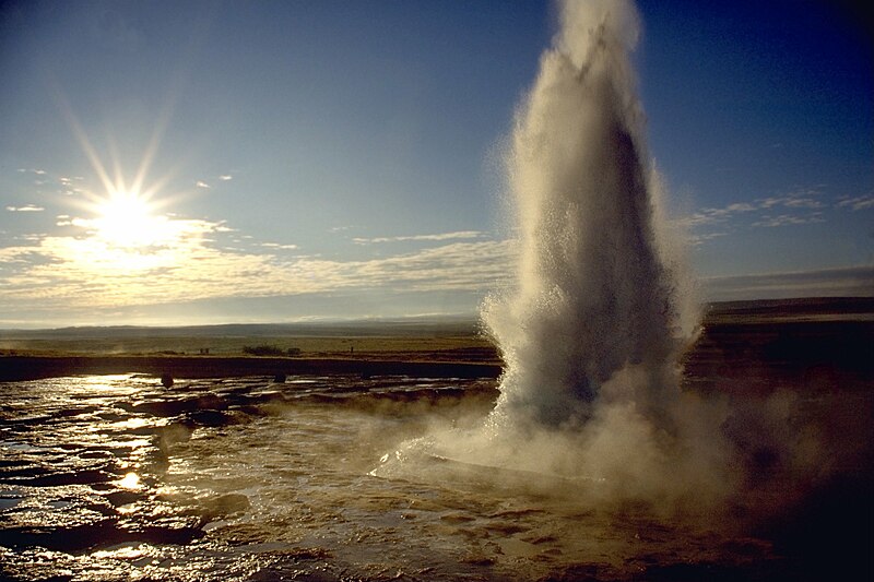
| 2005. gada 17. janvāris, plkst. 09.16 |  | 2 644 × 1 983 (542 KB) | Tillea | Eruption of Geysir close by |
Faila lietojums
Šo failu izmanto šajā 1 lapā:
Globālais faila lietojums
Šīs Vikipēdijas izmanto šo failu:
- Izmantojums af.wikipedia.org
- Izmantojums an.wikipedia.org
- Izmantojums ar.wikipedia.org
- Izmantojums arz.wikipedia.org
- Izmantojums azb.wikipedia.org
- Izmantojums bg.wikipedia.org
- Izmantojums bh.wikipedia.org
- Izmantojums bn.wikipedia.org
- Izmantojums bs.wikipedia.org
- Izmantojums ca.wikipedia.org
- Izmantojums csb.wikipedia.org
- Izmantojums cs.wikipedia.org
- Izmantojums cy.wikipedia.org
- Izmantojums da.wikipedia.org
- Izmantojums da.wiktionary.org
- Izmantojums de.wikipedia.org
- Izmantojums de.wikibooks.org
- Izmantojums de.wiktionary.org
- Izmantojums en.wikipedia.org
Skatīt šī faila pilno globālo izmantojumu.