
Attēls:Vilnius 1576.jpg
Sākotnējais fails (2 667 × 1 973 pikseļi, faila izmērs: 1,76 MB, MIME tips: image/jpeg)
| Šis fails ir no Vikikrātuves. Tā apraksts no attēla lapas Vikikrātuvē ir parādīts zemāk. Vikikrātuve ir brīvi licencēta failu krātuve. Tu vari tai palīdzēt. |
| Apraksts |
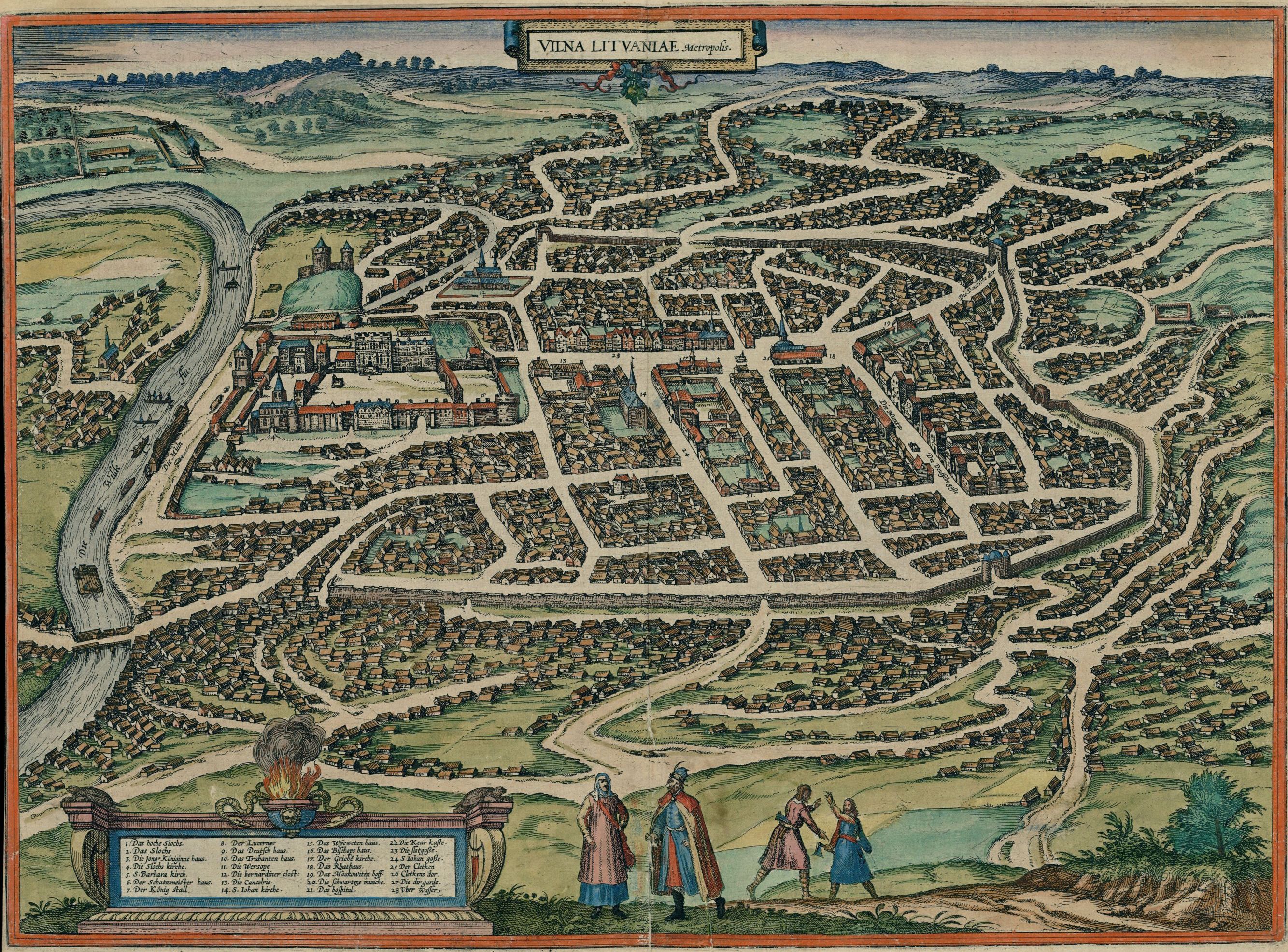
English: Map of Vilnius in 1576
Deutsch: Karte der Stadt Vilnius (als Vilna Lituaniae, Metropolis), 1576
Lietuvių: Vilniaus žemėlapis (lot. Vilna Lituaniae, Metropolis) 1576-ais metais |
| Datums | Drawn 1576; published in 1581 |
| Avots |
Original publication: Cities of the World (Civitates orbis terrarum. Koeln, 1581. T.3) Digital file: Historic Cities Center of the Department of Geography, the Hebrew University of Jerusalem and the Jewish National and University Library. |
| Autors | German cartographer and church diplomat G. Braun (1541-1622) and his assistants |
| Atļauja: (Šī faila izmantošana citur) |
public domain (pd-old) |
| Citas versijas |
 |
|
This work is in the public domain in its country of origin and other countries and areas where the copyright term is the author's life plus 70 years or fewer.
| |
| This file has been identified as being free of known restrictions under copyright law, including all related and neighboring rights. | |
| Annotations | This image is annotated: View the annotations at Commons |
Faila hronoloģija
Uzklikšķini uz datums/laiks kolonnā esošās saites, lai apskatītos, kā šis fails izskatījās tad.
| Datums/Laiks | Attēls | Izmēri | Dalībnieks | Komentārs | |
|---|---|---|---|---|---|
| tagadējais | 2010. gada 22. decembris, plkst. 05.47 | | 2 667 × 1 973 (1,76 MB) | Renata3 | http://historic-cities.huji.ac.il/lithuania/vilnius/maps/braun_hogenberg_III_59.html |
| 2009. gada 18. janvāris, plkst. 06.37 |  | 1 200 × 866 (549 KB) | Renata3 | http://portal.unesco.org/ci/photos/showphoto.php/photo/4065/size/big | |
| 2005. gada 10. aprīlis, plkst. 20.42 |  | 500 × 360 (81 KB) | Jcornelius | *Description: Vilnius 1576 *License: public domain (pd-old) {{PD-old}} |
Faila lietojums
Šo failu izmanto šajās 2 lapās:
Globālais faila lietojums
Šīs Vikipēdijas izmanto šo failu:
- Izmantojums af.wikipedia.org
- Izmantojums azb.wikipedia.org
- Izmantojums be.wikipedia.org
- Izmantojums da.wikipedia.org
- Izmantojums de.wikipedia.org
- Izmantojums el.wikipedia.org
- Izmantojums en.wikipedia.org
- Izmantojums es.wikipedia.org
- Izmantojums et.wikipedia.org
- Izmantojums hy.wikipedia.org
- Izmantojums it.wikipedia.org
- Izmantojums lt.wikipedia.org
- Izmantojums lt.wikibooks.org
- Izmantojums nl.wikipedia.org
- Izmantojums nn.wikipedia.org
- Izmantojums no.wikipedia.org
- Izmantojums ru.wikipedia.org
- Izmantojums szy.wikipedia.org
- Izmantojums uk.wikipedia.org
- Izmantojums zh.wikipedia.org