
Attēls:Одеська та Миколаївська губернії 1922.jpg

Šī priekšskata izmērs: 600 × 600 pikseļi. Citi izmēri: 240 × 240 pikseļi | 480 × 480 pikseļi | 768 × 768 pikseļi | 1 024 × 1 024 pikseļi | 1 456 × 1 456 pikseļi.
Sākotnējais fails (1 456 × 1 456 pikseļi, faila izmērs: 1,93 MB, MIME tips: image/jpeg)
| Šis fails ir no Vikikrātuves. Tā apraksts no attēla lapas Vikikrātuvē ir parādīts zemāk. Vikikrātuve ir brīvi licencēta failu krātuve. Tu vari tai palīdzēt. |
Kopsavilkums
| Apraksts |
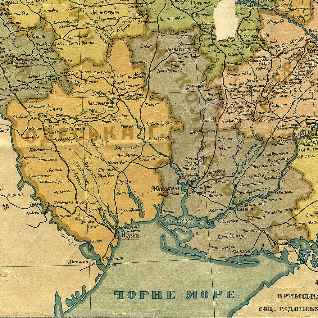
Українська: Одеська та Миколаївська губернії, фрагмент мапи Української соц. рад. республіки, січень 1922 |
| Datums | |
| Avots | Адміністраційна Мапа Української Соц.[іалістичної] Рад.[янської] Республіки [Карти] : січ. 1922 р. / Народ. Комісаріят Внутр. Справ ; уклад. С. Хургін. — 1:1 680 000 ; 40 в. у 1 дюймі. — Харків : [Б. вид-ва], [1922]. — 1 к. : кольор., табл. адм. поділу, штемпель ; 54×74 см (НБУВ СК 5364) |
| Autors | Nezināms (scan by AMY 2017-01-25) |
Licence
This file is a Ukrainian or Ukrainian SSR work and it is presently in the public domain in Ukraine, because it was published before January 1, 1954, and the creator (if known) died before that date (details).
|
 |
Faila hronoloģija
Uzklikšķini uz datums/laiks kolonnā esošās saites, lai apskatītos, kā šis fails izskatījās tad.
| Datums/Laiks | Attēls | Izmēri | Dalībnieks | Komentārs | |
|---|---|---|---|---|---|
| tagadējais | 2018. gada 14. augusts, plkst. 16.36 | | 1 456 × 1 456 (1,93 MB) | AMY 81-412 | == {{int:filedesc}} == {{Information |description={{uk|1=Одеська та Миколаївська губернії, фрагмент мапи Української соц. рад. республіки, січень 1922}} |date=1922-01 |source= Адміністраційна Мапа Української Соц.[іалістичної] Рад.[янської] Республіки [Карти] : січ. 1922 р. / Народ. Комісаріят Внутр. Справ ; уклад. С. Хургін. — 1:1 680 000 ; 40 в. у 1 дюймі. — Харків : [Б. вид-ва], [1922]. — 1 к. : кольор., табл. адм. поділу, штемпель ; 54×74 см (НБУВ СК 5364) |author={{unknown|author}} (sc... |
Faila lietojums
Šo failu izmanto šajā 1 lapā:
Globālais faila lietojums
Šīs Vikipēdijas izmanto šo failu:
- Izmantojums da.wikipedia.org
- Izmantojums el.wikipedia.org
- Izmantojums en.wikipedia.org
- Izmantojums hr.wikipedia.org
- Izmantojums krc.wikipedia.org
- Izmantojums pt.wikipedia.org
- Izmantojums ru.wikipedia.org
- Izmantojums uk.wikipedia.org