
Attēls:Antigua and Barbuda location map.svg

Size of this PNG preview of this SVG file: 521 × 599 pikseļi. Citi izmēri: 209 × 240 pikseļi | 417 × 480 pikseļi | 667 × 768 pikseļi | 890 × 1 024 pikseļi | 1 780 × 2 048 pikseļi | 864 × 994 pikseļi.
Sākotnējais fails (SVG fails, definētais izmērs 864 × 994 pikseļi, faila izmērs: 135 KB)
| Šis fails ir no Vikikrātuves. Tā apraksts no attēla lapas Vikikrātuvē ir parādīts zemāk. Vikikrātuve ir brīvi licencēta failu krātuve. Tu vari tai palīdzēt. |
| Apraksts |
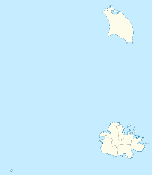
Deutsch: Positionskarte von Antigua und Barbuda. Geographische Begrenzungen der Karte:
English: Location map of Antigua and Barbuda. Geographic limits of the map:
|
| Datums | |
| Avots | Own work using: OpenStreetMap data for the coastlines |
| Autors |
Graphic made by Carport |
| Citas versijas |
_location_map.svg) |
| SVG veidošana | This map was created with Adobe Illustrator. |
Licence
Šis fails tiek izplatīts saskaņā ar licences Creative Commons Atsauce-Līdzīgi Noteikumi 2.0 Vispārējiem noteikumiem.
- Jūs varat brīvi:
- koplietot – kopēt, izplatīt un pārraidīt darbu
- remiksēt – pielāgot darbu
- Saskaņā ar šādiem nosacījumiem:
- atsaucoties – Tev ir jānorāda autors, saite uz licenci un to, vai veiktas kādas izmaiņas. To var darīt jebkādā saprātīgā veidā, bet ne tādā, kas norādītu, ka licencētājs atbalsta tevi vai veidu, kā tu izmanto šo darbu.
- nemainot licenci – Ja tu miksē, pārveido vai izmanto materiālu, tev savs devums jāpublicē ar to pašu vai saderīgu licenci kā oriģināls.
Faila hronoloģija
Uzklikšķini uz datums/laiks kolonnā esošās saites, lai apskatītos, kā šis fails izskatījās tad.
| Datums/Laiks | Attēls | Izmēri | Dalībnieks | Komentārs | |
|---|---|---|---|---|---|
| tagadējais | 2013. gada 21. oktobris, plkst. 20.25 | | 864 × 994 (135 KB) | TUBS | +subdivisions |
| 2009. gada 23. novembris, plkst. 22.58 |  | 1 080 × 1 243 (182 KB) | Carport | {{Information |Description={{de|1=Positionskarte von {{w|Antigua und Barbuda|3=de}}. Geographische Begrenzungen der Karte: * N: 17.755° N * S: 16.919° N * W: 62.4° W * E: 61.639° W}} {{en|1=Location map of {{w|Antigua and Barbuda}}. Geographic limits |
Faila lietojums
Šo failu izmanto šajās 4 lapās:
Globālais faila lietojums
Šīs Vikipēdijas izmanto šo failu:
- Izmantojums af.wikipedia.org
- Izmantojums an.wikipedia.org
- Izmantojums ar.wikipedia.org
- Izmantojums ast.wikipedia.org
- Izmantojums ay.wikipedia.org
- Izmantojums az.wikipedia.org
- Izmantojums be.wikipedia.org
- Izmantojums bg.wikipedia.org
- Izmantojums bn.wikipedia.org
- Izmantojums bs.wikipedia.org
- Izmantojums ceb.wikipedia.org
- Plantilya:Location map Antigua and Barbuda
- York Island (pulo sa Antigwa ug Barbuda, Parish of Saint Philip)
- Willoughby Bay (luuk sa Antigwa ug Barbuda)
- William Point (punta sa Antigwa ug Barbuda)
- White Cliff (pangpang sa Antigwa ug Barbuda)
- West Channel (agianan sa Antigwa ug Barbuda)
- Welch Point (punta sa Antigwa ug Barbuda)
- Tucks Point (punta)
- Mount Thomas (bukid sa Antigwa ug Barbuda)
- Table Hill (bungtod sa Antigwa ug Barbuda)
- Sugar Loaf Hill (bungtod sa Antigwa ug Barbuda)
- Spanish Point (punta sa Antigwa ug Barbuda)
- South Point (punta sa Antigwa ug Barbuda)
- South Channel (agianan nga kadagatan sa Antigwa ug Barbuda)
- Soldier Point (punta sa Antigwa ug Barbuda, Parish of Saint John)
- Soldier Point (punta sa Antigwa ug Barbuda, Parish of Saint Philip)
- Soldier Bay (luuk sa Antigwa ug Barbuda)
- Snapper Point (punta sa Antigwa ug Barbuda)
- Smith Island (pulo sa Antigwa ug Barbuda)
- Smith Hill (bungtod sa Antigwa ug Barbuda)
- The Sisters (pulo sa Antigwa ug Barbuda)
- Signal Hill (bukid sa Antigwa ug Barbuda)
- Shoal Point (punta sa Antigwa ug Barbuda)
- Scotts Hill (bungtod sa Antigwa ug Barbuda)
- Sandy Island Channel (agianan sa Antigwa ug Barbuda)
- Sandy Island (pulo sa Antigwa ug Barbuda)
- Parish of Saint Peter (parokya sa Antigwa ug Barbuda)
Skatīt šī faila pilno globālo izmantojumu.