
Attēls:Bikini Atoll 2001-01-14, Landsat 7 ETM+, bands 3-2-1-8.png

Šī priekšskata izmērs: 800 × 508 pikseļi. Citi izmēri: 320 × 203 pikseļi | 640 × 406 pikseļi | 1 024 × 650 pikseļi | 1 280 × 812 pikseļi | 3 063 × 1 944 pikseļi.
Sākotnējais fails (3 063 × 1 944 pikseļi, faila izmērs: 9,99 MB, MIME tips: image/png)
| Šis fails ir no Vikikrātuves. Tā apraksts no attēla lapas Vikikrātuvē ir parādīts zemāk. Vikikrātuve ir brīvi licencēta failu krātuve. Tu vari tai palīdzēt. |
Kopsavilkums
| Apraksts |
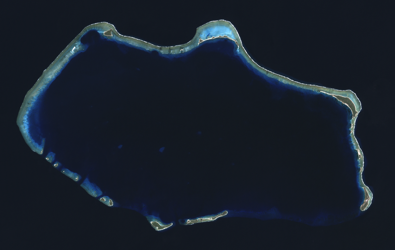
English: Composite "true color" multispectral satellite image of Bikini Atoll, Marshall Islands.
NASA Landsat 7 ETM+ bands used were 3 (red), 2 (green) and 1 (blue), and the image was pan-sharpened to 15m resolution. Imagery courtesy of NASA/USGS. |
| Datums | |
| Avots | NASA Landsat satellite image GeoTIFF archive, http://glovis.usgs.gov |
| Autors | NASA |
| Camera location | | View this and other nearby images on: OpenStreetMap |
|---|
Licence
| This file is in the public domain in the United States because it was solely created by NASA. NASA copyright policy states that "NASA material is not protected by copyright unless noted". (See Template:PD-USGov, NASA copyright policy page or JPL Image Use Policy.) | ||
 |
Warnings:
|
| Annotations | This image is annotated: View the annotations at Commons |
Faila hronoloģija
Uzklikšķini uz datums/laiks kolonnā esošās saites, lai apskatītos, kā šis fails izskatījās tad.
| Datums/Laiks | Attēls | Izmēri | Dalībnieks | Komentārs | |
|---|---|---|---|---|---|
| tagadējais | 2012. gada 24. septembris, plkst. 07.22 | | 3 063 × 1 944 (9,99 MB) | Разрывные | User created page with UploadWizard |
Faila lietojums
Šo failu izmanto šajās 3 lapās:
Globālais faila lietojums
Šīs Vikipēdijas izmanto šo failu:
- Izmantojums af.wikipedia.org
- Izmantojums ar.wikipedia.org
- Izmantojums ast.wikipedia.org
- Izmantojums bn.wikivoyage.org
- Izmantojums ca.wikipedia.org
- Izmantojums ceb.wikipedia.org
- Izmantojums cs.wikipedia.org
- Izmantojums cy.wikipedia.org
- Izmantojums de.wikivoyage.org
- Izmantojums el.wikivoyage.org
- Izmantojums en.wikipedia.org
- Izmantojums en.wikivoyage.org
- Izmantojums eu.wikipedia.org
- Izmantojums fa.wikipedia.org
- Izmantojums fa.wikivoyage.org
- Izmantojums fr.wikipedia.org
- Izmantojums he.wikipedia.org
- Izmantojums hr.wikipedia.org
- Izmantojums hu.wikipedia.org
- Izmantojums id.wikipedia.org
- Izmantojums ik.wikipedia.org
- Izmantojums incubator.wikimedia.org
- Izmantojums it.wikipedia.org
- Izmantojums ms.wikipedia.org
- Izmantojums ne.wikipedia.org
- Izmantojums pl.wikipedia.org
- Izmantojums ru.wikipedia.org
- Izmantojums sh.wikipedia.org
- Izmantojums sr.wikipedia.org
- Izmantojums tr.wikipedia.org
- Izmantojums uk.wikipedia.org
- Izmantojums ur.wikipedia.org
- Izmantojums vi.wikipedia.org
- Izmantojums www.wikidata.org
- Izmantojums zh.wikivoyage.org