
Attēls:Black Sea location map.svg

Size of this PNG preview of this SVG file: 532 × 330 pikseļi. Citi izmēri: 320 × 198 pikseļi | 640 × 397 pikseļi | 1 024 × 635 pikseļi | 1 280 × 794 pikseļi | 2 560 × 1 588 pikseļi.
Sākotnējais fails (SVG fails, definētais izmērs 532 × 330 pikseļi, faila izmērs: 86 KB)
| Šis fails ir no Vikikrātuves. Tā apraksts no attēla lapas Vikikrātuvē ir parādīts zemāk. Vikikrātuve ir brīvi licencēta failu krātuve. Tu vari tai palīdzēt. |
Kopsavilkums
| Apraksts |
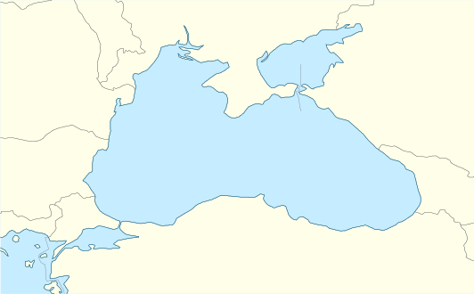
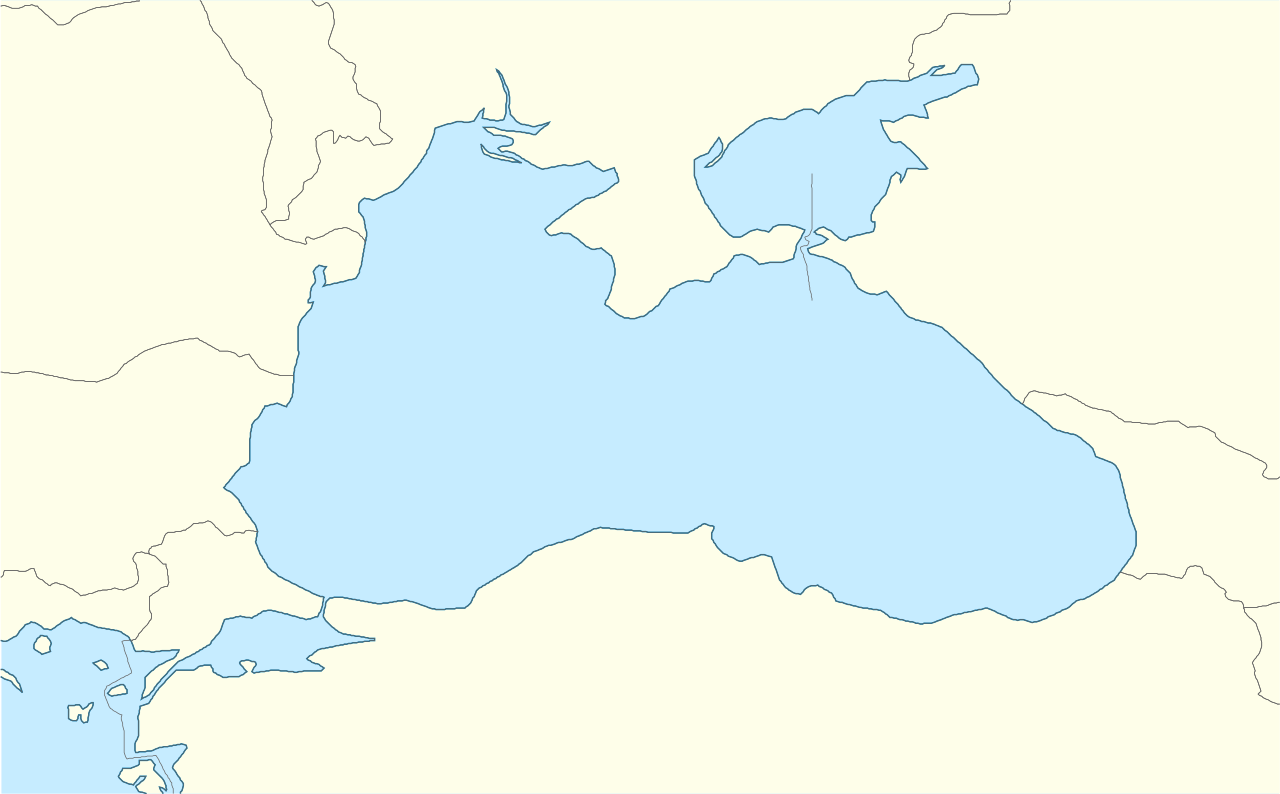
English: Location map of the Black Sea.
|
| Datums | |
| Avots | Paša darbs |
| Autors | Tentotwo |
Shell script for generating the map using GMT
#!/bin/sh

# Set common options
PROJECTION=Q34/43.5/15c
REGION=24/44/39/48
FILENAME=Black_Sea_location_map.ps

# Get Natural Earth datafiles
echo "Downloading datafiles from naturalearthdata.com"
wget -nv -nc \
 http://www.naturalearthdata.com/http//www.naturalearthdata.com/download/50m/physical/50m-coastline.zip\
 http://www.naturalearthdata.com/http//www.naturalearthdata.com/download/50m/physical/50m-land.zip\
 http://www.naturalearthdata.com/http//www.naturalearthdata.com/download/50m/cultural/50m-admin-0-countries.zip
echo "...done\n"

echo "Inflating archives"
unzip 50m\*.zip
unzip 110m\*.zip
echo "...done\n"

echo "Converting shapefiles to GMT"
ogr2ogr -F GMT 50m_land.gmt 50m_land.shp
ogr2ogr -F GMT 50m_coastline.gmt 50m_coastline.shp
ogr2ogr -F GMT 50m_borders.gmt ne_50m_admin_0_countries.shp
ogr2ogr -F GMT 10m_maritime_borders.gmt ne_10m_admin_0_boundary_lines_maritime_indicator.shp
echo "...done\n"

echo "Creating maps"
GMT psxy -m -J$PROJECTION -R$REGION --PAGE_COLOR=198/236/255  --POLAR_CAP=none --PAPER_MEDIA=A4  --BASEMAP_TYPE=plain --BASEMAP_AXES=NESW --FRAME_PEN=0.15p,black 50m_land.gmt -K -G254/254/233 > $FILENAME
GMT psxy -m -J$PROJECTION -R$REGION 50m_coastline.gmt -O -K -W0.535p,9/120/171  >> $FILENAME
GMT psxy -m -J$PROJECTION -R$REGION 50m_borders.gmt -O -K -W100/100/100  >> $FILENAME


EOF
GMT psxy -m -J$PROJECTION -R$REGION 10m_maritime_borders.gmt -O -W100/100/100  >> $FILENAME
echo "...done\n"

echo "You can now open $FILENAME in Inkscape to clean up the file and save it as SVG. You should add an ocean coloured background and simplify the graticules using CTRL+L."

gv $FILENAME
Licence
Es, šī darba autortiesību īpašnieks, publicēju to saskaņā ar šo licenci:
Šis fails tiek izplatīts saskaņā ar licences Creative Commons Atsauce-Līdzīgi Noteikumi 3.0 Vispārējiem noteikumiem.
- Jūs varat brīvi:
- koplietot – kopēt, izplatīt un pārraidīt darbu
- remiksēt – pielāgot darbu
- Saskaņā ar šādiem nosacījumiem:
- atsaucoties – Tev ir jānorāda autors, saite uz licenci un to, vai veiktas kādas izmaiņas. To var darīt jebkādā saprātīgā veidā, bet ne tādā, kas norādītu, ka licencētājs atbalsta tevi vai veidu, kā tu izmanto šo darbu.
- nemainot licenci – Ja tu miksē, pārveido vai izmanto materiālu, tev savs devums jāpublicē ar to pašu vai saderīgu licenci kā oriģināls.
Faila hronoloģija
Uzklikšķini uz datums/laiks kolonnā esošās saites, lai apskatītos, kā šis fails izskatījās tad.
| Datums/Laiks | Attēls | Izmēri | Dalībnieks | Komentārs | |
|---|---|---|---|---|---|
| tagadējais | 2016. gada 5. janvāris, plkst. 15.33 | | 532 × 330 (86 KB) | Seryo93 | Reverted to version as of 13:59: one pixel. needs to be fixed |
| 2016. gada 5. janvāris, plkst. 15.33 |  | 532 × 331 (136 KB) | Seryo93 | Narrowed too-wide Isthmus of Perekop using File:Ausschliessliche_Wirtschaftszonen_Schwarzes_Meer.svg as a base | |
| 2012. gada 14. februāris, plkst. 16.59 |  | 532 × 330 (86 KB) | Tentotwo |
Faila lietojums
Šo failu izmanto šajā 1 lapā:
Globālais faila lietojums
Šīs Vikipēdijas izmanto šo failu:
- Izmantojums az.wikipedia.org
- Izmantojums ce.wikipedia.org
- Izmantojums de.wikipedia.org
- Izmantojums dsb.wikipedia.org
- Izmantojums eo.wikipedia.org
- Izmantojums es.wikipedia.org
- Izmantojums eu.wikipedia.org
- Izmantojums fi.wikipedia.org
- Izmantojums frr.wikipedia.org
- Izmantojums fr.wikipedia.org
- Izmantojums he.wikipedia.org
- Izmantojums hsb.wikipedia.org
- Izmantojums hu.wikipedia.org
- Izmantojums hu.wiktionary.org
- Izmantojums kk.wikipedia.org
- Izmantojums ko.wikipedia.org
- Izmantojums krc.wikipedia.org
- Izmantojums nap.wikipedia.org
- Izmantojums no.wikipedia.org
- Izmantojums pl.wikipedia.org
- Izmantojums pl.wikibooks.org
- Izmantojums pl.wiktionary.org
- Izmantojums ru.wikipedia.org
- Izmantojums zh.wikipedia.org