
Attēls:Greenland.A2004208.1810.250m.jpg

Šī priekšskata izmērs: 800 × 600 pikseļi. Citi izmēri: 320 × 240 pikseļi | 640 × 480 pikseļi | 1 024 × 768 pikseļi | 1 280 × 960 pikseļi | 2 560 × 1 920 pikseļi | 3 200 × 2 400 pikseļi.
Sākotnējais fails (3 200 × 2 400 pikseļi, faila izmērs: 1,11 MB, MIME tips: image/jpeg)
| Šis fails ir no Vikikrātuves. Tā apraksts no attēla lapas Vikikrātuvē ir parādīts zemāk. Vikikrātuve ir brīvi licencēta failu krātuve. Tu vari tai palīdzēt. |
Kopsavilkums
| Apraksts |
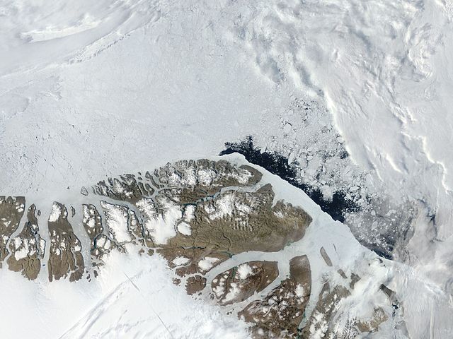
English: Northern Greenland (Peary Land): Moderate Resolution Imaging Spectroradiometer (MODIS) on NASA’s Terra satellite |
| Datums | |
| Avots | http://visibleearth.nasa.gov/view.php?id=71935 |
| Autors | NASA |
Licence
| This file is in the public domain in the United States because it was solely created by NASA. NASA copyright policy states that "NASA material is not protected by copyright unless noted". (See Template:PD-USGov, NASA copyright policy page or JPL Image Use Policy.) | ||
 |
Warnings:
|
| Annotations | This image is annotated: View the annotations at Commons |
Faila hronoloģija
Uzklikšķini uz datums/laiks kolonnā esošās saites, lai apskatītos, kā šis fails izskatījās tad.
| Datums/Laiks | Attēls | Izmēri | Dalībnieks | Komentārs | |
|---|---|---|---|---|---|
| tagadējais | 2012. gada 18. jūlijs, plkst. 09.06 | | 3 200 × 2 400 (1,11 MB) | Ratzer | {{Information |Description ={{en|1=Northern Greenland (Peary Land): Moderate Resolution Imaging Spectroradiometer (MODIS) on NASA’s Terra satellite}} |Source =http://visibleearth.nasa.gov/view.php?id=71935 |Author =NASA |Date ... |
Faila lietojums
Šo failu izmanto šajā 1 lapā:
Globālais faila lietojums
Šīs Vikipēdijas izmanto šo failu:
- Izmantojums be.wikipedia.org
- Izmantojums ca.wikipedia.org
- Izmantojums ceb.wikipedia.org
- Izmantojums cs.wikipedia.org
- Izmantojums da.wikipedia.org
- Izmantojums de.wikipedia.org
- Izmantojums en.wikipedia.org
- Peary Land
- Independence I culture
- Sverdrup Island (Greenland)
- East Jensen Island
- Hazenland
- John Murray Island
- Princess Dagmar Island
- Princess Thyra Island
- Borup Island
- Stephenson Island (Greenland)
- Princess Margaret Island
- De Long Fjord
- Beaumont Island (Greenland)
- Roosevelt Range
- Johannes V. Jensen Land
- Nansen Land
- Stjernebannertinde
- Roosevelt Land
- Amundsen Land
- Melville Land
Skatīt šī faila pilno globālo izmantojumu.