
Attēls:Kazakhstan location map.svg

Sākotnējais fails (SVG fails, definētais izmērs 1 984 × 1 134 pikseļi, faila izmērs: 634 KB)
| Šis fails ir no Vikikrātuves. Tā apraksts no attēla lapas Vikikrātuvē ir parādīts zemāk. Vikikrātuve ir brīvi licencēta failu krātuve. Tu vari tai palīdzēt. |
Kopsavilkums
| Apraksts |
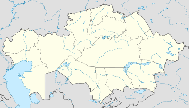
Deutsch: Positionskarte von Kasachstan
Quadratische Plattkarte, N-S-Streckung 150 %. Geographische Begrenzung der Karte:
English: Location map of Kazakhstan
Equirectangular projection, N/S stretching 150 %. Geographic limits of the map:
|
|
| Datums | ||
| Avots |
Paša darbs, using
|
|
| Autors | NordNordWest | |
| Atļauja: (Šī faila izmantošana citur) |
Šis fails tiek izplatīts saskaņā ar licenci Creative Commons Atsauce-Līdzīgi Noteikumi 3.0 Vācijā.
 Šis fails tiek izplatīts saskaņā ar licenci Creative Commons Atsauce-Līdzīgi Noteikumi 3.0 Vācijā.
|


|
Šī karte bija uzlabota vācu Kartenwerkstatt. Jūs arī varat piedāvāt citas kartes uzlabošanai.
|
Faila hronoloģija
Uzklikšķini uz datums/laiks kolonnā esošās saites, lai apskatītos, kā šis fails izskatījās tad.
| Datums/Laiks | Attēls | Izmēri | Dalībnieks | Komentārs | |
|---|---|---|---|---|---|
| tagadējais | 2010. gada 1. augusts, plkst. 21.48 | | 1 984 × 1 134 (634 KB) | NordNordWest | upd |
| 2009. gada 27. novembris, plkst. 22.15 |  | 1 985 × 1 134 (949 KB) | NordNordWest | c | |
| 2009. gada 24. novembris, plkst. 15.42 |  | 1 984 × 1 134 (942 KB) | NordNordWest | c | |
| 2009. gada 24. novembris, plkst. 15.38 |  | 1 985 × 1 134 (941 KB) | NordNordWest | ||
| 2009. gada 23. novembris, plkst. 21.41 |  | 1 985 × 1 134 (516 KB) | NordNordWest | =={{int:filedesc}}== {{Information |Description= {{de|Positionskarte von Kasachstan, '''Vorversion'''}} Quadratische Plattkarte, N-S-Streckung 150 %. Geographische Begrenzung der Karte: * N: 56° N * S: 40° N * W: 46° O * O: 88° O {{ |
Faila lietojums
Šo failu izmanto šajā 1 lapā:
Globālais faila lietojums
Šīs Vikipēdijas izmanto šo failu:
- Izmantojums av.wikipedia.org
- Izmantojums bg.wikinews.org
- Izmantojums de.wikipedia.org
- Izmantojums es.wikipedia.org
- Izmantojums fr.wikipedia.org
- Izmantojums incubator.wikimedia.org
- Izmantojums kaa.wikipedia.org
- Izmantojums mt.wikipedia.org
- Izmantojums pt.wikipedia.org
- Izmantojums rue.wikipedia.org
- Izmantojums ru.wikipedia.org
- Izmantojums sk.wikipedia.org