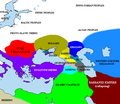
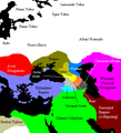
Attēls:Pontic steppe region around 650 AD.png

Lapas saturs netiek atbalstīts citās valodās.
Vikipēdijas lapa

Pontic_steppe_region_around_650_AD.png(637 × 553 pikseļi, faila izmērs: 40 KB, MIME tips: image/png)

Kopsavilkums

This historical map image could be re-created using vector graphics as an SVG file. This has several advantages; see Commons:Media for cleanup for more information. If an SVG form of this image is available, please upload it and afterwards replace this template with {{vector version available|new image name}}.


It is recommended to name the SVG file “Pontic steppe region around 650 AD.svg”—then the template Vector version available (or Vva) does not need the new image name parameter.
Apraksts
English: The en:Pontic steppe region, c. 650 CE.
Русский: Черноморско-каспийский регион около 650 года н.э.
Deutsch: Die Verteilung von Stämmen und Herrschaften in der Pontokaspischen Region um 650 n. Chr.
Français : Carte de la steppe pontique aux environs de l'an 650.
Datums 2005. gada 29. decembris (original upload date)
Avots Transferred from en.wikipedia to Commons.
Izveidotājs
The original uploader was Briangotts at angļu Vikipēdija.
 Geotemporal data
Bounding box
N: 64.190751°N
W: 13.879759°E E: 72.5553846°E
S: 27.6329482°N
Georeferencing View the georeferenced map in the Wikimaps Warper

Licence

GNU head Ir dota atļauja kopēt, izplatīt un/vai pārveidot šo dokumentu saskaņā ar GNU brīvās dokumentācijas licences, versijas 1.2 vai jebkuras vēlākas versijas, ko publiskojis Brīvās programmatūras fonds nosacījumiem; bez nemainīgajām sadaļā, priekšējā un aizmugurēja'vāka tekstiem. Licences kopija ir iekļauta sadaļā ar nosaukumu GNU brīvās dokumentācijas licence.
w:en:Creative Commons
atsaucoties nemainot licenci
Šis fails tiek izplatīts saskaņā ar licences Creative Commons Atsauce-Līdzīgi Noteikumi 3.0 Vispārējiem noteikumiem.
Jūs varat brīvi:
  • koplietot – kopēt, izplatīt un pārraidīt darbu
  • remiksēt – pielāgot darbu
Saskaņā ar šādiem nosacījumiem:
  • atsaucoties – Tev ir jānorāda autors, saite uz licenci un to, vai veiktas kādas izmaiņas. To var darīt jebkādā saprātīgā veidā, bet ne tādā, kas norādītu, ka licencētājs atbalsta tevi vai veidu, kā tu izmanto šo darbu.
  • nemainot licenci – Ja tu miksē, pārveido vai izmanto materiālu, tev savs devums jāpublicē ar to pašu vai saderīgu licenci kā oriģināls.
This licensing tag was added to this file as part of the GFDL licensing update.

Original upload log

The original description page was here. All following user names refer to en.wikipedia.
  • 2007-04-11 19:01 Briangotts 637×553×8 (27154 bytes) == Summary == The [[Pontic steppe]] region, c. AD 650. [[Category:Historical maps by User:Briangotts]] [[Category:Maps of the history of Russia]]
  • 2006-01-24 17:57 Briangotts 406×448×8 (15464 bytes) == Summary == The [[Pontic steppe]] region, c. 650 CE. [[Category:Historical maps by User:Briangotts]] == Licensing == {{GFDL-self}}
  • 2005-12-29 20:33 Briangotts 406×448×8 (15489 bytes) == Summary == The [[Pontic steppe]] region, c. 650 CE. [[Category:Historical maps by User:Briangotts]] == Licensing == {{GFDL-self}}
  • 2005-12-29 20:30 Briangotts 406×448×8 (15662 bytes) The [[Pontic steppe]] region, c. 650 CE. [[Category:Historical maps by User:Briangotts]]

Captions

Pievieno vienas rindiņas aprakstu, ko šis fails attēlo

Šajā failā attēlotais

attēlo

image/png

Faila hronoloģija

Uzklikšķini uz datums/laiks kolonnā esošās saites, lai apskatītos, kā šis fails izskatījās tad.

Datums/LaiksAttēlsIzmēriDalībnieksKomentārs
tagadējais2022. gada 14. oktobris, plkst. 20.352022. gada 14. oktobris, plkst. 20.35 versijas sīktēls637 × 553 (40 KB)Gyalu22The Byzantine and Sassanian empires were under invasion
2016. gada 24. februāris, plkst. 23.332016. gada 24. februāris, plkst. 23.33 versijas sīktēls637 × 553 (53 KB)Taron SaharyanАрмения был автономна, см. Theodore Rshtuni
2015. gada 23. decembris, plkst. 16.352015. gada 23. decembris, plkst. 16.35 versijas sīktēls637 × 553 (51 KB)Ercwlfffor 650 armenia was already conquered by the arabs
2015. gada 25. septembris, plkst. 14.082015. gada 25. septembris, plkst. 14.08 versijas sīktēls637 × 553 (53 KB)Taron Saharyanисправлены восточные пределы Армении
2014. gada 10. augusts, plkst. 14.102014. gada 10. augusts, plkst. 14.10 versijas sīktēls637 × 553 (40 KB)Spiridon Ion CepleanuCosmetic little changes according with H.E.Stier (dir.) « Westermann Grosser Atlas zur Weltgeschichte », 1985, ISBN 3-14-100919-8, the « Putzger historischer Weltatlas Cornelsen » 1990, ISBN 3-464-00176-8, the André & Jean Sellier « Atlas des Peu...
2007. gada 25. maijs, plkst. 13.432007. gada 25. maijs, plkst. 13.43 versijas sīktēls637 × 553 (27 KB)Angusmclellan{{Information |Description=The en:Pontic steppe region, c. AD 650. en:Category:Historical maps by User:Briangotts en:Category:Maps of the history of Russia |Source=Originally from [http://en.wikipedia.org en.wikipedia]; description page
2006. gada 17. janvāris, plkst. 11.442006. gada 17. janvāris, plkst. 11.44 versijas sīktēls406 × 448 (15 KB)Jrohr== Summary == The Pontic steppe region, c. 650 CE. Category:Historical maps by User:Briangotts == Licensing == {{GFDL-self}}

Šo failu izmanto šajās 2 lapās:

Globālais faila lietojums

Šīs Vikipēdijas izmanto šo failu:

Skatīt šī faila pilno globālo izmantojumu.

Metadati