
Attēls:USA Counties.svg

Size of this PNG preview of this SVG file: 555 × 352 pikseļi. Citi izmēri: 320 × 203 pikseļi | 640 × 406 pikseļi | 1 024 × 649 pikseļi | 1 280 × 812 pikseļi | 2 560 × 1 624 pikseļi.
Sākotnējais fails (SVG fails, definētais izmērs 555 × 352 pikseļi, faila izmērs: 1,11 MB)
| Šis fails ir no Vikikrātuves. Tā apraksts no attēla lapas Vikikrātuvē ir parādīts zemāk. Vikikrātuve ir brīvi licencēta failu krātuve. Tu vari tai palīdzēt. |

|
This file has been superseded by Usa counties large.svg. It is recommended to use the other file. Please note that deleting superseded images requires consent. Reason to use the other file: "Contains county names and county codes in the svg code"
|

|
| Apraksts |
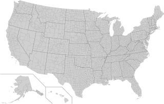
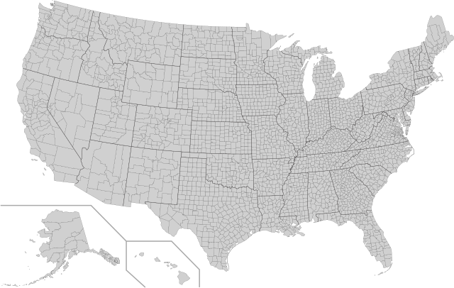
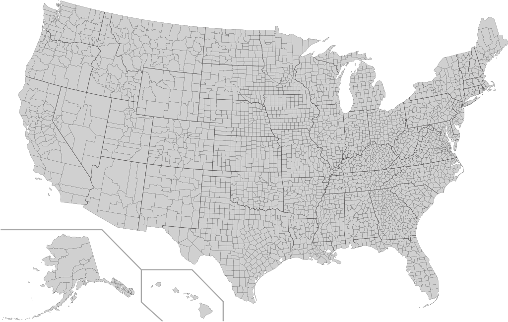
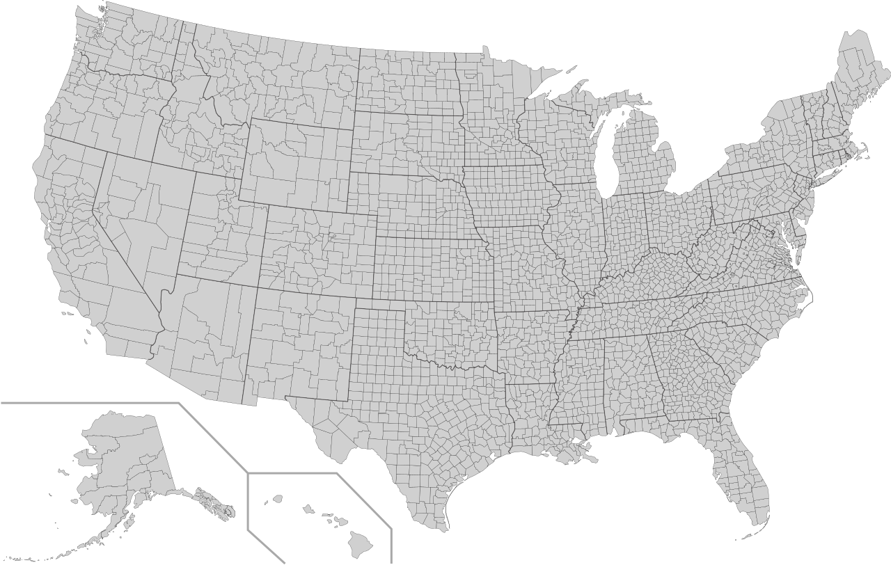
English: This is a map of the United States showing the borders of states and counties in high detail. |
|||
| Avots |
It was derived from this public-domain document published by the U.S. Census Bureau. |
|||
| Autors | U.S. Census Bureau | |||
| Atļauja: (Šī faila izmantošana citur) |
|
|||
| Citas versijas | Derivative works of this file: Usa counties large.svg | |||
| SVG veidošana |

Faila hronoloģija
Uzklikšķini uz datums/laiks kolonnā esošās saites, lai apskatītos, kā šis fails izskatījās tad.
| Datums/Laiks | Attēls | Izmēri | Dalībnieks | Komentārs | |
|---|---|---|---|---|---|
| tagadējais | 2022. gada 10. augusts, plkst. 08.18 | | 555 × 352 (1,11 MB) | DemonDays64 | Fixed some problems: merged southern part of Unorganized Alaska into one shape; properly labeled Somerset MD, which Accomack VA had been mislabeled as |
| 2020. gada 17. septembris, plkst. 09.22 |  | 555 × 352 (1,11 MB) | DemonDays64 | Fixed misspelling of "Albemarle" as "Albermarle" | |
| 2018. gada 10. septembris, plkst. 18.56 |  | 555 × 352 (1,11 MB) | JoKalliauer | restored id-names and css from 03:49, 26. Mär. 2016 | |
| 2018. gada 30. augusts, plkst. 09.38 |  | 555 × 352 (670 KB) | JoKalliauer | Smaller file-size. Cleaner code. valid file | |
| 2016. gada 26. marts, plkst. 06.49 |  | 555 × 352 (1,58 MB) | Spesh531 | updating borders, more accurate | |
| 2007. gada 23. decembris, plkst. 18.47 |  | 555 × 352 (2,03 MB) | Lokal Profil | Fixed state borders and fixed the two parts of Fulton County (Kentucky) | |
| 2007. gada 10. decembris, plkst. 05.20 |  | 555 × 352 (2,04 MB) | Lokal Profil | Graphical and code cleanup | |
| 2007. gada 10. decembris, plkst. 04.15 |  | 792 × 612 (2,04 MB) | Lokal Profil | First stab at a code cleanup | |
| 2006. gada 29. augusts, plkst. 03.14 |  | 792 × 612 (2,71 MB) | Petr Dlouhý | Original file: en:Image:USA CountiesSVG.zip This ZIP file contains an SVG map of the United States showing the borders of states and counties in high detail. It was derived from [http://www2.census.gov/geo/maps/special |
Faila lietojums
Šo failu neizmanto nevienā lapā.
Globālais faila lietojums
Šīs Vikipēdijas izmanto šo failu:
- Izmantojums af.wikipedia.org
- Izmantojums en.wikipedia.org
- Izmantojums fa.wikipedia.org
- Izmantojums fi.wikipedia.org
- Izmantojums he.wikipedia.org
- Izmantojums hi.wikipedia.org
- Izmantojums hu.wikipedia.org
- Izmantojums io.wikipedia.org
- Izmantojums pnb.wikipedia.org
- Izmantojums pt.wikipedia.org
- Izmantojums ro.wikipedia.org
- Izmantojums sh.wikipedia.org
- Izmantojums sq.wikipedia.org
- Izmantojums sr.wikipedia.org
- Izmantojums tr.wikipedia.org
- Izmantojums ur.wikipedia.org