
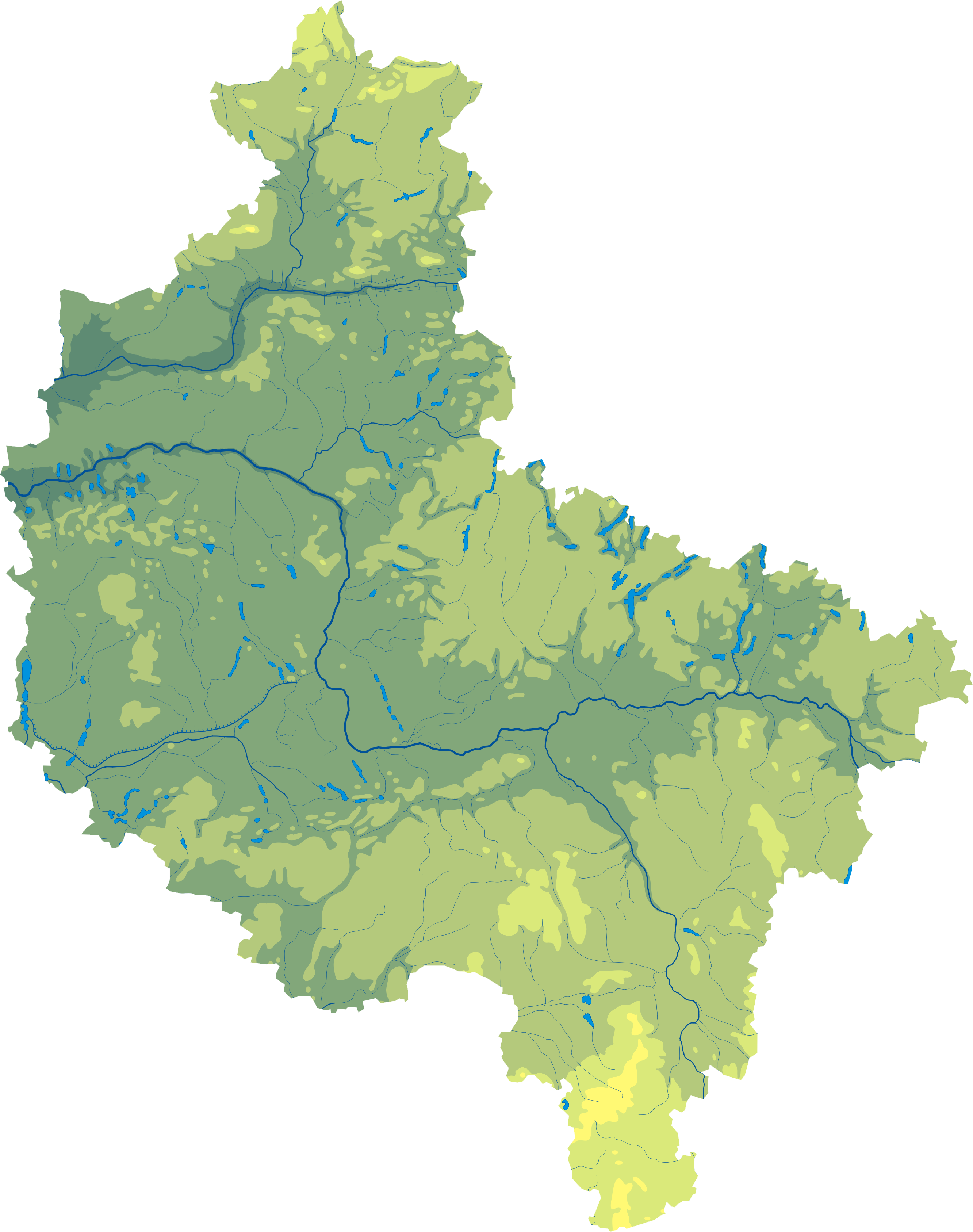
Attēls:Wielkopolskie mapa fizyczna.png
Šī priekšskata izmērs: 473 × 599 pikseļi. Citi izmēri: 189 × 240 pikseļi | 379 × 480 pikseļi | 607 × 768 pikseļi | 809 × 1 024 pikseļi | 1 618 × 2 048 pikseļi | 2 665 × 3 374 pikseļi.
Sākotnējais fails (2 665 × 3 374 pikseļi, faila izmērs: 918 KB, MIME tips: image/png)
| Šis fails ir no Vikikrātuves. Tā apraksts no attēla lapas Vikikrātuvē ir parādīts zemāk. Vikikrātuve ir brīvi licencēta failu krātuve. Tu vari tai palīdzēt. |
| Apraksts |
Polski: Mapa wód i ukształtowania powierzchni województwa wielkopolskiego.
Współrzędne graniczne mapy:
English: Relief map of Greater Poland Voivodeship. |
||
| Datums | |||
| Avots | Wielkopolskie mapa fizyczna, which was created and published under GFDL-self by Aotearoa. | ||
| Autors | Aotearoa | ||
| Atļauja: (Šī faila izmantošana citur) |
|

Legend

Faila hronoloģija
Uzklikšķini uz datums/laiks kolonnā esošās saites, lai apskatītos, kā šis fails izskatījās tad.
| Datums/Laiks | Attēls | Izmēri | Dalībnieks | Komentārs | |
|---|---|---|---|---|---|
| tagadējais | 2012. gada 29. oktobris, plkst. 14.05 | | 2 665 × 3 374 (918 KB) | Aotearoa | drobne techniczne |
| 2007. gada 8. februāris, plkst. 09.14 |  | 548 × 691 (118 KB) | Bonas | {{Information |Description= Relief map of Greater Poland Voivodeship. |Source= Wielkopolskie mapa fizyczna, which was created and published under GFDL-self by [[:pl:Wikipe |
Faila lietojums
Šo failu izmanto šajā 1 lapā:
Globālais faila lietojums
Šīs Vikipēdijas izmanto šo failu:
- Izmantojums be.wikipedia.org
- Izmantojums bg.wikipedia.org
- Познан
- Жележница (Великополско войводство)
- Волщин
- Калиш
- Конин
- Лешно
- Гнезно
- Остров Велкополски
- Пила (град)
- Сважендз
- Шрем
- Кротошин
- Вжешня
- Любон
- Турек
- Ярочин
- Вонгровец
- Кошчян
- Коло (Великополско войводство)
- Шрода Велкополска
- Равич
- Гостин
- Плешев
- Лобженица
- Гроджиск Велкополски
- Злотов
- Кемпно
- Мендзиход
- Нови Томишъл
- Оборники
- Остшешов
- Слупца
- Ходжеж
- Чарнков
- Шамотули
- Тшчянка
- Шаблон:ПК Полша Великополско войводство
- Костшинек
- Променко
- Нежихово
- Винна Гора (Великополско войводство)
- Качори (Пилски окръг)
- Мошчиска
- Хутка
- Жулч
- Остророг
- Izmantojums ce.wikipedia.org
- Izmantojums de.wikipedia.org
- Izmantojums hu.wikipedia.org
Skatīt šī faila pilno globālo izmantojumu.