
Attēls:Estonia location map (2005-2017) no rivers.svg

Size of this PNG preview of this SVG file: 718 × 600 pikseļi. Citi izmēri: 287 × 240 pikseļi | 575 × 480 pikseļi | 920 × 768 pikseļi | 1 226 × 1 024 pikseļi | 2 452 × 2 048 pikseļi | 1 668 × 1 393 pikseļi.
Sākotnējais fails (SVG fails, definētais izmērs 1 668 × 1 393 pikseļi, faila izmērs: 407 KB)
| Šis fails ir no Vikikrātuves. Tā apraksts no attēla lapas Vikikrātuvē ir parādīts zemāk. Vikikrātuve ir brīvi licencēta failu krātuve. Tu vari tai palīdzēt. |
Kopsavilkums
| Apraksts |
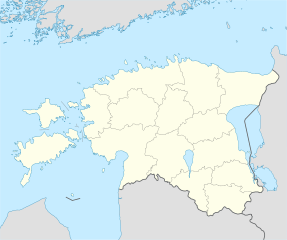
Deutsch: Positionskarte von Estland
Quadratische Plattkarte, N-S-Streckung 180 %. Geographische Begrenzung der Karte:
English: Location map of Estonia
Equirectangular projection, N/S stretching 180 %. Geographic limits of the map:
|
||
| Datums | |||
| Avots | own work, using United States National Imagery and Mapping Agency data | ||
| Autors | NordNordWest | ||
| Citas versijas |
Derivative works of this file: |
||
| SVG veidošana |
|

_no_rivers.svg?uselang=lv)
.svg)
Licence
Es, šī darba autortiesību īpašnieks, publicēju to saskaņā ar šīm licencēm:

|
Ir dota atļauja kopēt, izplatīt un/vai pārveidot šo dokumentu saskaņā ar GNU brīvās dokumentācijas licences, versijas 1.2 vai jebkuras vēlākas versijas, ko publiskojis Brīvās programmatūras fonds nosacījumiem; bez nemainīgajām sadaļā, priekšējā un aizmugurēja'vāka tekstiem. Licences kopija ir iekļauta sadaļā ar nosaukumu GNU brīvās dokumentācijas licence. |
Šis fails tiek izplatīts saskaņā ar licences Creative Commons Atsauce-Līdzīgi Noteikumi 3.0 Vispārējiem noteikumiem.
- Jūs varat brīvi:
- koplietot – kopēt, izplatīt un pārraidīt darbu
- remiksēt – pielāgot darbu
- Saskaņā ar šādiem nosacījumiem:
- atsaucoties – Tev ir jānorāda autors, saite uz licenci un to, vai veiktas kādas izmaiņas. To var darīt jebkādā saprātīgā veidā, bet ne tādā, kas norādītu, ka licencētājs atbalsta tevi vai veidu, kā tu izmanto šo darbu.
- nemainot licenci – Ja tu miksē, pārveido vai izmanto materiālu, tev savs devums jāpublicē ar to pašu vai saderīgu licenci kā oriģināls.
Jūs varat izvēlēties licenci pēc jūsu vēlmes.
Faila hronoloģija
Uzklikšķini uz datums/laiks kolonnā esošās saites, lai apskatītos, kā šis fails izskatījās tad.
| Datums/Laiks | Attēls | Izmēri | Dalībnieks | Komentārs | |
|---|---|---|---|---|---|
| tagadējais | 2019. gada 6. maijs, plkst. 09.14 | | 1 668 × 1 393 (407 KB) | Lasunncty | fix svg errors and reduce file size |
| 2009. gada 9. maijs, plkst. 23.05 |  | 1 668 × 1 393 (464 KB) | NordNordWest | some troubles with changing location maps that way | |
| 2009. gada 9. maijs, plkst. 20.18 |  | 1 000 × 835 (639 KB) | Ahnode | *1. Resized the objects to W:1000px, H:835px. *2. Created two separate layers for Estonia itself and the rest of the world. *3. Subtracted lakes from shape areas and divided area of Estonia into counties to ease future creation of location maps. | |
| 2008. gada 25. augusts, plkst. 22.03 |  | 1 668 × 1 393 (464 KB) | NordNordWest | size correction | |
| 2008. gada 7. jūlijs, plkst. 17.11 |  | 556 × 464 (467 KB) | NordNordWest | ||
| 2008. gada 29. jūnijs, plkst. 17.25 |  | 556 × 464 (468 KB) | NordNordWest | {{Information |Description= {{de|Positionskarte von Estland}} Quadratische Plattkarte, N-S-Streckung 180 %. Geographische Begrenzung der Karte: * N: 60.4° N * S: 57.2° N * W: 21.5° O * O: 28.4° O {{en|Location map of [[:en:Estonia|Esto |
Faila lietojums
Šo failu izmanto šajās 5 lapās:
Globālais faila lietojums
Šīs Vikipēdijas izmanto šo failu:
- Izmantojums af.wikipedia.org
- Izmantojums ba.wikipedia.org
- Izmantojums be-tarask.wikipedia.org
- Талін
- Шаблён:Лякалізацыйная мапа Эстоніі
- Саарэмаа
- Талінскі ўнівэрсытэт
- Валга
- Выру
- Йыхві
- Вільяндзі
- Харку (возера)
- Выртс’ярв
- Пярну
- Муху
- Йыгева
- Раквэрэ
- Тартускі ўнівэрсытэт
- Тарту
- Шаблён:Пратока
- Шаблён:Пратока/Дакумэнтацыя
- Музэй акупацыяў
- Царква Сьвятога Міхаіла (Кейля)
- Царква прытулку Сьвятога Яна (Талін)
- Палдыскі
- Царква Сьвятога Яна (Талін)
- Калёна Перамогі ў вайне за незалежнасьць Эстоніі
- Нарва (горад)
- Кейля
- Курэсаарэ
- Саўэ
- Царква Сьвятога Олафа (Талін)
- Домскі сабор (Талін)
- Нараўскі замак
- Кохтла-Ярвэ
- Кейля (замак)
- Царква Сьвятога Марціна (Вальяла)
- Пылва
- Талінская ратуша
- Суўр Мунамягі
- Юлемістэ (возера)
- Кляштар Сьвятой Біргіты
- Пюхціцкі манастыр
- Элва
- Сабор Аляксандра Неўскага (Талін)
- Царква Сьвятога Духа (Талін)
- Хіюмаа
- Кік-ін-дэ-Кёк
- Стары Томас
- Эстонскі марскі музэй
Skatīt šī faila pilno globālo izmantojumu.
_no_rivers.svg)
_no_rivers.svg)