
Attēls:China Gansu rel location map.svg

Sākotnējais fails (SVG fails, definētais izmērs 998 × 789 pikseļi, faila izmērs: 724 KB)
| Šis fails ir no Vikikrātuves. Tā apraksts no attēla lapas Vikikrātuvē ir parādīts zemāk. Vikikrātuve ir brīvi licencēta failu krātuve. Tu vari tai palīdzēt. |
Kopsavilkums
| Apraksts |
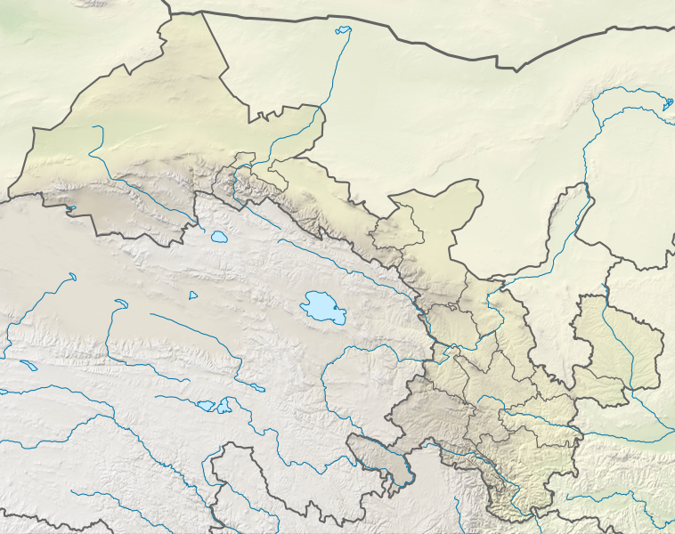
Deutsch: Positionskarte von Gansu, Volksrepublik China
English: Location map of Gansu, People's Republic of China
|
||||||||||||
| Datums | |||||||||||||
| Avots |
Own work using:
|
||||||||||||
| Autors | NordNordWest | ||||||||||||
| Citas versijas |
|
||||||||||||


|
Šī karte bija uzlabota vācu Kartenwerkstatt. Jūs arī varat piedāvāt citas kartes uzlabošanai.
|
Licence
Usage of this file with:

explanatory notes: Legally binding is only the full legalcode. For a free usage I recommend to respect the following licence conditions:
1. Provide my name as given above: NordNordWest,
2. a copy of, or the URI for, the applicable license: https://creativecommons.org/licenses/by-sa/3.0/de/legalcode,
3. the title of the work,
4. in the case of an adaptation, a credit identifying the use of the work in the adaptation.
This license and the rights granted hereunder will terminate automatically upon any breach by you of the terms of this license. Any of the above conditions can be waived if you get permission from the copyright holder. If you have questions or wish differing conditions, please contact me through nnwest or my discussion page ![]() t-online.de
t-online.de
- Jūs varat brīvi:
- koplietot – kopēt, izplatīt un pārraidīt darbu
- remiksēt – pielāgot darbu
- Saskaņā ar šādiem nosacījumiem:
- atsaucoties – Tev ir jānorāda autors, saite uz licenci un to, vai veiktas kādas izmaiņas. To var darīt jebkādā saprātīgā veidā, bet ne tādā, kas norādītu, ka licencētājs atbalsta tevi vai veidu, kā tu izmanto šo darbu.
- nemainot licenci – Ja tu miksē, pārveido vai izmanto materiālu, tev savs devums jāpublicē ar to pašu vai saderīgu licenci kā oriģināls.

Faila hronoloģija
Uzklikšķini uz datums/laiks kolonnā esošās saites, lai apskatītos, kā šis fails izskatījās tad.
| Datums/Laiks | Attēls | Izmēri | Dalībnieks | Komentārs | |
|---|---|---|---|---|---|
| tagadējais | 2022. gada 24. aprīlis, plkst. 20.49 | | 998 × 789 (724 KB) | NordNordWest | == {{int:filedesc}} == {{Information |Description= {{de|1=Positionskarte von Gansu, Volksrepublik China}} {{en|1=Location map of Gansu, People's Republic of China}} {{Location map series N |stretching=126 |top=43 |bottom=32.4 |left=92.1 |right=109 }} |Source={{Own using}} * United States National Imagery and Mapping Agency data * World Data Base II data * ETOPO1 data |Date=2022-04-24 |Author={{U|NordNordWest}} |Permission= |other_versions=<gallery>China Gansu adm location map.svg</gallery> }}... |
Faila lietojums
Šo failu izmanto šajā 1 lapā:
Globālais faila lietojums
Šīs Vikipēdijas izmanto šo failu:
- Izmantojums bn.wikipedia.org
- Izmantojums de.wikipedia.org
- Izmantojums en.wikipedia.org
- Dunhuang
- Mogao Caves
- Yumen City
- Crescent Lake (Dunhuang)
- Zhangye
- Lintao County
- Wushao Mountain
- Hekou Group
- Liujiaxia Reservoir
- 2010 Gansu mudslide
- Lazikou Pass
- Battle of Mount Qi
- 1879 Gansu earthquake
- Module:Location map/data/China Gansu
- Module:Location map/data/China Gansu/doc
- User:Ty654/List of earthquakes from 1900-1949 exceeding magnitude 7+
- User:Ty654/List of earthquakes from 1950-1999 exceeding magnitude 7+
- User:Ty654/List of earthquakes from 1920-1929 exceeding magnitude 6+
- User:Ty654/List of earthquakes from 1930-1939 exceeding magnitude 6+
- User:Ty654/List of earthquakes from 1950-1954 exceeding magnitude 6+
- Suoyang City
- User:Ty654/List of earthquakes before 1900 exceeding magnitude 8+
- Baishiya Karst Cave
- Module:Location map/data/Gansu
- Donggang Subdistrict
- Dahe Township, Gansu
- Zhuanglang River
- 1718 Tongwei–Gansu earthquake
- Module:Location map/data/Gansu/doc
- 2023 Jishishan earthquake
- Izmantojums fr.wikipedia.org
- Izmantojums he.wikipedia.org
Skatīt šī faila pilno globālo izmantojumu.