
Attēls:Filchner-ronne-schelfeis.jpg
Šī priekšskata izmērs: 463 × 599 pikseļi. Citi izmēri: 185 × 240 pikseļi | 371 × 480 pikseļi | 850 × 1 100 pikseļi.
Sākotnējais fails (850 × 1 100 pikseļi, faila izmērs: 81 KB, MIME tips: image/jpeg)
| Šis fails ir no Vikikrātuves. Tā apraksts no attēla lapas Vikikrātuvē ir parādīts zemāk. Vikikrātuve ir brīvi licencēta failu krātuve. Tu vari tai palīdzēt. |
Kopsavilkums
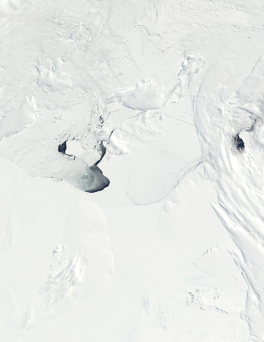
| Apraksts | This true-color image from the MODIS on NASA’s Terra satellite shows a portion of the West Antarctic coastline from about 60 degrees West (left) to about 20 degrees West (right). The image span (left to right) The Ronne Ice Shelf and Filchner Ice Shelf (the two are separated by Berkner Island, whose outline is barely visible just left of the center of the image), and Coats Land. At bottom right, a few rocky peaks are visible through the snow, and are known as the Shackleton Range. |
| Datums | |
| Avots |
http://visibleearth.nasa.gov/view_rec.php?id=3851
|
| Autors | NASA |
Licence
| This file is in the public domain in the United States because it was solely created by NASA. NASA copyright policy states that "NASA material is not protected by copyright unless noted". (See Template:PD-USGov, NASA copyright policy page or JPL Image Use Policy.) | ||
 |
Warnings:
|
Faila hronoloģija
Uzklikšķini uz datums/laiks kolonnā esošās saites, lai apskatītos, kā šis fails izskatījās tad.
| Datums/Laiks | Attēls | Izmēri | Dalībnieks | Komentārs | |
|---|---|---|---|---|---|
| tagadējais | 2005. gada 22. decembris, plkst. 08.25 | | 850 × 1 100 (81 KB) | Saperaud~commonswiki | *'''Description:''' Ronne-Filchner-Schelfeis *'''Source:''' http://visibleearth.nasa.gov/cgi-bin/viewrecord?19900 / German Wikipedia, original upload 26. Jun 2004 by Jensflorian [[de:Bild:{{subst:PAGENAME}}]] {{PD-USGov-NOAA} |
Faila lietojums
Šo failu izmanto šajā 1 lapā:
Globālais faila lietojums
Šīs Vikipēdijas izmanto šo failu:
- Izmantojums ar.wikipedia.org
- Izmantojums ast.wikipedia.org
- Izmantojums bg.wikipedia.org
- Izmantojums ca.wikipedia.org
- Izmantojums de.wikipedia.org
- Izmantojums en.wikinews.org
- Izmantojums es.wikipedia.org
- Izmantojums ka.wikipedia.org
- Izmantojums ru.wikipedia.org
- Izmantojums sv.wikipedia.org
- Izmantojums tr.wikipedia.org
- Izmantojums www.wikidata.org