
Attēls:First ETR in China.svg

Size of this PNG preview of this SVG file: 705 × 599 pikseļi. Citi izmēri: 282 × 240 pikseļi | 565 × 480 pikseļi | 904 × 768 pikseļi | 1 205 × 1 024 pikseļi | 2 409 × 2 048 pikseļi | 1 000 × 850 pikseļi.
Sākotnējais fails (SVG fails, definētais izmērs 1 000 × 850 pikseļi, faila izmērs: 232 KB)
| Šis fails ir no Vikikrātuves. Tā apraksts no attēla lapas Vikikrātuvē ir parādīts zemāk. Vikikrātuve ir brīvi licencēta failu krātuve. Tu vari tai palīdzēt. |
Kopsavilkums
| Apraksts |
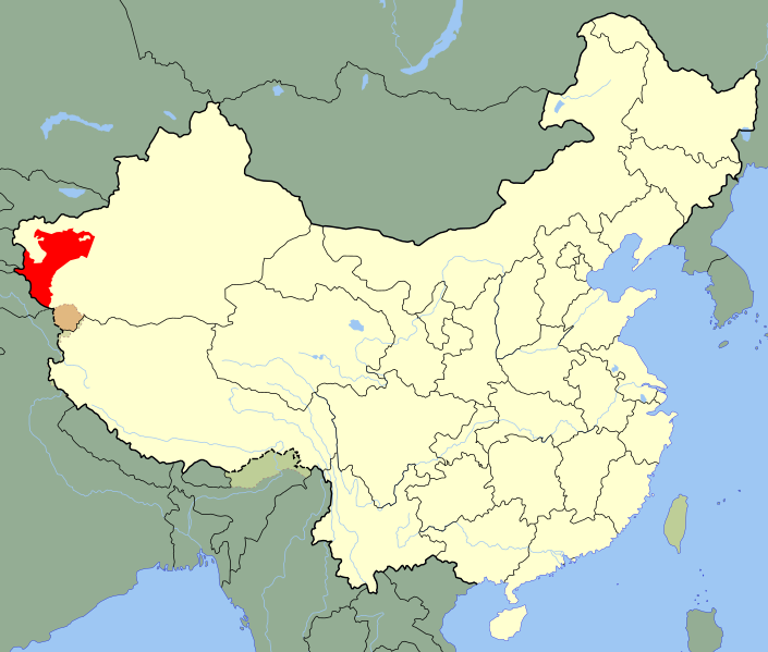
A SVG map of China with Xinjiang's Kashgar Prefecture highlighted in red; the modern-day district in which the w:en:First East Turkestan Republic was located. Legend: |
||
| Datums | (UTC) | ||
| Avots | |||
| Autors |
|
||
| SVG veidošana |
|
.svg)
| This is a retouched picture, which means that it has been digitally altered from its original version. Modifications: Unhighlighted Xinjiang as a whole, removed sub-provincial markers. The original can be viewed here: China Xinjiang Kashgar.svg:
|
Licence
Es, šī darba autortiesību īpašnieks, publicēju to saskaņā ar šo licenci:
| I, the copyright holder of this work, release this work into the public domain. This applies worldwide. In some countries this may not be legally possible; if so: I grant anyone the right to use this work for any purpose, without any conditions, unless such conditions are required by law. |
Original upload log
This image is a derivative work of the following images:
- File:China_Xinjiang_Kashgar.svg licensed with PD-self
- 2010-02-12T14:52:39Z Joowwww 1000x850 (237684 Bytes) {{Information |Description=An SVG map of China with Xinjiang highlighted in orange and Kashgar Prefecture highlighted in red Legend:[[:File:China map legend.png]] |Source=self-made; based on CIA public domain maps: *http://w
Uploaded with derivativeFX
Faila hronoloģija
Uzklikšķini uz datums/laiks kolonnā esošās saites, lai apskatītos, kā šis fails izskatījās tad.
| Datums/Laiks | Attēls | Izmēri | Dalībnieks | Komentārs | |
|---|---|---|---|---|---|
| tagadējais | 2020. gada 25. maijs, plkst. 00.10 | | 1 000 × 850 (232 KB) | Roy17 | Reverted to version as of 23:09, 18 August 2010 (UTC) |
| 2020. gada 24. maijs, plkst. 05.39 |  | 1 000 × 810 (249 KB) | Anchuhu | Reverted to version as of 12:39, 19 January 2019 (UTC) roc borders isn’t like China now | |
| 2020. gada 12. marts, plkst. 04.43 |  | 1 000 × 850 (232 KB) | Jonteemil | Reverted to version as of 23:09, 18 August 2010 (UTC) | |
| 2019. gada 19. janvāris, plkst. 15.39 |  | 1 000 × 810 (249 KB) | 复旦大学张超 | edit | |
| 2010. gada 19. augusts, plkst. 02.09 |  | 1 000 × 850 (232 KB) | Splittist | {{Information |Description=A SVG map of China with Xinjiang's Kashgar Prefecture highlighted in red; the modern-day district in which the w:en:First East Turkestan Republic was located. Legend:<br />File:China map legend.png |Source=*[[:File:China |
Faila lietojums
Šo failu izmanto šajā 1 lapā:
Globālais faila lietojums
Šīs Vikipēdijas izmanto šo failu:
- Izmantojums ar.wikipedia.org
- Izmantojums azb.wikipedia.org
- Izmantojums az.wikipedia.org
- Izmantojums bn.wikipedia.org
- Izmantojums de.wikipedia.org
- Izmantojums en.wikipedia.org
- Izmantojums es.wikipedia.org
- Izmantojums eu.wikipedia.org
- Izmantojums fa.wikipedia.org
- Izmantojums fr.wikipedia.org
- Izmantojums id.wikipedia.org
- Izmantojums incubator.wikimedia.org
- Izmantojums it.wikipedia.org
- Izmantojums ja.wikipedia.org
- Izmantojums ko.wikipedia.org
- Izmantojums nl.wikipedia.org
- Izmantojums nn.wikipedia.org
- Izmantojums pl.wikipedia.org
- Izmantojums pnb.wikipedia.org
- Izmantojums pt.wikipedia.org
- Izmantojums ru.wikipedia.org
- Izmantojums sr.wikipedia.org
Skatīt šī faila pilno globālo izmantojumu.