
Attēls:Fore Street, Ivybridge - geograph.org.uk - 1410954.jpg
Augstāka izšķirtspēja nav pieejama.
Fore_Street,_Ivybridge_-_geograph.org.uk_-_1410954.jpg (640 × 442 pikseļi, faila izmērs: 65 KB, MIME tips: image/jpeg)
| Šis fails ir no Vikikrātuves. Tā apraksts no attēla lapas Vikikrātuvē ir parādīts zemāk. Vikikrātuve ir brīvi licencēta failu krātuve. Tu vari tai palīdzēt. |
Kopsavilkums
| Apraksts |
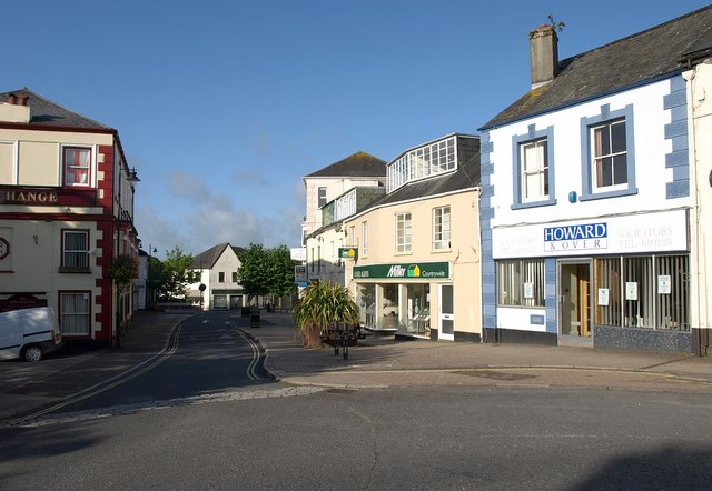
English: Fore Street, Ivybridge. A very similar view to 880629 from the bridge over the Erme. On the left is the Exchange. "The Kings Arms, now the Exchange public house, received its licence to trade in 1832 from Sir John Rogers. Unfortunately the open mill leat serving the lower mills ran immediately outside the inn door. Customers leaving the premises had difficulty in avoiding this. Despite the publican's protests to the mill owners it remained uncovered. The public house was rebuilt and substantially changed in 1891." http://www.burrows.co.uk/ivybridge/03TheM.htm |
| Datums | |
| Avots | From geograph.org.uk |
| Autors | Derek Harper |
| Atsauce (required by the license) | Derek Harper / Fore Street, Ivybridge / |
| Camera location | | View this and other nearby images on: OpenStreetMap |
|---|
_heading:202.00&language=lv)
| Object location | | View this and other nearby images on: OpenStreetMap |
|---|
_heading:202.00&language=lv)
Licence

|
This image was taken from the Geograph project collection. See this photograph's page on the Geograph website for the photographer's contact details. The copyright on this image is owned by Derek Harper and is licensed for reuse under the Creative Commons Attribution-ShareAlike 2.0 license.
|
Šis fails tiek izplatīts saskaņā ar licences Creative Commons Atsauce-Līdzīgi Noteikumi 2.0 Vispārējiem noteikumiem.
Atsauce: Derek Harper
- Jūs varat brīvi:
- koplietot – kopēt, izplatīt un pārraidīt darbu
- remiksēt – pielāgot darbu
- Saskaņā ar šādiem nosacījumiem:
- atsaucoties – Tev ir jānorāda autors, saite uz licenci un to, vai veiktas kādas izmaiņas. To var darīt jebkādā saprātīgā veidā, bet ne tādā, kas norādītu, ka licencētājs atbalsta tevi vai veidu, kā tu izmanto šo darbu.
- nemainot licenci – Ja tu miksē, pārveido vai izmanto materiālu, tev savs devums jāpublicē ar to pašu vai saderīgu licenci kā oriģināls.
Faila hronoloģija
Uzklikšķini uz datums/laiks kolonnā esošās saites, lai apskatītos, kā šis fails izskatījās tad.
| Datums/Laiks | Attēls | Izmēri | Dalībnieks | Komentārs | |
|---|---|---|---|---|---|
| tagadējais | 2011. gada 1. marts, plkst. 18.49 | | 640 × 442 (65 KB) | GeographBot | == {{int:filedesc}} == {{Information |description={{en|1=Fore Street, Ivybridge A very similar view to 880629 from the bridge over the Erme. On the left is the Exchange. "The Kings Arms, now the Exchange public house, received its licence to trade in |
Faila lietojums
Šo failu izmanto šajā 1 lapā:
Globālais faila lietojums
Šīs Vikipēdijas izmanto šo failu:
- Izmantojums en.wikipedia.org