
Attēls:Great Chicago Fire map.jpg
Sākotnējais fails (3 588 × 5 382 pikseļi, faila izmērs: 4,42 MB, MIME tips: image/jpeg)
| Šis fails ir no Vikikrātuves. Tā apraksts no attēla lapas Vikikrātuvē ir parādīts zemāk. Vikikrātuve ir brīvi licencēta failu krātuve. Tu vari tai palīdzēt. |
| Apraksts |
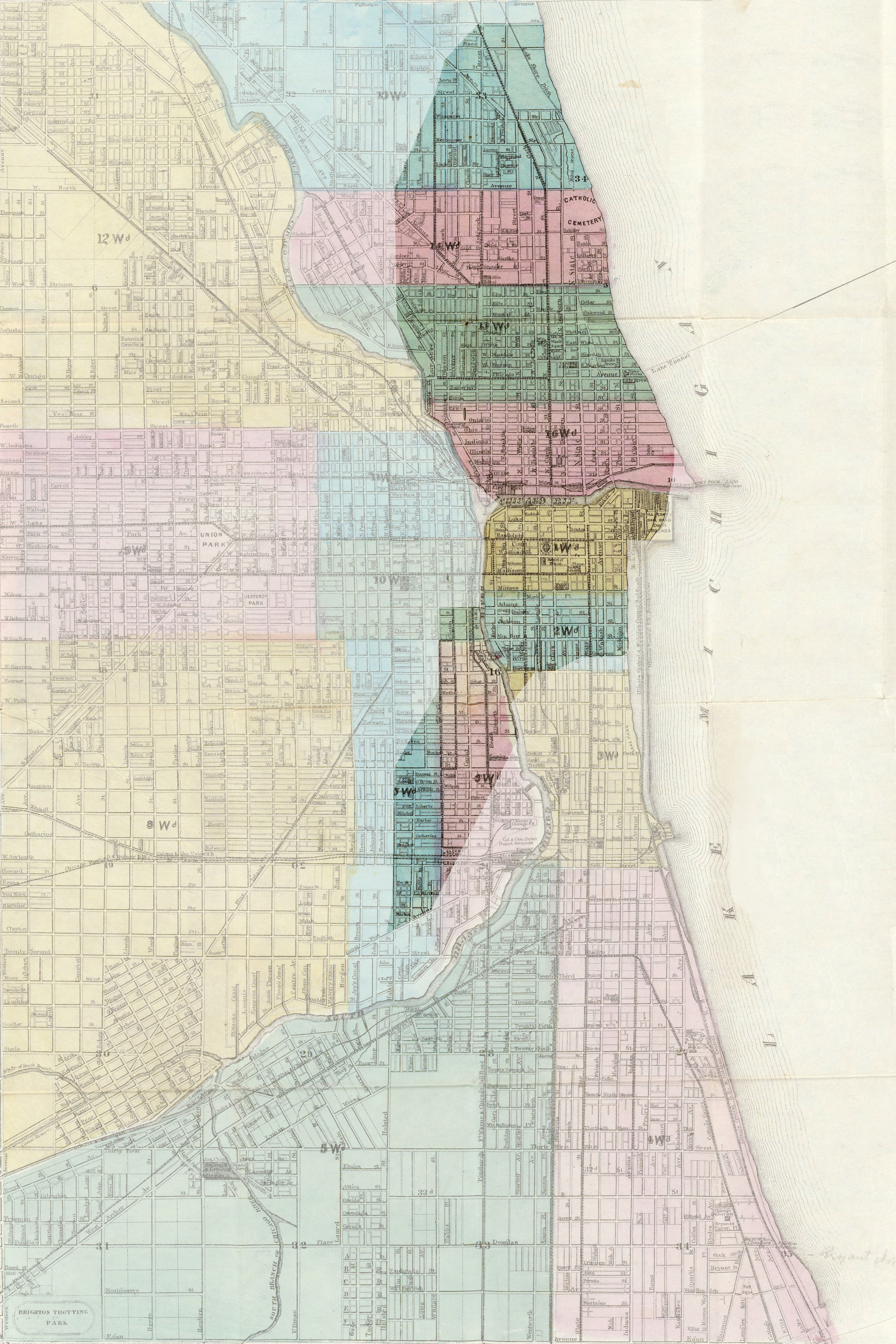
English: Map of Chicago, showing the burned area after the Great Chicago Fire in 1871. Français : Carte de Chicago, montrant la zone incendiée lors du Grand incendie de Chicago en 1871. Deutsch: Stadtplan von Chicago, die dunkle Fläche zeigt das Gebiet, das durch den Großen Brand von Chicago im Jahre 1871 zerstört wurde. |
| Datums | (UTC) |
| Avots |
|
| Autors |
|
| Camera location | | View this and other nearby images on: OpenStreetMap |
|---|
| This is a retouched picture, which means that it has been digitally altered from its original version. Modifications: Mise en valeur de la zone incendiée. The original can be viewed here: 1869 chicago.jpg:
|
|
This work is in the public domain in its country of origin and other countries and areas where the copyright term is the author's life plus 70 years or fewer.
| |
| This file has been identified as being free of known restrictions under copyright law, including all related and neighboring rights. | |
Original upload log
This image is a derivative work of the following images:
- File:1869_chicago.jpg licensed with PD-old
- 2005-08-12T08:01:34Z SPUI 4902x6376 (9280310 Bytes) {{PD}} 1869 map of Chicago from [http://www.davidrumsey.com/ davidrumsey.com]. [[Category:Maps of Chicago]]
Uploaded with derivativeFX
Faila hronoloģija
Uzklikšķini uz datums/laiks kolonnā esošās saites, lai apskatītos, kā šis fails izskatījās tad.
| Datums/Laiks | Attēls | Izmēri | Dalībnieks | Komentārs | |
|---|---|---|---|---|---|
| tagadējais | 2009. gada 17. februāris, plkst. 16.03 | | 3 588 × 5 382 (4,42 MB) | Sémhur | {{Information |Description= {{en|Map of Chicago, showing the burned area during the Great Chicago Fire in 1871.}} {{fr|Carte de Chicago, montrant la zone incendiée lors du [[:fr:Grand incendie de Chicago|Grand incendie de Chica |
Faila lietojums
Šo failu izmanto šajā 1 lapā:
Globālais faila lietojums
Šīs Vikipēdijas izmanto šo failu:
- Izmantojums ca.wikipedia.org
- Izmantojums da.wikipedia.org
- Izmantojums de.wikipedia.org
- Izmantojums fr.wikipedia.org
- Izmantojums it.wikipedia.org
- Izmantojums ja.wikipedia.org
- Izmantojums no.wikipedia.org
- Izmantojums pl.wikipedia.org
- Izmantojums pt.wikipedia.org
- Izmantojums ta.wikipedia.org