
Attēls:Haanja Upland.jpg

Šī priekšskata izmērs: 800 × 600 pikseļi. Citi izmēri: 320 × 240 pikseļi | 640 × 480 pikseļi | 1 024 × 768 pikseļi | 1 280 × 960 pikseļi | 2 560 × 1 920 pikseļi | 3 072 × 2 304 pikseļi.
Sākotnējais fails (3 072 × 2 304 pikseļi, faila izmērs: 1,9 MB, MIME tips: image/jpeg)
| Šis fails ir no Vikikrātuves. Tā apraksts no attēla lapas Vikikrātuvē ir parādīts zemāk. Vikikrātuve ir brīvi licencēta failu krātuve. Tu vari tai palīdzēt. |
Kopsavilkums
| Apraksts |
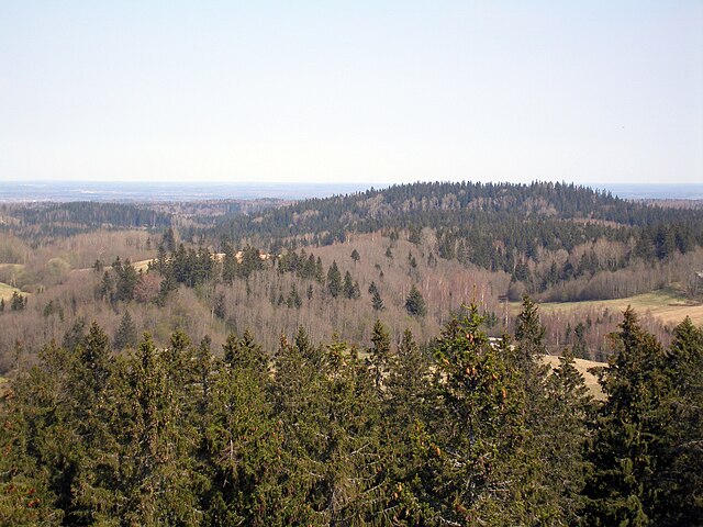
English: View of Haanja Upland from the tower of Suur Munamägi in early spring. Mixed forest on some of the hills is clearly visible.
Eesti: Vaade Suure Munamäe tornist läände. |
| Datums | |
| Avots | Paša darbs |
| Autors | Hannu |
| Camera location | | View this and other nearby images on: OpenStreetMap |
|---|
Licence
| I, the copyright holder of this work, release this work into the public domain. This applies worldwide. In some countries this may not be legally possible; if so: I grant anyone the right to use this work for any purpose, without any conditions, unless such conditions are required by law. |
Faila hronoloģija
Uzklikšķini uz datums/laiks kolonnā esošās saites, lai apskatītos, kā šis fails izskatījās tad.
| Datums/Laiks | Attēls | Izmēri | Dalībnieks | Komentārs | |
|---|---|---|---|---|---|
| tagadējais | 2009. gada 23. janvāris, plkst. 02.38 | | 3 072 × 2 304 (1,9 MB) | Hannu~commonswiki | {{Information |Description={{en|1=View of Haanja Upland from the tower of Suur Munamägi in early spring. Mixed forest on some of the hills is clearly visible.}} |Source=Own work by uploader |Author=Hannu |Date=27 Apr |
Faila lietojums
Šo failu izmanto šajās 2 lapās:
Globālais faila lietojums
Šīs Vikipēdijas izmanto šo failu:
- Izmantojums ar.wikipedia.org
- Izmantojums az.wikipedia.org
- Izmantojums be-tarask.wikipedia.org
- Izmantojums bg.wikipedia.org
- Izmantojums ca.wikipedia.org
- Izmantojums ceb.wikipedia.org
- Izmantojums cs.wikipedia.org
- Izmantojums da.wikipedia.org
- Izmantojums en.wikipedia.org
- Izmantojums en.wikivoyage.org
- Izmantojums eo.wikipedia.org
- Izmantojums es.wikipedia.org
- Izmantojums et.wikipedia.org
- Izmantojums fa.wikipedia.org
- Izmantojums fiu-vro.wikipedia.org
- Izmantojums fi.wikipedia.org
- Izmantojums hy.wikipedia.org
- Izmantojums id.wikipedia.org
- Izmantojums incubator.wikimedia.org
- Izmantojums mk.wikipedia.org
- Izmantojums nl.wikipedia.org
- Izmantojums pl.wikipedia.org
- Izmantojums ru.wikipedia.org
- Izmantojums sah.wikipedia.org
- Izmantojums sh.wikipedia.org
- Izmantojums sr.wikipedia.org
- Izmantojums sv.wikipedia.org
- Izmantojums uk.wikipedia.org
- Izmantojums ur.wikipedia.org
- Izmantojums www.wikidata.org
- Izmantojums zea.wikipedia.org
- Izmantojums zh.wikipedia.org