
Attēls:Hebrides and The Minch.svg

Size of this PNG preview of this SVG file: 334 × 599 pikseļi. Citi izmēri: 134 × 240 pikseļi | 268 × 480 pikseļi | 428 × 768 pikseļi | 571 × 1 024 pikseļi | 1 142 × 2 048 pikseļi | 1 060 × 1 900 pikseļi.
Sākotnējais fails (SVG fails, definētais izmērs 1 060 × 1 900 pikseļi, faila izmērs: 903 KB)
| Šis fails ir no Vikikrātuves. Tā apraksts no attēla lapas Vikikrātuvē ir parādīts zemāk. Vikikrātuve ir brīvi licencēta failu krātuve. Tu vari tai palīdzēt. |
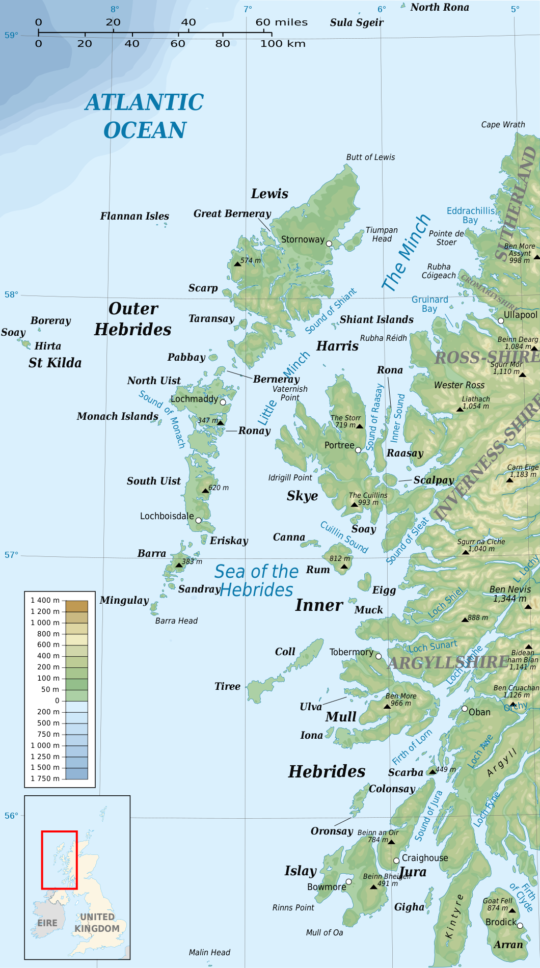
| Apraksts | Map of the Hebrides, with the Sea of the Hebrides and the Minch | ||
| Datums | |||
| Avots | |||
| Autors |
|
||
| Atļauja: (Šī faila izmantošana citur) |
Es, šī darba autortiesību īpašnieks, publicēju to saskaņā ar šīm licencēm:
This file is licensed under the Creative Commons Attribution-Share Alike 4.0 International, 3.0 Unported, 2.5 Generic, 2.0 Generic and 1.0 Generic license.
Jūs varat izvēlēties licenci pēc jūsu vēlmes. |
||
| Citas versijas |
|

| This is a retouched picture, which means that it has been digitally altered from its original version. Modifications: Translated from French into English, Traduisé de français en anglais. The original can be viewed here: SeaHebrides TheMinch map-fr.svg:
|
Atsauce
(required by the license)
© Sémhur / Wikimedia Commons /
© Sémhur / Wikimedia Commons
| Camera location | | View this and other nearby images on: OpenStreetMap |
|---|
Faila hronoloģija
Uzklikšķini uz datums/laiks kolonnā esošās saites, lai apskatītos, kā šis fails izskatījās tad.
| Datums/Laiks | Attēls | Izmēri | Dalībnieks | Komentārs | |
|---|---|---|---|---|---|
| tagadējais | 2013. gada 1. novembris, plkst. 22.37 | | 1 060 × 1 900 (903 KB) | Hogweard | {{Information |Description=Map of the Hebrides, with the Sea of the Hebrides and the Minch |Source=*SeaHebrides TheMinch map-fr.svg |Date=2013-11-01 |Author=*[[:File:SeaHebrides TheMinch map-fr.svg|User:Sémhur... |
Faila lietojums
Šo failu neizmanto nevienā lapā.
Globālais faila lietojums
Šīs Vikipēdijas izmanto šo failu:
- Izmantojums eu.wikipedia.org
- Izmantojums sh.wikipedia.org
- Izmantojums sl.wikipedia.org