
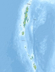
Attēls:India Andaman and Nicobar Islands relief map.png

Šī priekšskata izmērs: 457 × 600 pikseļi. Citi izmēri: 183 × 240 pikseļi | 567 × 744 pikseļi.
Sākotnējais fails (567 × 744 pikseļi, faila izmērs: 160 KB, MIME tips: image/png)
| Šis fails ir no Vikikrātuves. Tā apraksts no attēla lapas Vikikrātuvē ir parādīts zemāk. Vikikrātuve ir brīvi licencēta failu krātuve. Tu vari tai palīdzēt. |
Kopsavilkums
| Apraksts |
|
|||||||||
| Datums | ||||||||||
| Avots |
|
|||||||||
| Izveidotājs | ||||||||||
| Geotemporal data | ||||||||||
| Bounding box |
|
|||||||||
| Georeferencing | If inappropriate please set warp_status = skip to hide. | |||||||||
| Citas versijas |
|
|||||||||

Licence
Es, šī darba autortiesību īpašnieks, publicēju to saskaņā ar šo licenci:
This file is licensed under the Creative Commons Attribution-Share Alike 4.0 International license.
- Jūs varat brīvi:
- koplietot – kopēt, izplatīt un pārraidīt darbu
- remiksēt – pielāgot darbu
- Saskaņā ar šādiem nosacījumiem:
- atsaucoties – Tev ir jānorāda autors, saite uz licenci un to, vai veiktas kādas izmaiņas. To var darīt jebkādā saprātīgā veidā, bet ne tādā, kas norādītu, ka licencētājs atbalsta tevi vai veidu, kā tu izmanto šo darbu.
- nemainot licenci – Ja tu miksē, pārveido vai izmanto materiālu, tev savs devums jāpublicē ar to pašu vai saderīgu licenci kā oriģināls.
Faila hronoloģija
Uzklikšķini uz datums/laiks kolonnā esošās saites, lai apskatītos, kā šis fails izskatījās tad.
| Datums/Laiks | Attēls | Izmēri | Dalībnieks | Komentārs | |
|---|---|---|---|---|---|
| tagadējais | 2016. gada 27. jūnijs, plkst. 20.30 | | 567 × 744 (160 KB) | Nzeemin | User created page with UploadWizard |
Faila lietojums
Šo failu izmanto šajā 1 lapā:
Globālais faila lietojums
Šīs Vikipēdijas izmanto šo failu:
- Izmantojums az.wikipedia.org
- Izmantojums bg.wikipedia.org
- Izmantojums bh.wikipedia.org
- Izmantojums bn.wikipedia.org
- Izmantojums ca.wikipedia.org
- Izmantojums de.wikipedia.org
- Andamanen
- North Sentinel Island
- Trinket
- Narkondam
- Barren Island (Andamanen)
- South Andaman Island
- North Andaman Island
- Groß Nikobar
- Klein Nikobar
- Middle Andaman Island
- Camorta (Insel)
- Nancowry
- Katchal
- Car Nicobar
- Teressa
- Chowra
- Little Andaman
- Vorlage:Positionskarte Indien Andamanen und Nikobaren
- Havelock Island
- Campbell-Bay-Nationalpark
- Galathea-Bay-Nationalpark
- Ross Island (Andamanen)
- South Sentinel Island
- Baratang Island
- Operation Buccaneer
- Izmantojums en.wikipedia.org
- Sunda Strait
- Sentinelese
- Mount Thullier
- Ten Degree Channel
- Mount Harriet National Park
- Car Nicobar Air Force Station
- Andaman and Nicobar Command
- Duncan Passage
- 2009 Andaman Islands earthquake
- Kaplong Hydroelectric Project
- Cleugh Passage
- Module:Location map/data/India Andaman and Nicobar Islands
- Module:Location map/data/India Andaman and Nicobar Islands/doc
- User:Ty654/List of earthquakes from 1900-1949 exceeding magnitude 7+
- User:Ty654/List of earthquakes from 1950-1999 exceeding magnitude 7+
Skatīt šī faila pilno globālo izmantojumu.