
Attēls:Indian Ocean laea location map.svg

Size of this PNG preview of this SVG file: 638 × 599 pikseļi. Citi izmēri: 256 × 240 pikseļi | 511 × 480 pikseļi | 818 × 768 pikseļi | 1 090 × 1 024 pikseļi | 2 180 × 2 048 pikseļi | 709 × 666 pikseļi.
Sākotnējais fails (SVG fails, definētais izmērs 709 × 666 pikseļi, faila izmērs: 168 KB)
| Šis fails ir no Vikikrātuves. Tā apraksts no attēla lapas Vikikrātuvē ir parādīts zemāk. Vikikrātuve ir brīvi licencēta failu krātuve. Tu vari tai palīdzēt. |
Kopsavilkums
| Apraksts |
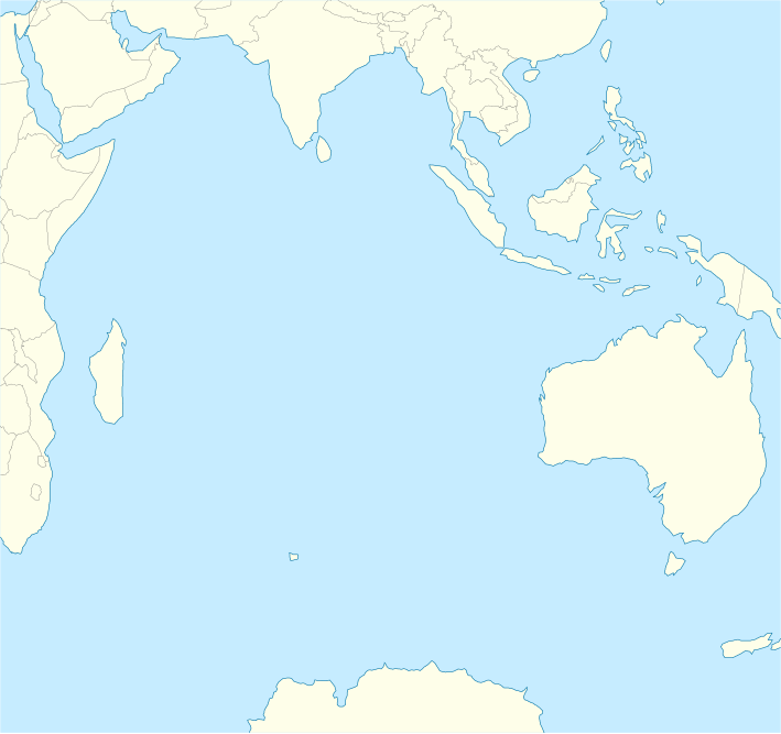
English: Location map of the Indian Ocean.
|
| Datums | |
| Avots | Paša darbs |
| Autors | Tentotwo |
Shell script for generating the map using GMT archive copy at the Wayback Machine
#!/bin/sh

# Set common options
PROJECTION=A90.0/-20.0/180/19.998266666666666c
REGION=-12.856058461183775/-43.848273739920856/151.50519408595028/33.22162400070504r
FILENAME=Indian_Ocean_laea_location_map.ps

# Get Natural Earth datafiles
echo "Downloading datafiles from naturalearthdata.com"
wget -nv -nc \
 http://www.naturalearthdata.com/http//www.naturalearthdata.com/download/110m/physical/110m-coastline.zip\
 http://www.naturalearthdata.com/http//www.naturalearthdata.com/download/110m/physical/110m-land.zip\
 http://www.naturalearthdata.com/http//www.naturalearthdata.com/download/110m/cultural/110m-admin-0-boundary-lines.zip
echo "...done\n"

echo "Inflating archives"
unzip 110m\*.zip
echo "...done\n"

echo "Converting shapefiles to GMT"
ogr2ogr -F GMT 110m_land.gmt 110m_land.shp
ogr2ogr -F GMT 110m_coastline.gmt 110m_coastline.shp
ogr2ogr -F GMT 50m_borders.gmt ne_50m_admin_0_boundary_lines_land.shp
echo "...done\n"

echo "Creating maps"
GMT psxy -m -J$PROJECTION -R$REGION --PAGE_COLOR=198/236/255  --POLAR_CAP=none --PAPER_MEDIA=A3  --BASEMAP_TYPE=plain --BASEMAP_AXES=NESW --FRAME_PEN=0.15p,black 110m_land.gmt -K -G254/254/233 > $FILENAME
GMT psxy -m -J$PROJECTION -R$REGION 110m_coastline.gmt -O -K -W0.535p,9/120/171  >> $FILENAME
GMT psxy -m -J$PROJECTION -R$REGION 50m_borders.gmt -O -W100/100/100  >> $FILENAME
echo "...done\n"

echo "You can now open $FILENAME in Inkscape to clean up the file and save it as SVG. You should add an ocean coloured background and simplify the graticules using CTRL+L."

gv $FILENAME
Licence
Es, šī darba autortiesību īpašnieks, publicēju to saskaņā ar šo licenci:
Šis fails tiek izplatīts saskaņā ar licences Creative Commons Atsauce-Līdzīgi Noteikumi 3.0 Vispārējiem noteikumiem.
- Jūs varat brīvi:
- koplietot – kopēt, izplatīt un pārraidīt darbu
- remiksēt – pielāgot darbu
- Saskaņā ar šādiem nosacījumiem:
- atsaucoties – Tev ir jānorāda autors, saite uz licenci un to, vai veiktas kādas izmaiņas. To var darīt jebkādā saprātīgā veidā, bet ne tādā, kas norādītu, ka licencētājs atbalsta tevi vai veidu, kā tu izmanto šo darbu.
- nemainot licenci – Ja tu miksē, pārveido vai izmanto materiālu, tev savs devums jāpublicē ar to pašu vai saderīgu licenci kā oriģināls.
Faila hronoloģija
Uzklikšķini uz datums/laiks kolonnā esošās saites, lai apskatītos, kā šis fails izskatījās tad.
| Datums/Laiks | Attēls | Izmēri | Dalībnieks | Komentārs | |
|---|---|---|---|---|---|
| tagadējais | 2012. gada 1. februāris, plkst. 13.02 | | 709 × 666 (168 KB) | Tentotwo |
Faila lietojums
Šo failu izmanto šajās 7 lapās:
Globālais faila lietojums
Šīs Vikipēdijas izmanto šo failu:
- Izmantojums af.wikipedia.org
- Izmantojums als.wikipedia.org
- Izmantojums an.wikipedia.org
- Izmantojums ar.wikipedia.org
- Izmantojums ast.wikipedia.org
- Islles Agalega
- Islla Marión
- Islles Glorioses
- Islla de la Posesión
- Islla Yeye
- Islles Esvalixaes del Océanu Índicu
- Flying Fish Cove
- Islla Oeste
- Islles Ḥeard y McDonald
- Mar de les Laquedives
- Islles Mascareñes
- San Denís (Reunión)
- Islles Crozet
- Islla Saint-Paul
- Islla Ámsterdam
- Bassas da India
- Archipiélagu de Chagos
- Islla Christmas
- Aeropuertu Sir Gaëtan Duval
- Aeropuertu d'Islla Christmas
- Aeropuertu de les Islles Cocos (Keeling)
- Módulu:Mapa de llocalización/datos/Océanu Índicu/usu
- Módulu:Mapa de llocalización/datos/Océanu Índicu
- Izmantojums az.wikipedia.org
- Izmantojums ban.wikipedia.org
- Izmantojums ba.wikipedia.org
- Izmantojums bg.wikipedia.org
- Izmantojums bh.wikipedia.org
- Izmantojums ceb.wikipedia.org
Skatīt šī faila pilno globālo izmantojumu.