
Attēls:Los Alamos aerial view.jpeg

Sākotnējais fails (1 435 × 1 153 pikseļi, faila izmērs: 757 KB, MIME tips: image/jpeg)
| Šis fails ir no Vikikrātuves. Tā apraksts no attēla lapas Vikikrātuvē ir parādīts zemāk. Vikikrātuve ir brīvi licencēta failu krātuve. Tu vari tai palīdzēt. |
Kopsavilkums
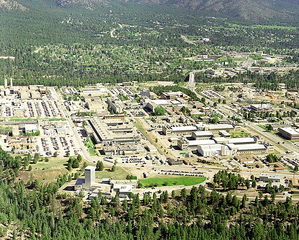
| Apraksts | Aerial view of Los Alamos National Laboratory, "1995 aerial TA-3 south to north". |
| Avots | http://www.lanl.gov/worldview/news/photos/aerials.shtml |
| Autors | Los Alamos National Laboratory |
| Object location | | View this and other nearby images on: OpenStreetMap |
|---|
|
This is an image of a place or building that is listed on the National Register of Historic Places in the United States of America. Its reference number is 66000893. |

|
Attribution information, such as the author's name, e-mail, website, or signature, that was once visible in the image itself has been moved into the image metadata and/or image description page. This makes the image easier to reuse and more language-neutral, and makes the text easier to process and search for. Commons discourages placing visible author information in images.
|
Licence

|
This image comes from Los Alamos National Laboratory, a national laboratory privately operated under contract from the United States Department of Energy by Los Alamos National Security, LLC between October 1, 2007 and October 31, 2018. LANL allowed anyone to use it for any purpose, provided that the copyright holder is properly attributed. Redistribution, derivative work, commercial use, and all other use is permitted. LANL requires the following text be used when crediting images to it: (link)
Unless otherwise indicated, this information has been authored by an employee or employees of the Los Alamos National Security, LLC (LANS), operator of the Los Alamos National Laboratory under Contract No. DE-AC52-06NA25396 with the U.S. Department of Energy. The U.S. Government has rights to use, reproduce, and distribute this information. The public may copy and use this information without charge, provided that this Notice and any statement of authorship are reproduced on all copies. Neither the Government nor LANS makes any warranty, express or implied, or assumes any liability or responsibility for the use of this information. |
|
Faila hronoloģija
Uzklikšķini uz datums/laiks kolonnā esošās saites, lai apskatītos, kā šis fails izskatījās tad.
| Datums/Laiks | Attēls | Izmēri | Dalībnieks | Komentārs | |
|---|---|---|---|---|---|
| tagadējais | 2011. gada 26. jūnijs, plkst. 17.22 | | 1 435 × 1 153 (757 KB) | Keraunoscopia | removed watermark |
| 2005. gada 8. maijs, plkst. 12.18 |  | 1 435 × 1 153 (750 KB) | Floriang | Aerial view of Los Alamos National Laboratory, "1995 aerial TA-3 south to north", from http://www.lanl.gov/worldview/news/photos/aerials.shtml ''Source:'' en.wikipedia.org, upload by Fastfission {{PD-USGov}} [[Category:Bi |
Faila lietojums
Šo failu izmanto šajā 1 lapā:
Globālais faila lietojums
Šīs Vikipēdijas izmanto šo failu:
- Izmantojums ar.wikipedia.org
- Izmantojums bg.wikipedia.org
- Izmantojums bn.wikipedia.org
- Izmantojums bo.wikipedia.org
- Izmantojums br.wikipedia.org
- Izmantojums ca.wikipedia.org
- Izmantojums cs.wikipedia.org
- Izmantojums da.wikipedia.org
- Izmantojums de.wikipedia.org
- Izmantojums el.wikipedia.org
- Izmantojums en.wikipedia.org
- Fermi paradox
- Los Alamos National Laboratory
- Theodore Hall
- Bechtel
- Albuquerque–Santa Fe–Los Alamos combined statistical area
- List of National Historic Landmarks in New Mexico
- National Register of Historic Places listings in Los Alamos County, New Mexico
- User:CM at Bechtel/Major projects table
- Draft:Triad National Security
- Izmantojums en.wikiversity.org
- Izmantojums eo.wikipedia.org
- Izmantojums es.wikipedia.org
- Izmantojums et.wikipedia.org
- Izmantojums eu.wikipedia.org
- Izmantojums fa.wikipedia.org
- Izmantojums fi.wikipedia.org
- Izmantojums fr.wikipedia.org
- Izmantojums gl.wikipedia.org
- Izmantojums ha.wikipedia.org
- Izmantojums he.wikipedia.org
Skatīt šī faila pilno globālo izmantojumu.