
Attēls:Maricopa County Incorporated and Planning areas Peoria highlighted.svg

Size of this PNG preview of this SVG file: 694 × 599 pikseļi. Citi izmēri: 278 × 240 pikseļi | 556 × 480 pikseļi | 889 × 768 pikseļi | 1 185 × 1 024 pikseļi | 2 371 × 2 048 pikseļi | 940 × 812 pikseļi.
Sākotnējais fails (SVG fails, definētais izmērs 940 × 812 pikseļi, faila izmērs: 1,05 MB)
| Šis fails ir no Vikikrātuves. Tā apraksts no attēla lapas Vikikrātuvē ir parādīts zemāk. Vikikrātuve ir brīvi licencēta failu krātuve. Tu vari tai palīdzēt. |
Kopsavilkums
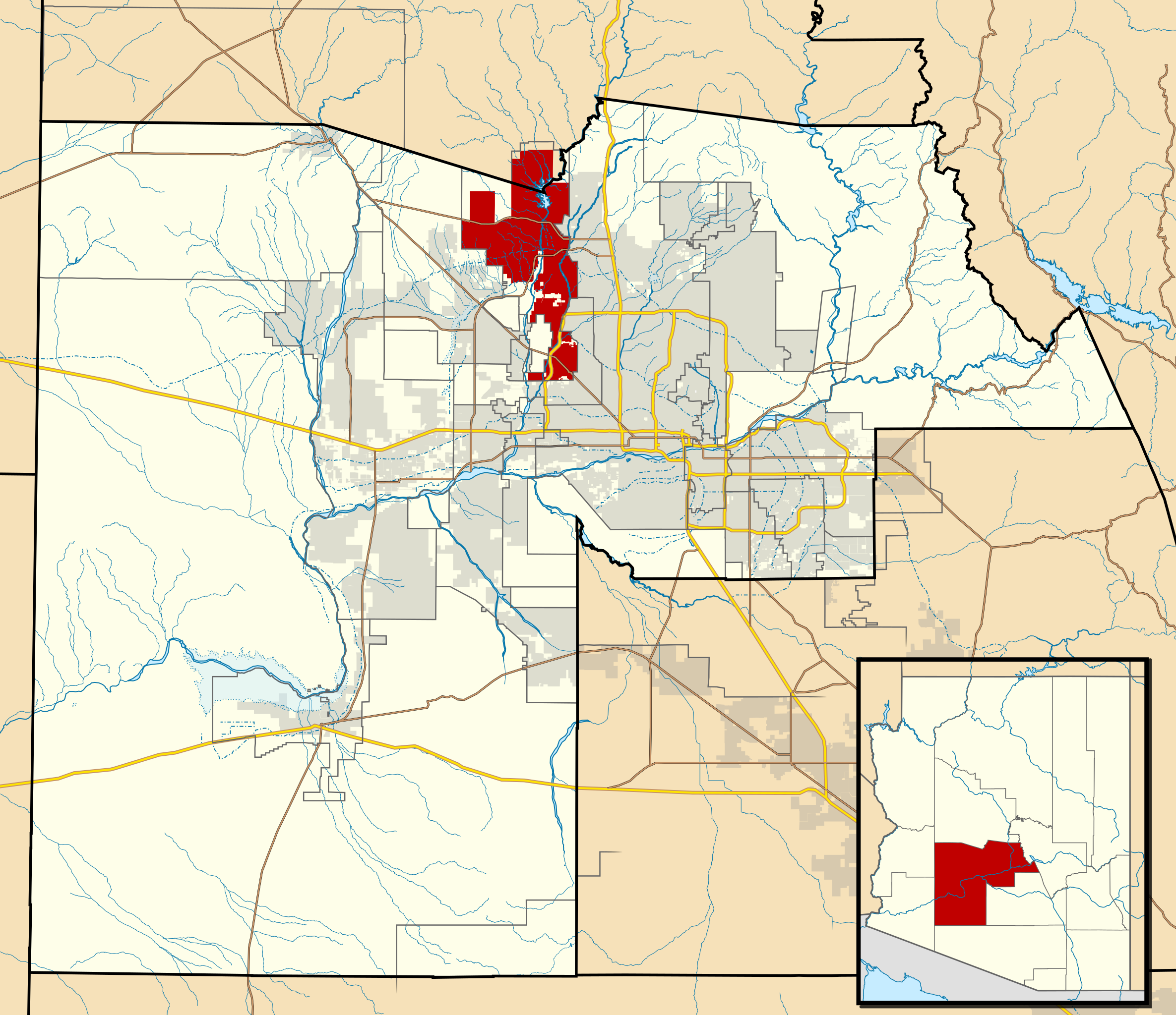
| Apraksts | This map shows the incorporated areas and Indian reservation boundaries in Maricopa County, Arizona, along with water bodies and major highways and roads. Peoria is highlighted in red. Other incorporated cities are shown in gray, planning area borders for these cities and Indian reservation borders are shown as solid black lines. Changes from Previous Version: Updated the maps to include water bodies and to make "less boring" than the plain black/white/gray maps. Format was updated to match standards laid out by WikiProject Maps/Conventions. Map data is based on data from the following Webpage: Maricopa County Interactive GIS Map. I created this map in Inkscape. |
| Datums | |
| Avots | My own work, based on government information |
| Autors | Ixnayonthetimmay |
| Atļauja: (Šī faila izmantošana citur) |
Public Domain |
| Citas versijas | See Category:Maps of Maricopa County for other versions of this image. |
Licence
| I, the copyright holder of this work, release this work into the public domain. This applies worldwide. In some countries this may not be legally possible; if so: I grant anyone the right to use this work for any purpose, without any conditions, unless such conditions are required by law. |
Faila hronoloģija
Uzklikšķini uz datums/laiks kolonnā esošās saites, lai apskatītos, kā šis fails izskatījās tad.
| Datums/Laiks | Attēls | Izmēri | Dalībnieks | Komentārs | |
|---|---|---|---|---|---|
| tagadējais | 2011. gada 20. maijs, plkst. 09.39 | | 940 × 812 (1,05 MB) | Ixnayonthetimmay | Uploading new version |
| 2008. gada 30. augusts, plkst. 07.33 |  | 900 × 800 (413 KB) | Ixnayonthetimmay | == Summary == {{Information |Description=This map shows the incorporated areas and unincorporated areas in Maricopa County, Arizona. [[:en:Paloma, Arizona|Pa | |
| 2007. gada 16. septembris, plkst. 03.17 |  | 900 × 800 (384 KB) | Ixnayonthetimmay | {{Information |Description= |Source= |Date= |Author= |Permission= |other_versions= }} | |
| 2007. gada 28. maijs, plkst. 13.10 |  | 900 × 780 (329 KB) | Ixnayonthetimmay | ||
| 2007. gada 22. maijs, plkst. 03.54 |  | 900 × 780 (318 KB) | Ixnayonthetimmay | ||
| 2007. gada 30. janvāris, plkst. 08.21 |  | 904 × 758 (189 KB) | Ixnayonthetimmay | {{Information |Description=This map shows the incorporated areas in Maricopa County, Arizona, highlighting Peoria in red. It also shows the boundaries for the mun |
Faila lietojums
Šo failu izmanto šajā 1 lapā:
Globālais faila lietojums
Šīs Vikipēdijas izmanto šo failu:
- Izmantojums azb.wikipedia.org
- Izmantojums ceb.wikipedia.org
- Izmantojums de.wikipedia.org
- Izmantojums en.wikipedia.org
- Izmantojums eo.wikipedia.org
- Izmantojums fa.wikipedia.org
- Izmantojums fi.wikipedia.org
- Izmantojums ja.wikipedia.org
- Izmantojums ml.wikipedia.org
- Izmantojums nl.wikipedia.org
- Izmantojums pl.wikipedia.org
- Izmantojums pt.wikipedia.org
- Izmantojums sco.wikipedia.org
- Izmantojums sr.wikipedia.org
- Izmantojums sv.wikipedia.org
- Izmantojums sw.wikipedia.org
- Izmantojums ur.wikipedia.org
- Izmantojums vi.wikipedia.org
- Izmantojums zh.wikipedia.org