
Attēls:Mole Valley UK locator map.svg

Size of this PNG preview of this SVG file: 790 × 599 pikseļi. Citi izmēri: 317 × 240 pikseļi | 633 × 480 pikseļi | 1 013 × 768 pikseļi | 1 280 × 971 pikseļi | 2 560 × 1 942 pikseļi | 1 425 × 1 081 pikseļi.
Sākotnējais fails (SVG fails, definētais izmērs 1 425 × 1 081 pikseļi, faila izmērs: 948 KB)
| Šis fails ir no Vikikrātuves. Tā apraksts no attēla lapas Vikikrātuvē ir parādīts zemāk. Vikikrātuve ir brīvi licencēta failu krātuve. Tu vari tai palīdzēt. |
| Apraksts |
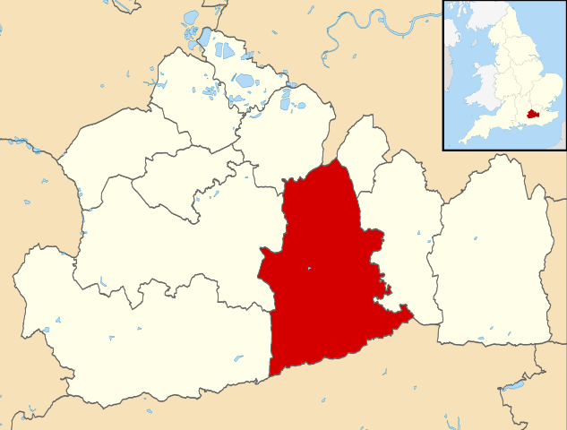
Map of Surrey, UK with Mole Valley highlighted. Equirectangular map projection on WGS 84 datum, with N/S stretched 160% |
| Datums | |
| Avots |
|
| Autors | Nilfanion, created using Ordnance Survey data |
| Atļauja: (Šī faila izmantošana citur) |
Šis fails tiek izplatīts saskaņā ar licences Creative Commons Atsauce-Līdzīgi Noteikumi 3.0 Vispārējiem noteikumiem. Atsauce: Contains Ordnance Survey data © Crown copyright and database right
|
Faila hronoloģija
Uzklikšķini uz datums/laiks kolonnā esošās saites, lai apskatītos, kā šis fails izskatījās tad.
| Datums/Laiks | Attēls | Izmēri | Dalībnieks | Komentārs | |
|---|---|---|---|---|---|
| tagadējais | 2011. gada 2. augusts, plkst. 12.26 | | 1 425 × 1 081 (948 KB) | Nilfanion | {{Information |Description=Map of Surrey, UK with Mole Valley highlighted. Equirectangular map projection on WGS 84 datum, with N/S stretched 160% |Source=Ordnance Survey [https://www.ordnancesurvey.co |
Faila lietojums
Šo failu izmanto šajā 1 lapā:
Globālais faila lietojums
Šīs Vikipēdijas izmanto šo failu:
- Izmantojums cy.wikipedia.org
- Izmantojums en.wikipedia.org
- Dorking
- Ashtead
- Leatherhead
- Fetcham
- Great Bookham
- Little Bookham
- Mole Valley
- Box Hill, Surrey
- City of London Freemen's School
- Abinger Hammer
- Leith Hill
- Headley Court
- Denbies Wine Estate
- Brockham
- Mickleham, Surrey
- Charlwood
- Westcott, Surrey
- St John's School, Leatherhead
- Polesden Lacey
- Bookham Commons
- Newdigate
- Abinger
- Betchworth
- Buckland, Surrey
- Westhumble
- Leatherhead F.C.
- Dorking F.C.
- The Ashcombe School
- Bookham F.C.
- Ashtead Common
- Bocketts Farm
- Headley, Surrey
- Ashtead railway station
- Mullard Space Science Laboratory
- Box Hill & Westhumble railway station
- Cherkley Court
- Leatherhead railway station
- Dorking railway station
- Holmwood railway station
- Ockley railway station
- Downsend School
- Box Hill School
- Bookham railway station
- Betchworth railway station
- Dorking West railway station
- Church of St Mary, Fetcham
- Dorking Deepdene railway station
- Leigh, Surrey
- St Andrew's Catholic School
Skatīt šī faila pilno globālo izmantojumu.