
Attēls:Ostrava location map.png

Šī priekšskata izmērs: 571 × 600 pikseļi. Citi izmēri: 228 × 240 pikseļi | 457 × 480 pikseļi | 815 × 856 pikseļi.
Sākotnējais fails (815 × 856 pikseļi, faila izmērs: 870 KB, MIME tips: image/png)
| Šis fails ir no Vikikrātuves. Tā apraksts no attēla lapas Vikikrātuvē ir parādīts zemāk. Vikikrātuve ir brīvi licencēta failu krātuve. Tu vari tai palīdzēt. |
Kopsavilkums
| Apraksts |
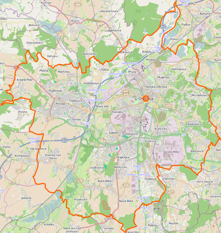
Location map of Ostrava, Czech Republic This map of Lędziny was created from OpenStreetMap project data, collected by the community. This map may be incomplete, and may contain errors. Don't rely solely on it for navigation. |
|||||||||
| Datums | (see file history) | |||||||||
| Avots | You may find a page on the OpenStreetMap wiki page for Lędziny | |||||||||
| Izveidotājs |
OpenStreetMap contributors OpenStreetMap contributors |
|||||||||
| Atļauja: (Šī faila izmantošana citur) |
OpenStreetMap data is available under the Open Database License (details). Standard style map tiles are licensed as ODbL Produced Works.
|
|||||||||
| Geotemporal data | ||||||||||
| Bounding box |
|
|||||||||
| Georeferencing | If inappropriate please set warp_status = skip to hide. | |||||||||
Faila hronoloģija
Uzklikšķini uz datums/laiks kolonnā esošās saites, lai apskatītos, kā šis fails izskatījās tad.
| Datums/Laiks | Attēls | Izmēri | Dalībnieks | Komentārs | |
|---|---|---|---|---|---|
| tagadējais | 2014. gada 14. novembris, plkst. 00.03 | | 815 × 856 (870 KB) | D T G | User created page with UploadWizard |
Faila lietojums
Šo failu izmanto šajās 2 lapās:
Globālais faila lietojums
Šīs Vikipēdijas izmanto šo failu:
- Izmantojums cs.wikipedia.org
- Izmantojums fr.wikipedia.org
- Izmantojums ja.wikipedia.org
- Izmantojums pl.wikipedia.org
- Stadion Bazaly
- Morawska Ostrawa
- Uniwersytet Ostrawski
- OKD (przedsiębiorstwo)
- Zamek w Śląskiej Ostrawie
- Park miniatur Miniuni w Ostrawie
- Ostrava hlavní nádraží
- Ratusz w Śląskiej Ostrawie
- Stodolní
- Zoo Ostrava
- Katedra Boskiego Zbawiciela w Ostrawie
- Ostravar Aréna
- Nowy Ratusz w Ostrawie
- Ostrava-Svinov
- Willa Eduarda Lisky
- Stary Ratusz w Ostrawie
- Plac Tomasza Masaryka w Ostrawie
- Dom Książki Librex w Ostrawie
- Ostrava-Třebovice
- Ostrava-Vítkovice
- Ostrava-Bartovice
- Ostrava-Kunčice
- Bartowice
- Ostrava-Kunčičky
- Ostrava střed
- Ostrava-Stodolní
- Ostrava-Mariánské Hory
- Ostrava-Hrušov
- Koblów
- Nowa Huta (Ostrawa)
- Herzmanice
- Gruszów (Ostrawa)
- Muglinów
- Polanka nad Odrou (przystanek kolejowy)
- Kończyce Małe (Ostrawa)
- Kończyce Wielkie (Ostrawa)
- Antoszowice
- Przywóz (Ostrawa)
- Muzeum Ostrawskie
- Stadion Miejski w Ostrawie-Witkowicach
- Kościół ewangelicki w Ostrawie
- Hrabůvka (Ostrawa)
- Bělský Les
- Dubina (Ostrawa)
- Hulváky
- Zábřeh (Ostrawa)
- Výškovice (Ostrawa)
Skatīt šī faila pilno globālo izmantojumu.