
Attēls:Rongelap Atoll - 2014-12-06 - Landsat 8 - 15m.png
Šī priekšskata izmērs: 733 × 600 pikseļi. Citi izmēri: 294 × 240 pikseļi | 587 × 480 pikseļi | 939 × 768 pikseļi | 1 252 × 1 024 pikseļi | 2 504 × 2 048 pikseļi | 3 741 × 3 060 pikseļi.
Sākotnējais fails (3 741 × 3 060 pikseļi, faila izmērs: 7,88 MB, MIME tips: image/png)
| Šis fails ir no Vikikrātuves. Tā apraksts no attēla lapas Vikikrātuvē ir parādīts zemāk. Vikikrātuve ir brīvi licencēta failu krātuve. Tu vari tai palīdzēt. |
Kopsavilkums
| Apraksts |
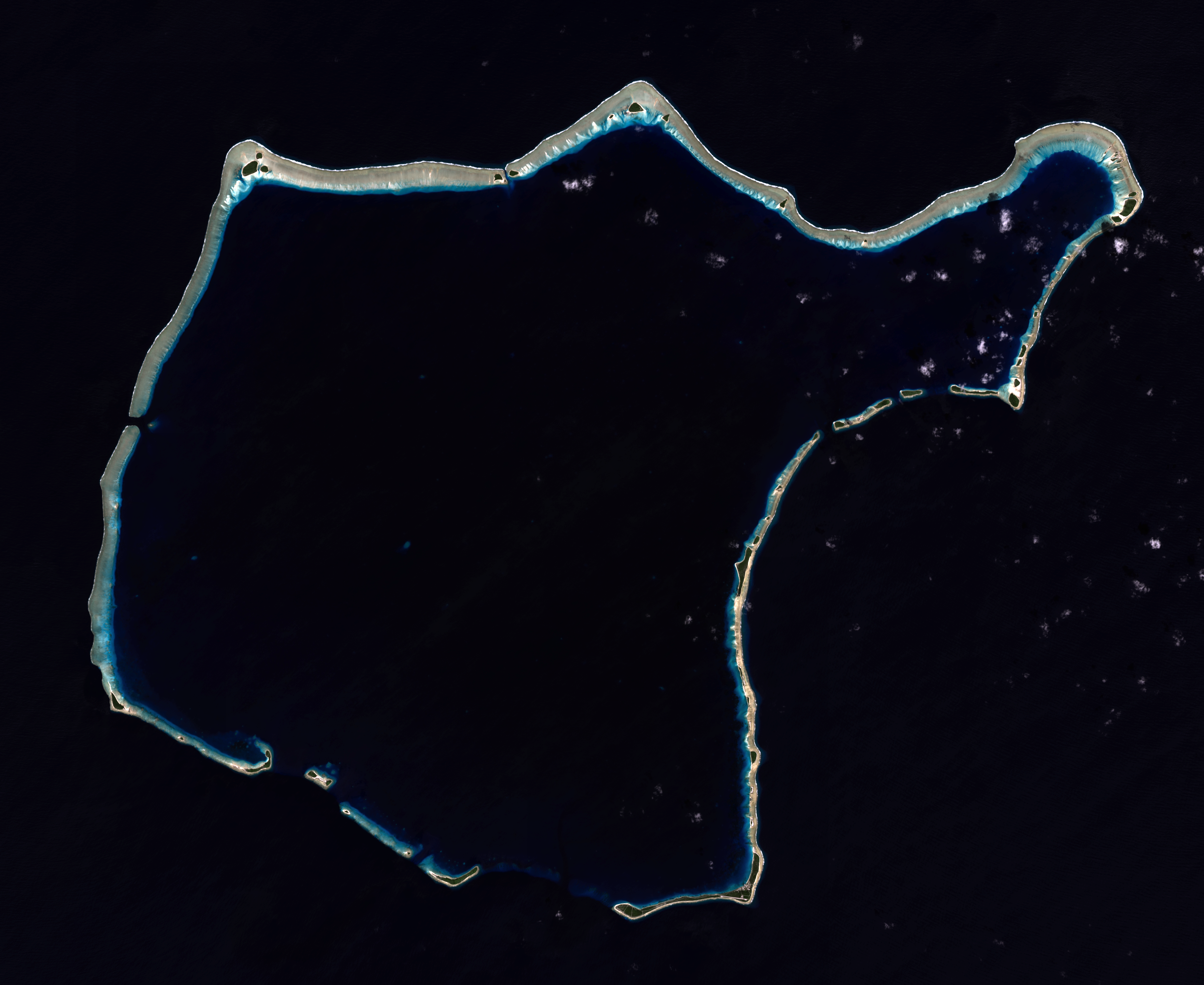
English: Composite "true color" multispectral satellite image of Rongelap Atoll.
NASA Landsat 8 OLI bands used were 4 (red), 3 (green), 2 (blue). Pan-sharpened with band 8. Manual color balance. Projection: UTM (zone 58), WGS84. Imagery courtesy NASA/USGS. (note: atmospheric haze is present and could not be fully removed) |
| Datums | |
| Avots | NASA/USGS Landsat satellite image GeoTIFF archive, http://glovis.usgs.gov |
| Autors | NASA |
| Camera location | | View this and other nearby images on: OpenStreetMap |
|---|
Licence
| This file is in the public domain in the United States because it was solely created by NASA. NASA copyright policy states that "NASA material is not protected by copyright unless noted". (See Template:PD-USGov, NASA copyright policy page or JPL Image Use Policy.) | ||
 |
Warnings:
|
Faila hronoloģija
Uzklikšķini uz datums/laiks kolonnā esošās saites, lai apskatītos, kā šis fails izskatījās tad.
| Datums/Laiks | Attēls | Izmēri | Dalībnieks | Komentārs | |
|---|---|---|---|---|---|
| tagadējais | 2015. gada 22. janvāris, plkst. 05.57 | | 3 741 × 3 060 (7,88 MB) | Разрывные | User created page with UploadWizard |
Faila lietojums
Šo failu izmanto šajā 1 lapā:
Globālais faila lietojums
Šīs Vikipēdijas izmanto šo failu:
- Izmantojums ast.wikipedia.org
- Izmantojums ceb.wikipedia.org
- Izmantojums en.wikipedia.org
- Izmantojums en.wikivoyage.org
- Izmantojums es.wikipedia.org
- Izmantojums fa.wikipedia.org
- Izmantojums fr.wikipedia.org
- Izmantojums fr.wiktionary.org
- Izmantojums id.wikipedia.org
- Izmantojums mt.wikipedia.org
- Izmantojums no.wikipedia.org
- Izmantojums pl.wikipedia.org
- Izmantojums uk.wikipedia.org
- Izmantojums ur.wikipedia.org
- Izmantojums www.wikidata.org