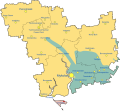
Attēls:Russian Occupation of Mykolaiv Oblast.svg

Lapas saturs netiek atbalstīts citās valodās.
Vikipēdijas lapa

Sākotnējais fails(SVG fails, definētais izmērs 1 134 × 1 043 pikseļi, faila izmērs: 107 KB)

Render this image in .

Kopsavilkums

This file may be updated to reflect new information.
If you wish to use a specific version of the file without new updates being mirrored, please upload the required version as a separate file.
Apraksts
English: Map of Mykolaiv Oblast showing the rough zones of occupation during the southern offensive of the 2022 Russian invasion of Ukraine, as of August 2022. Ukraine (    ) has maintained control over the north of the oblast. The Russian occupation (    ) currently controls the whole of Kinburn Peninsula; in which includes the village of Vasylivka. Russian Armed Forces also formerly occupied large parts of Mykolaiv Raion including some parts of Mykolaiv, the capital city of the Oblast, as well as some border areas of Bashtanka Raion and also areas of Voznesensk Raion. These areas however would soon be recaptured by Ukraine. Russia occupied the areas around Snihurivka and most of the extreme southeast of the oblast until November 2022, when they were liberated as part of the Ukrainian southern counteroffensive. (    )
Datums
Avots

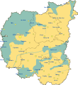
Paša darbs, derivate of 2022 Russian invasion of Ukraine.svg by Viewsridge, Mykolaiv in Ukraine (claims hatched).svg by TUBS, & Russian occupation of Mykolaiv Oblast.png by Cryw 9

Autors Physeters
Citas versijas

[labot šo lapu]

SVG Maps
PNG Maps
This file is translated using SVG <switch> elements. All translations are stored in the same file! Learn more.

For most Wikipedia projects, you can embed the file normally (without a lang parameter). The Wikipedia will use its language if the SVG file supports that language. For example, the German Wikipedia will use German if the SVG file has German. To embed this file in a particular language use the lang parameter with the appropriate language code, e.g. [[File:Russian Occupation of Mykolaiv Oblast.svg|lang=en]] for the English version. Do not specify a lang parameter if it is not needed. The parameter may prevent the use of a subsequent translation.

To translate the text into your language, you can use the SVG Translate tool. Alternatively, you can download the file to your computer, add your translations using whatever software you're familiar with, and re-upload it with the same name. You will find help in Graphics Lab if you're not sure how to do this.

Licence

Es, šī darba autortiesību īpašnieks, publicēju to saskaņā ar šo licenci:
w:en:Creative Commons
atsaucoties nemainot licenci
This file is licensed under the Creative Commons Attribution-Share Alike 4.0 International license.
Jūs varat brīvi:
  • koplietot – kopēt, izplatīt un pārraidīt darbu
  • remiksēt – pielāgot darbu
Saskaņā ar šādiem nosacījumiem:
  • atsaucoties – Tev ir jānorāda autors, saite uz licenci un to, vai veiktas kādas izmaiņas. To var darīt jebkādā saprātīgā veidā, bet ne tādā, kas norādītu, ka licencētājs atbalsta tevi vai veidu, kā tu izmanto šo darbu.
  • nemainot licenci – Ja tu miksē, pārveido vai izmanto materiālu, tev savs devums jāpublicē ar to pašu vai saderīgu licenci kā oriģināls.

Captions

Pievieno vienas rindiņas aprakstu, ko šis fails attēlo
Map of Russian occupation zones in Mykolaiv Oblast

31 augusts 2022

image/svg+xml

Faila hronoloģija

Uzklikšķini uz datums/laiks kolonnā esošās saites, lai apskatītos, kā šis fails izskatījās tad.

(Jaunākās | Senākās) Skatīt (10 jaunākas | ) (10 | 20 | 50 | 100 | 250 | 500 vienā lapā).
Datums/LaiksAttēlsIzmēriDalībnieksKomentārs
tagadējais2022. gada 11. novembris, plkst. 18.532022. gada 11. novembris, plkst. 18.53 versijas sīktēls1 134 × 1 043 (107 KB)Basque mappingUpdate per https://liveuamap.com/
2022. gada 11. novembris, plkst. 04.022022. gada 11. novembris, plkst. 04.02 versijas sīktēls1 134 × 1 043 (107 KB)DinoSoupCanadaReverted to version as of 00:47, 11 November 2022 (UTC)
2022. gada 11. novembris, plkst. 04.012022. gada 11. novembris, plkst. 04.01 versijas sīktēls2 497 × 2 458 (1,27 MB)DinoSoupCanadaUpdate
2022. gada 11. novembris, plkst. 03.472022. gada 11. novembris, plkst. 03.47 versijas sīktēls1 134 × 1 043 (107 KB)PhysetersReverted to version as of 00:29, 11 November 2022 (UTC) Good faith edit, but as of Thursday evening, there is no confirmation that the Russians have completely withdrawn from this part of Mykolaiv Oblast
2022. gada 11. novembris, plkst. 03.322022. gada 11. novembris, plkst. 03.32 versijas sīktēls1 134 × 1 043 (106 KB)TimetorockknowlegeUpdated to reflect the withdrawal from the Oblast with the exception of Vasylivka east of the Dnipro
2022. gada 11. novembris, plkst. 03.292022. gada 11. novembris, plkst. 03.29 versijas sīktēls1 134 × 1 043 (107 KB)PhysetersUpdates per ISW
2022. gada 10. novembris, plkst. 03.162022. gada 10. novembris, plkst. 03.16 versijas sīktēls1 134 × 1 043 (108 KB)PhysetersUpdates per the ISW & detailed map
2022. gada 8. oktobris, plkst. 07.392022. gada 8. oktobris, plkst. 07.39 versijas sīktēls1 134 × 1 043 (107 KB)Physeterssmall update per ISW
2022. gada 4. oktobris, plkst. 03.472022. gada 4. oktobris, plkst. 03.47 versijas sīktēls1 134 × 1 043 (107 KB)Physetersadd Pervomaiske
2022. gada 16. septembris, plkst. 23.392022. gada 16. septembris, plkst. 23.39 versijas sīktēls1 134 × 1 043 (106 KB)PhysetersUpdates per ISW
(Jaunākās | Senākās) Skatīt (10 jaunākas | ) (10 | 20 | 50 | 100 | 250 | 500 vienā lapā).

Šo failu izmanto šajā 1 lapā:

Globālais faila lietojums

Metadati