
Attēls:TabulaRogeriana.jpg
Šī priekšskata izmērs: 800 × 363 pikseļi. Citi izmēri: 320 × 145 pikseļi | 640 × 290 pikseļi | 1 024 × 464 pikseļi | 1 280 × 580 pikseļi | 4 128 × 1 872 pikseļi.
Sākotnējais fails (4 128 × 1 872 pikseļi, faila izmērs: 3,37 MB, MIME tips: image/jpeg)
| Šis fails ir no Vikikrātuves. Tā apraksts no attēla lapas Vikikrātuvē ir parādīts zemāk. Vikikrātuve ir brīvi licencēta failu krātuve. Tu vari tai palīdzēt. |
Kopsavilkums
| Apraksts |
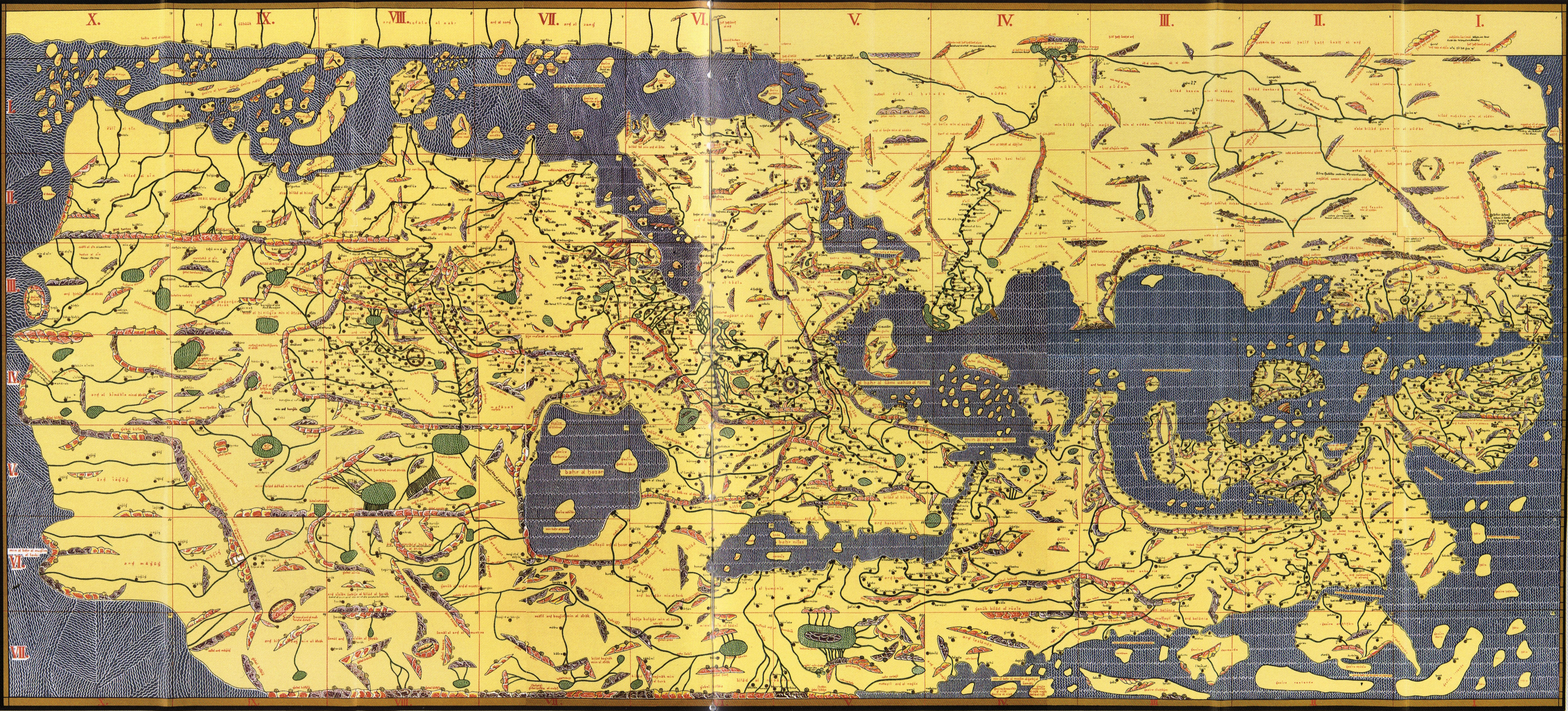
English: Copy of Al Idrisi Tabula Rogeriana with arabic names translitterated into the roman alphabet. The original has north at the bottom, so it appears "upside down". Please do not rotate it to have north at the top, as we seek to preserve the original. |
| Datums | (translitteration of arabic names by Konrad Miller, based on a 1300 (French) or 1486 (Bodleian) copy of a 1154 original) |
| Avots | Konrad Miller's collage of the Bodleian MS. Pococke 375 or possibly another based on the French National Library's MS. Arabe 2221 |
| Autors | Konrad Miller (copy and translitteration) |
| Citas versijas |
|


Licence
|
This is a faithful photographic reproduction of a two-dimensional, public domain work of art. The work of art itself is in the public domain for the following reason:
The official position taken by the Wikimedia Foundation is that "faithful reproductions of two-dimensional public domain works of art are public domain".
This photographic reproduction is therefore also considered to be in the public domain in the United States. In other jurisdictions, re-use of this content may be restricted; see Reuse of PD-Art photographs for details. | ||||
Faila hronoloģija
Uzklikšķini uz datums/laiks kolonnā esošās saites, lai apskatītos, kā šis fails izskatījās tad.
| Datums/Laiks | Attēls | Izmēri | Dalībnieks | Komentārs | |
|---|---|---|---|---|---|
| tagadējais | 2013. gada 7. septembris, plkst. 22.18 | | 4 128 × 1 872 (3,37 MB) | Denniss | lossles rotation of original upload |
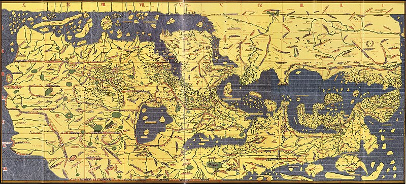
| 2009. gada 25. maijs, plkst. 04.33 |  | 4 135 × 1 875 (2,86 MB) | Hopefully acceptable username~commonswiki | Rotated 180 degrees, North in this map is at the bottom, as can be seen by reading row and column names or any other label. | |
| 2007. gada 23. novembris, plkst. 23.47 |  | 4 135 × 1 875 (3,45 MB) | World Imaging | {{Information |Description=Tabula Rogeriana, 1154 |Source=Bibliotheque Nationale de France (MSO Arable 2221) |Date=1154 |Author=Al-Idrisi |Permission= |other_versions= }} |
Faila lietojums
Šo failu izmanto šajās 3 lapās:
Globālais faila lietojums
Šīs Vikipēdijas izmanto šo failu:
- Izmantojums als.wikipedia.org
- Izmantojums ar.wikipedia.org
- Izmantojums bn.wikipedia.org
- Izmantojums bs.wikipedia.org
- Izmantojums ca.wikipedia.org
- Izmantojums ckb.wikipedia.org
- Izmantojums cs.wikipedia.org
- Izmantojums da.wikipedia.org
- Izmantojums de.wikipedia.org
- Izmantojums en.wikipedia.org
- Izmantojums en.wiktionary.org
- Izmantojums es.wikipedia.org
- Izmantojums et.wikipedia.org
- Izmantojums eu.wikipedia.org
- Izmantojums fi.wikipedia.org
- Izmantojums fr.wikipedia.org
Skatīt šī faila pilno globālo izmantojumu.