
Attēls:Tahoua Region departments.png

Sākotnējais fails (1 056 × 816 pikseļi, faila izmērs: 24 KB, MIME tips: image/png)
| Šis fails ir no Vikikrātuves. Tā apraksts no attēla lapas Vikikrātuvē ir parādīts zemāk. Vikikrātuve ir brīvi licencēta failu krātuve. Tu vari tai palīdzēt. |
| Apraksts |
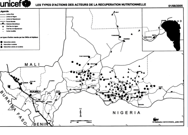
SummaryMap of the Departments of Tahoua Region, following the changes in administrative naming 1999-2005, with the addition of Abalak Department: a new subdivision created from the Tchin-tabaraden Department. Derived from Map of the arrondissements of Tahoua department in Niger. Created by Rarelibra 18:37, 13 September 2006 (UTC) for public domain use, using MapInfo Professional v8.5 and various mapping resources. See: fr:Tahoua (région) and en:Departments of Niger Image:Tahoua arrondissements.png http://www.senat.fr/rap/r04-512/r04-5128.gif Unicef Map http://www.fao.org/ag/agl/agll/wocat/wqasum.asp?questid=NIG05 FAO report http://www.fao.org/ag/agl/agll/wocat/img/qtnig7d.jpg FAO Map http://fr.wikipedia.org/wiki/Tahoua_%28r%C3%A9gion%29 Tahoua (région) * Département de Abalak Superficie: 77 445 km² (1) Population: 80 777 hts Centre urbaine: Ville d'Abalak |
| Datums | (UTC) |
| Avots | |
| Autors |
|
| Citas versijas |
|

| This is a retouched picture, which means that it has been digitally altered from its original version. Modifications: added subdivision. The original can be viewed here: Tahoua arrondissements.png: File:Tahoua arrondissements.png. Modifications made by T L Miles.
|
| I, the copyright holder of this work, release this work into the public domain. This applies worldwide. In some countries this may not be legally possible; if so: I grant anyone the right to use this work for any purpose, without any conditions, unless such conditions are required by law. |
Original upload log
This image is a derivative work of the following images:
- Image:Tahoua_arrondissements.png licensed with PD-self
- 2006-11-10T12:48:31Z Béka 1056x816 (23579 Bytes) {{Information| |Description= == Summary == Map of the arrondissements of Tahoua department in Niger. Created by [[:en:User:Rarelibra|Rarelibra]] 18:37, 13 September 2006 (UTC) for public domain use, using MapInfo Professional
Uploaded with derivativeFX
Faila hronoloģija
Uzklikšķini uz datums/laiks kolonnā esošās saites, lai apskatītos, kā šis fails izskatījās tad.
| Datums/Laiks | Attēls | Izmēri | Dalībnieks | Komentārs | |
|---|---|---|---|---|---|
| tagadējais | 2008. gada 19. jūnijs, plkst. 21.48 | | 1 056 × 816 (24 KB) | T L Miles | {{Information |Description=== Summary == Map of the Departments of Tahoua Region, following the changes in administrative naming 1999-2005, with the addition of Abalak Department: a new subdivision created from the Tchin-tabaraden Department. Derived f |
Faila lietojums
Šo failu izmanto šajā 1 lapā:
Globālais faila lietojums
Šīs Vikipēdijas izmanto šo failu:
- Izmantojums da.wikipedia.org
- Izmantojums de.wikipedia.org
- Izmantojums en.wikipedia.org
- Izmantojums es.wikipedia.org
- Izmantojums fr.wikipedia.org
- Izmantojums ha.wikipedia.org
- Izmantojums ja.wikipedia.org
- Izmantojums pt.wikipedia.org
- Izmantojums ro.wikipedia.org
- Izmantojums ru.wikipedia.org
- Izmantojums tr.wikipedia.org
- Izmantojums ur.wikipedia.org
- Izmantojums www.wikidata.org
Skatīt šī faila pilno globālo izmantojumu.