
Attēls:The maximum extent of the Safavid Empire under Shah Abbas I.png
Augstāka izšķirtspēja nav pieejama.
The_maximum_extent_of_the_Safavid_Empire_under_Shah_Abbas_I.png (620 × 428 pikseļi, faila izmērs: 20 KB, MIME tips: image/png)
| Šis fails ir no Vikikrātuves. Tā apraksts no attēla lapas Vikikrātuvē ir parādīts zemāk. Vikikrātuve ir brīvi licencēta failu krātuve. Tu vari tai palīdzēt. |
Kopsavilkums
| Apraksts |
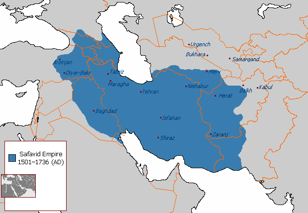
English: The maximum extent of the Safavid Empire under Shah Abbas I. فارسی: حداکثر وسعت امپراتوری صفوی در زمان شاه عباس یکم. |
||
| Avots | File:Safavid_Empire_1501_1722_AD.png | ||
| Autors | Arab_Hafez, edited by HistoryofIran (me). | ||
| Citas versijas |
|

Licence
| This map is ineligible for copyright and therefore in the public domain, because it consists entirely of information that is common property and contains no original authorship. For more information, see Commons:Threshold of originality § Maps.
|
Faila hronoloģija
Uzklikšķini uz datums/laiks kolonnā esošās saites, lai apskatītos, kā šis fails izskatījās tad.
| Datums/Laiks | Attēls | Izmēri | Dalībnieks | Komentārs | |
|---|---|---|---|---|---|
| tagadējais | 2018. gada 2. janvāris, plkst. 00.03 | | 620 × 428 (20 KB) | HistoryofIran | rv, take your concerns to the talk page |
| 2017. gada 31. decembris, plkst. 00.54 |  | 620 × 428 (24 KB) | Qizilbash | Eastern Anatolia has never been under the control of Shah Abbas. After Shah Ismail this region has always been under Ottoman control. | |
| 2015. gada 7. jūlijs, plkst. 07.56 |  | 620 × 428 (20 KB) | HistoryofIran | Removed disprutive edit from banned user. | |
| 2015. gada 23. jūnijs, plkst. 05.03 |  | 620 × 428 (20 KB) | Artin Mehraban | the minor changes are examples of original research which is banned by wikipedia | |
| 2015. gada 22. jūnijs, plkst. 07.09 |  | 620 × 428 (20 KB) | LouisAragon | they didn't rule such area under Abbas sigh. Stop being such a nuisance really. | |
| 2015. gada 21. jūnijs, plkst. 02.12 |  | 620 × 428 (27 KB) | Artin Mehraban | changed the map size | |
| 2015. gada 21. jūnijs, plkst. 02.03 |  | 582 × 401 (25 KB) | Artin Mehraban | It was well known Shah Abbas took daghestan | |
| 2015. gada 20. jūnijs, plkst. 23.57 |  | 582 × 401 (24 KB) | Artin Mehraban | small edits | |
| 2015. gada 20. jūnijs, plkst. 22.24 |  | 582 × 401 (23 KB) | Artin Mehraban | A few minor changes | |
| 2015. gada 20. jūnijs, plkst. 07.00 |  | 585 × 414 (22 KB) | Artin Mehraban | Better text for cities |
Faila lietojums
Šo failu izmanto šajā 1 lapā:
Globālais faila lietojums
Šīs Vikipēdijas izmanto šo failu:
- Izmantojums af.wikipedia.org
- Izmantojums azb.wikipedia.org
- Izmantojums az.wikipedia.org
- Izmantojums bn.wikipedia.org
- Izmantojums cs.wikipedia.org
- Izmantojums el.wikipedia.org
- Izmantojums en.wikipedia.org
- Greater Iran
- Abbas II of Persia
- Iranian Armenia (1502–1828)
- Safavid Shirvan
- Safavid Karabakh
- Template:Safavid provinces
- Safavid Georgia
- Safavid Daghestan
- Erivan Province (Safavid Iran)
- User talk:EdJohnston/Archive 44
- User:LouisAragon/sandbox/Dagh
- Safavid Diyarbakr
- User:Falcaorib
- Baghdad Province (Safavid Empire)
- Safavid Talish
- Marie Petit
- Azerbaijan Province (Safavid Iran)
- Safavid Khuzestan
- Safavid Astarabad
- Safavid Lorestan
- Safavid Kandahar
- Safavid Kurdistan
- User:Kailanmapper/sandbox4
- User:Kailanmapper/sandbox5
- Izmantojums en.wikibooks.org
- Izmantojums et.wikipedia.org
- Izmantojums eu.wikipedia.org
- Izmantojums fa.wikipedia.org
Skatīt šī faila pilno globālo izmantojumu.