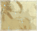
Attēls:USA Wyoming relief location map.svg
Izskats

Size of this PNG preview of this SVG file: 721 × 600 pikseļi. Citi izmēri: 289 × 240 pikseļi | 577 × 480 pikseļi | 923 × 768 pikseļi | 1 231 × 1 024 pikseļi | 2 462 × 2 048 pikseļi | 1 500 × 1 248 pikseļi.
Sākotnējais fails (SVG fails, definētais izmērs 1 500 × 1 248 pikseļi, faila izmērs: 4,33 MB)
Faila hronoloģija
Uzklikšķini uz datums/laiks kolonnā esošās saites, lai apskatītos, kā šis fails izskatījās tad.
| Datums/Laiks | Attēls | Izmēri | Dalībnieks | Komentārs | |
|---|---|---|---|---|---|
| tagadējais | 2022. gada 4. februāris, plkst. 16.53 |  | 1 500 × 1 248 (4,33 MB) | Ikonact | desc // Editing SVG source code using c:User:Rillke/SVGedit.js |
| 2022. gada 4. februāris, plkst. 16.52 |  | 1 500 × 1 248 (4,33 MB) | Ikonact | desc & title modification // Editing SVG source code using c:User:Rillke/SVGedit.js | |
| 2022. gada 4. februāris, plkst. 16.50 |  | 1 500 × 1 248 (4,33 MB) | Ikonact | +desc // Editing SVG source code using c:User:Rillke/SVGedit.js | |
| 2022. gada 4. februāris, plkst. 16.47 |  | 1 500 × 1 248 (4,33 MB) | Ikonact | + title // Editing SVG source code using c:User:Rillke/SVGedit.js | |
| 2022. gada 4. februāris, plkst. 10.31 |  | 1 500 × 1 248 (4,33 MB) | Ikonact | =={{int:filedesc}}== {{Information |description={{en|1=Relief location map of {{W|Wyoming}}, {{W|USA}} Geographic limits of the map: * N: 45.2° N * S: 40.8° N * W: 111.3° W * E: 103.9° W}} |date=2022-02-04 |source={{own}} *Based on File:USA Wyoming location map.svg *Public domain SRTM3 |author=ikonact |permission= |other versions= }} =={{int:license-header}}== {{self|cc-by-sa-4.0}} Category:Location maps of Wyoming |
Faila lietojums
Šo failu izmanto šajās 2 lapās:
Globālais faila lietojums
Šīs Vikipēdijas izmanto šo failu:
- Izmantojums de.wikipedia.org
- Grand Canyon of the Yellowstone
- Upper Falls
- Lower Falls
- Hayden Valley
- Mount Washburn
- Crystal Falls
- Eagle Peak (Park County)
- Oberes Geysir-Becken
- Jackson Hole
- Gibbon-Fälle
- Jackson Lake
- Jenny Lake
- Vorlage:Positionskarte USA Wyoming
- Lewis Lake
- Buffalo Bill Dam
- Shoshone Lake
- Lake DeSmet
- Bear River State Park
- Mount Moran
- Boysen State Park
- Hot Springs State Park
- Glendo State Park
- Laramie Peak
- Heart Lake (Wyoming)
- Sinks Canyon State Park
- Buffalo Bill State Park
- Curt Gowdy State Park
- Gannett Peak
- Edness K. Wilkins State Park
- Wyoming Hereford Ranch Reservoir Number 1
- Wyoming Hereford Ranch Reservoir Number 2
- Packer Lake (Wyoming)
- Cirque of the Towers
- Mount Sheridan
- KKPL
- Hawk Springs State Recreation Area
- Keyhole State Park
- Seminoe State Park
- Mount Everts
- Two Ocean Lake
- Grand Teton
- Cedar Mountain (Wyoming)
- Mount Schurz
- Lamar Valley
- KWRR
- KUWA
- Breccia Peak (Wyoming)
- Buck Mountain (Wyoming)
- Union Peak (Wyoming)
- Whiskey Mountain
Skatīt šī faila pilno globālo izmantojumu.
