
Attēls:Wales Cardiff locator map.svg

Size of this PNG preview of this SVG file: 502 × 600 pikseļi. Citi izmēri: 201 × 240 pikseļi | 402 × 480 pikseļi | 643 × 768 pikseļi | 857 × 1 024 pikseļi | 1 714 × 2 048 pikseļi | 1 047 × 1 251 pikseļi.
Sākotnējais fails (SVG fails, definētais izmērs 1 047 × 1 251 pikseļi, faila izmērs: 146 KB)
| Šis fails ir no Vikikrātuves. Tā apraksts no attēla lapas Vikikrātuvē ir parādīts zemāk. Vikikrātuve ir brīvi licencēta failu krātuve. Tu vari tai palīdzēt. |
Kopsavilkums
| Apraksts |
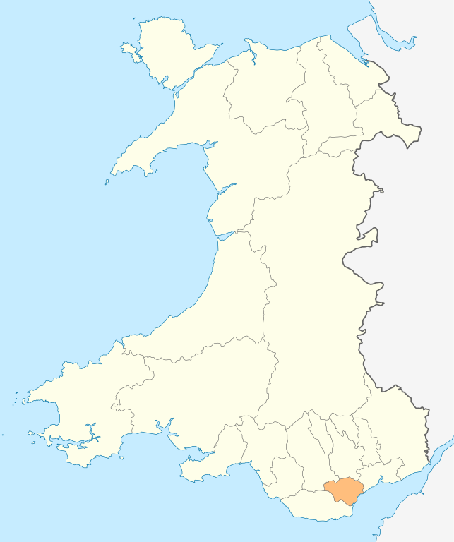
Deutsch: Lagekarte von Cardiff in Wales
English: Locator map of Cardiff in Wales |
| Datums | |
| Avots | Paša darbs |
| Autors | NordNordWest |
| Atļauja: (Šī faila izmantošana citur) |
Es, šī darba autortiesību īpašnieks, publicēju to saskaņā ar šo licenci: Šis fails tiek izplatīts saskaņā ar licences Creative Commons Atsauce-Līdzīgi Noteikumi 3.0 Vispārējiem noteikumiem.
|

|
Šī karte bija uzlabota vācu Kartenwerkstatt. Jūs arī varat piedāvāt citas kartes uzlabošanai.
|
Faila hronoloģija
Uzklikšķini uz datums/laiks kolonnā esošās saites, lai apskatītos, kā šis fails izskatījās tad.
| Datums/Laiks | Attēls | Izmēri | Dalībnieks | Komentārs | |
|---|---|---|---|---|---|
| tagadējais | 2010. gada 4. maijs, plkst. 21.48 | | 1 047 × 1 251 (146 KB) | NordNordWest | {{int:filedesc}} {{Information |Description= {{de|Lagekarte von Cardiff in Wales}} {{en|Locator map of Cardiff in Wales}} |Source={{Own}} |Date=2010-05-04 |Author={{U|NordNordWest}} |Permission={{self|cc-by-sa-3.0}} |other_versions= }} {{Kartenwerkstatt} |
Faila lietojums
Šo failu izmanto šajā 1 lapā:
Globālais faila lietojums
Šīs Vikipēdijas izmanto šo failu:
- Izmantojums ar.wikipedia.org
- Izmantojums en.wikipedia.org
- Mynachdy
- Maindy
- Trowbridge, Cardiff
- Michaelston-super-Ely
- Pentrebane
- Birchgrove, Cardiff
- Coryton, Cardiff
- Template:Cardiff-geo-stub
- Cathedral Road, Cardiff
- Cowbridge Road West
- Cowbridge Road East
- Cardiff English
- Penylan Quarry
- Lisvane (CAC) Tennis Club
- 19 High Street, Llandaff
- 2-4 High Street, Llandaff
- List of standardised Welsh place-names in Cardiff
- Registered historic parks and gardens in Cardiff
- Izmantojums eu.wikipedia.org
- Cardiff
- Lankide:Euskaldunaa
- Cardiffko gaztelua
- Tiger Bay
- Cardiffko badia
- Cathays Park
- Txantiloi:Cardiffko auzo aurkibidea
- Culverhouse Cross
- Pentyrch
- Gwaelod-y-Garth
- Atlantic Wharf
- Birchgrove (Cardiff)
- Butetown
- Cardiff hiriko erdigunea
- Cardiff Gate
- Castle Quarter
- Cefn Mably
- Coryton (Cardiff)
- Cyncoed
- Danescourt
- Ely (Cardiff)
- Gabalfa
- The Hayes
- Cardiffko Nazioarteko Kirolgunea
- Leckwith (Cardiff)
- Llandaff
- Maindy
Skatīt šī faila pilno globālo izmantojumu.