Attēls:Worcestershire UK location map.svg
Izskats

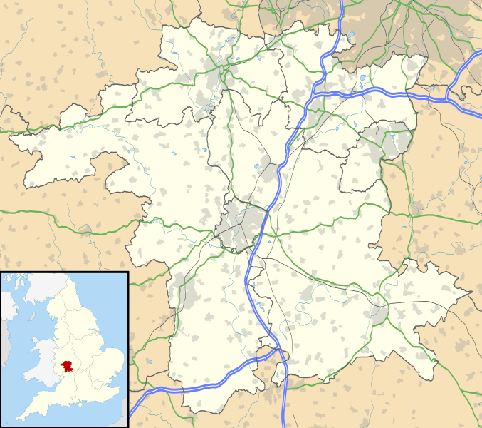
Size of this PNG preview of this SVG file: 677 × 600 pikseļi. Citi izmēri: 271 × 240 pikseļi | 542 × 480 pikseļi | 867 × 768 pikseļi | 1 156 × 1 024 pikseļi | 2 313 × 2 048 pikseļi | 1 425 × 1 262 pikseļi.
Sākotnējais fails (SVG fails, definētais izmērs 1 425 × 1 262 pikseļi, faila izmērs: 1,8 MB)
Faila hronoloģija
Uzklikšķini uz datums/laiks kolonnā esošās saites, lai apskatītos, kā šis fails izskatījās tad.
| Datums/Laiks | Attēls | Izmēri | Dalībnieks | Komentārs | |
|---|---|---|---|---|---|
| tagadējais | 2010. gada 26. septembris, plkst. 21.20 |  | 1 425 × 1 262 (1,8 MB) | Nilfanion | {{Information |Description=Map of Worcestershire, UK with the following information shown: *Administrative borders *Coastline, lakes and rivers *Roads and railways *Urban areas Equirectangular map projection on WGS 84 datum, with N/S |
Faila lietojums
Šo failu izmanto šajās 3 lapās:
Globālais faila lietojums
Šīs Vikipēdijas izmanto šo failu:
- Izmantojums ar.wikipedia.org
- Izmantojums bg.wikipedia.org
- Izmantojums ceb.wikipedia.org
- Izmantojums en.wikipedia.org
- Kidderminster
- Battle of Worcester
- Worcester Cathedral
- Droitwich Spa
- Evesham
- Bromsgrove
- Bewdley
- Malvern, Worcestershire
- Pershore
- Upton-upon-Severn
- Stourport-on-Severn
- Stoke Heath, Worcestershire
- Tenbury Wells
- Barnt Green
- Great Malvern
- Bredon
- Wythall
- Hollywood, Worcestershire
- Lindridge
- Abberley
- Malvern Wells
- Hartlebury
- Bordesley, Worcestershire
- Wadborough
- Malvern Link
- Tardebigge
- Shelsley Walsh
- Barnards Green
- Pinvin
- Broadway, Worcestershire
- The Fleece Inn
- Droitwich Transmitting Station
- Eckington, Worcestershire
- Alvechurch
- Areley Kings
- Leigh, Worcestershire
- Romsley, Worcestershire
- Lickey
- Lickey End
- Cofton Hackett
- Upper Arley
- Kempsey, Worcestershire
- List of places in Worcestershire
- Hopwood, Worcestershire
- Ryall, Worcestershire
- Hopwood Park services
Skatīt šī faila pilno globālo izmantojumu.
